– Lat/Long: 52.55° N 2.77° W
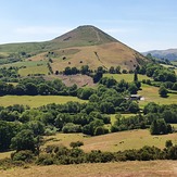
 Caer Caradoc
Weather Forecast, United KingdomIssued: 6 am Sat 04 Apr Local TimeUpdates in: hr min sUpdate imminent
Issued: 6 am Sat 04 Apr Local Time
Updates in:
Update imminent hr min s

Issued: 6 am Sat 04 Apr Local Time
Updates in:
Update imminent hr min s
Days 1–3 Weather SummarySome drizzle, heaviest during Sun morning. Very mild (max 11°C on Sat morning, min 1°C on Sun night). Winds decreasing (severe gales from the SW on Sat night, light winds from the SW by Sun night). | Days 4–6 Weather SummaryModerate rain (total 14mm), heaviest on Thu morning. Very mild (max 16°C on Wed afternoon, min 3°C on Thu night). Winds decreasing (strong winds from the SE on Tue morning, calm by Thu night). | |||||||||||||||||
Saturday 4 | Sunday 5 | Monday 6 | Tuesday 7 | Wednesday 8 | Thursday 9 | |||||||||||||
AM | PM | night | AM | PM | night | AM | PM | night | AM | PM | night | AM | PM | night | AM | PM | night | |
rain shwrs | rain shwrs | rain shwrs | rain shwrs | rain shwrs | some clouds | cloudy | some clouds | some clouds | some clouds | cloudy | some clouds | some clouds | light rain | light rain | mod. rain | light rain | clear | |
km/h | ||||||||||||||||||
 |  |  |  |  |  | |||||||||||||
— | — | — | — | — | — | — | — | — | — | — | — | — | — | — | — | — | — | |
0.1 | 0.1 | 0.2 | 0.8 | 0.1 | — | — | — | — | — | — | — | — | 0.2 | 2 | 8 | 2 | — | |
max °C | 11 | 11 | 8 | 4 | 4 | 1 | 8 | 10 | 7 | 14 | 15 | 10 | 15 | 16 | 13 | 6 | 5 | 4 |
min °C | 7 | 8 | 2 | 3 | 3 | 1 | 4 | 9 | 5 | 10 | 14 | 9 | 12 | 15 | 10 | 6 | 4 | 3 |
3 | 2 | -5 | -3 | -2 | -3 | 0 | 6 | 1 | 6 | 12 | 7 | 11 | 14 | 8 | 4 | -1 | 0 | |
1900 | 1950 | 1150 | 800 | 900 | 650 | 1300 | 2950 | 2950 | 2900 | 2900 | 2950 | 2850 | 2850 | 2650 | 1500 | 1100 | 1300 | |
Cloud base (m) | 700 | 300 | 300 | 800 | 4750 | 2550 | 600 | 6600 | 5300 | 2950 | 3000 | 2650 | 600 | 550 | 1500 | 200 | 2050 | |
6:39 | — | — | 6:37 | — | — | 6:35 | — | — | 6:31 | — | — | 6:30 | — | — | 6:28 | — | — | |
— | 7:49 | — | — | 7:51 | — | — | 7:52 | — | — | 7:53 | — | — | 7:55 | — | — | 7:58 | — | |
Loading...
Caer Caradoc Weather (Days 0-3):
The weather forecast for Caer Caradoc is: Some drizzle, heaviest during Sun morning. Very mild (max 11°C on Sat morning, min 1°C on Sun night). Winds decreasing (severe gales from the SW on Sat night, light winds from the SW by Sun night).
Caer Caradoc Weather (Days 3-6):
Moderate rain (total 14mm), heaviest on Thu morning. Very mild (max 16°C on Wed afternoon, min 3°C on Thu night). Winds decreasing (strong winds from the SE on Tue morning, calm by Thu night).
This table gives the weather forecast for Caer Caradoc at the specific elevation of 459 m. Our advanced weather models allow us to provide distinct weather forecasts for several elevations of Caer Caradoc. To see the weather forecasts for the other elevations, use the tab navigation above the table. For a wider overview of the weather, consult the Weather Map of United Kingdom.
| Weather Station | Temp. | Weather | Wind | Gusts | Cloud / Visibility |
|---|---|---|---|---|---|
Planned - The Lawley | |||||
Long Mynd | |||||
Shawbury RAF Airport | |||||
Cosford RAF Airport | |||||
Clatter | |||||
Llangollen | |||||
Hawarden Airport | |||||
Birmingham Airport |
* NOTE: not all weather observatories update at the same frequency which is the reason why some locations may show data from stations that are further away than known closer ones.
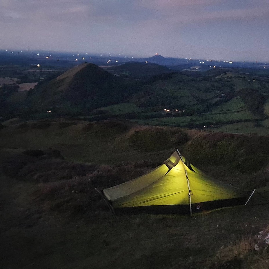
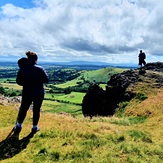
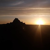
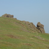
Caer Caradoc Photos
View all
Shropshire Hills photos (7) |
Other ranges of England photos (48) |
photos from mountains in United Kingdom (2115) |
all photos
 Upload new photo
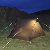

Lanshan 2
Caer Caradoc