– Lat/Long: 50.13° N 122.25° W
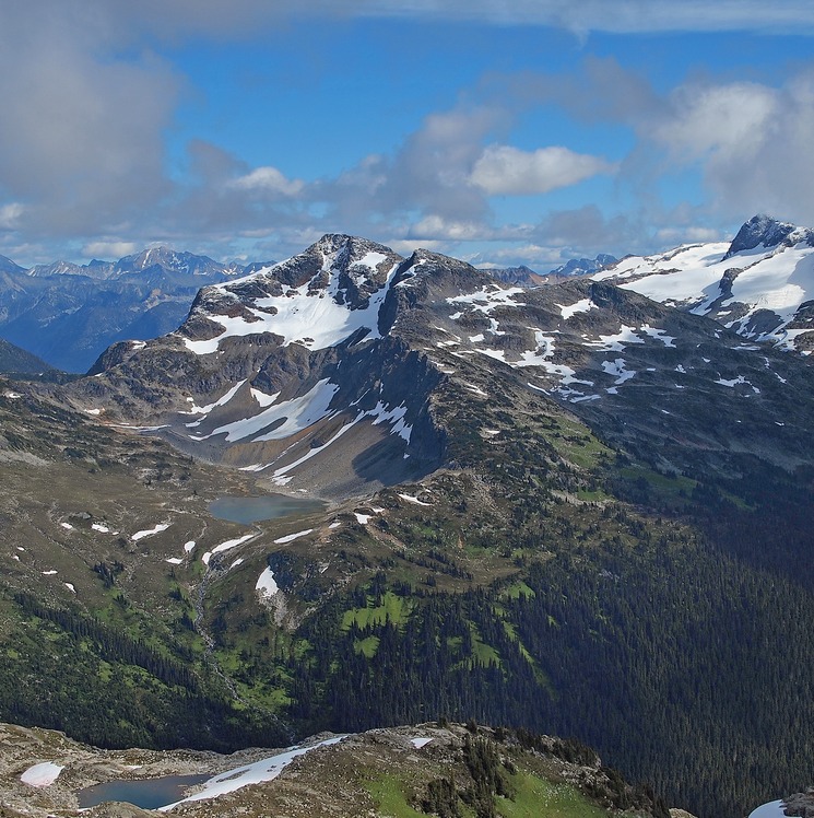
 Caltha Peak
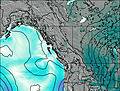
Weather Forecast, CanadaIssued: 4 am Mon 31 Mar Local TimeUpdates in: hr min sUpdate imminent
Caltha Peak Weather Forecast, Canada
Issued: 4 am Mon 31 Mar Local Time
Updates in:
Update imminent hr min s

Issued: 4 am Mon 31 Mar Local Time
Updates in:
Update imminent hr min s
Days 1–3 Weather SummaryA dusting of new snow. Freeze-thaw conditions (max 1°C on Mon afternoon, min -3°C on Mon night). Wind will be generally light. | Days 4–6 Weather SummaryMostly dry. Freeze-thaw conditions (max 8°C on Sat afternoon, min -3°C on Thu morning). Wind will be generally light. | Days 7–9 Weather SummaryDrizzle at first, then turning colder with dusting of snow on Mon morning. Freeze-thaw conditions (max 11°C on Sun afternoon, min -2°C on Mon night). Wind will be generally light. | Days 10–12 Weather SummaryDrizzle, on Wed night followed by colder weather and a moderate fall of snow, heaviest on Thu morning.. Freeze-thaw conditions (max 7°C on Wed afternoon, min -4°C on Fri night). Wind will be generally light. | |||||||||||||||||||||||||||||||||
Monday 31 | Tuesday 1 | Wednesday 2 | Thursday 3 | Friday 4 | Saturday 5 | Sunday 6 | Monday 7 | Tuesday 8 | Wednesday 9 | Thursday 10 | Friday 11 | |||||||||||||||||||||||||
AM | PM | night | AM | PM | night | AM | PM | night | AM | PM | night | AM | PM | night | AM | PM | night | AM | PM | night | AM | PM | night | AM | PM | night | AM | PM | night | AM | PM | night | AM | PM | night | |
light snow | cloudy | some clouds | cloudy | cloudy | cloudy | cloudy | cloudy | snow shwrs | some clouds | rain shwrs | some clouds | cloudy | clear | clear | some clouds | some clouds | clear | some clouds | clear | some clouds | light snow | light snow | snow shwrs | cloudy | some clouds | cloudy | some clouds | some clouds | rain shwrs | mod. snow | light snow | some clouds | cloudy | light rain | some clouds | |
km/h | ||||||||||||||||||||||||||||||||||||
 |  |  |  |  |  |  |  |  |  |  |  | |||||||||||||||||||||||||
1.0 | — | — | — | — | — | — | — | 1.0 | — | — | — | — | — | — | — | — | — | — | — | — | 1.0 | 2.0 | 1.0 | — | — | — | — | — | — | 8 | 2.0 | — | — | — | — | |
— | — | — | — | — | — | — | — | — | — | 0.1 | — | — | — | — | — | — | — | — | — | — | 1.5 | — | — | — | — | — | — | — | 1.1 | — | — | — | — | 0.2 | — | |
max°C | 0 | 1 | -1 | -1 | 0 | -2 | -2 | 0 | -1 | 1 | 4 | 2 | 3 | 6 | 4 | 5 | 8 | 6 | 8 | 11 | 8 | 3 | 1 | -1 | -1 | 3 | 2 | 5 | 7 | 5 | 2 | 1 | 0 | -1 | 2 | 0 |
min°C | -1 | 1 | -3 | -3 | 0 | -3 | -3 | 0 | -3 | -3 | 3 | 1 | 1 | 5 | 2 | 3 | 8 | 4 | 5 | 11 | 4 | 2 | 0 | -2 | -2 | 2 | 0 | 2 | 7 | 2 | 1 | 1 | -3 | -2 | 1 | -4 |
-3 | -1 | -3 | -3 | -2 | -3 | -5 | -2 | -5 | -6 | 3 | 0 | 1 | 5 | 2 | 3 | 7 | 3 | 5 | 10 | 1 | -1 | -3 | -5 | -4 | 2 | 0 | 2 | 5 | 0 | -2 | -2 | -3 | -2 | 0 | -4 | |
1450 | 1600 | 1200 | 1300 | 1500 | 1100 | 1250 | 1550 | 1100 | 1600 | 1950 | 1600 | 2100 | 2350 | 2250 | 2750 | 3000 | 3100 | 3350 | 3100 | 2350 | 1800 | 1550 | 1350 | 1400 | 2050 | 1700 | 2200 | 2350 | 1900 | 1650 | 1600 | 1100 | 1400 | 1750 | 950 | |
Cloud base (m) | 1750 | 1850 | 1750 | 1750 | 1800 | 1750 | 1750 | 1850 | 1750 | 1800 | 2750 | 1950 | 1850 | 2400 | 9350 | 7500 | 9500 | 8400 | 1800 | 1800 | 1750 | 1800 | 1850 | 2100 | 1750 | 2900 | 2450 | 1750 | 1750 | 1750 | 1750 | 2050 | 1750 | |||
6:48 | — | — | 6:46 | — | — | 6:43 | — | — | 6:41 | — | — | 6:39 | — | — | 6:37 | — | — | 6:35 | — | — | 6:33 | — | — | 6:31 | — | — | 6:28 | — | — | 6:26 | — | — | 6:24 | — | — | |
— | 7:38 | — | — | 7:39 | — | — | 7:42 | — | — | 7:43 | — | — | 7:45 | — | — | 7:45 | — | — | 7:47 | — | — | 7:50 | — | — | 7:51 | — | — | 7:52 | — | — | 7:53 | — | — | 7:55 | — | |
Caltha Peak Weather (Days 0-3):
The weather forecast for Caltha Peak is: A dusting of new snow. Freeze-thaw conditions (max 1°C on Mon afternoon, min -3°C on Mon night). Wind will be generally light.
Caltha Peak Weather (Days 3-6):
Mostly dry. Freeze-thaw conditions (max 8°C on Sat afternoon, min -3°C on Thu morning). Wind will be generally light.
Caltha Peak Weather (Days 6-9):
Drizzle at first, then turning colder with dusting of snow on Mon morning. Freeze-thaw conditions (max 11°C on Sun afternoon, min -2°C on Mon night). Wind will be generally light.
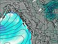
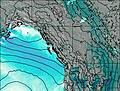
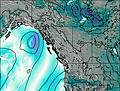
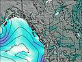
This table gives the weather forecast for Caltha Peak at the specific elevation of 1500 m. Our advanced weather models allow us to provide distinct weather forecasts for several elevations of Caltha Peak. To see the weather forecasts for the other elevations, use the tab navigation above the table. For a wider overview of the weather, consult the Weather Map of British-Columbia.
Caltha Peak Photos
View all
British Columbia Coast Ranges photos (58) |
Pacific Coast Ranges photos (999) |
photos from mountains in Canada (440) |
all photos
 Upload new photo
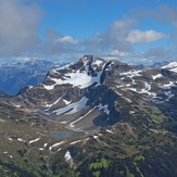
Caltha Peak from Tabletop Mountain

