
– Lat/Long: 1.40° S 78.75° W
 Carihuairazo
Weather Forecast, EcuadorIssued: 12 am Fri 09 May Local TimeUpdates in: hr min sUpdate imminent
Issued: 12 am Fri 09 May Local Time
Updates in:
Update imminent hr min s

Issued: 12 am Fri 09 May Local Time
Updates in:
Update imminent hr min s
Days 1–4 Weather SummaryA light covering of new snow mostly falling on Sat morning. Freeze-thaw conditions (max 3°C on Fri morning, min -2°C on Thu night). Winds increasing (light winds from the ESE on Thu night, fresh winds from the E by Sun morning). | Days 5–7 Weather SummaryA light covering of new snow mostly falling on Sun night. Freeze-thaw conditions (max 2°C on Tue morning, min -1°C on Sun night). Wind will be generally light. | ||||||||||||||||||
Friday 9 | Saturday 10 | Sunday 11 | Monday 12 | Tuesday 13 | Wednesday 14 | ||||||||||||||
night | AM | PM | night | AM | PM | night | AM | PM | night | AM | PM | night | AM | PM | night | AM | PM | night | |
clear | rain shwrs | rain shwrs | some clouds | light snow | cloudy | light snow | light snow | light snow | light snow | light snow | cloudy | cloudy | some clouds | some clouds | cloudy | some clouds | some clouds | some clouds | |
km/h | |||||||||||||||||||
 |  |  |  |  |  |  | |||||||||||||
— | — | — | — | 1.0 | — | 2.0 | 2.0 | 2.0 | 4 | 1.0 | — | — | — | — | — | — | — | — | |
— | 0.1 | 0.2 | — | — | — | — | — | — | — | — | — | — | — | — | — | — | — | — | |
max°C | -1 | 3 | 2 | 0 | 0 | 1 | 0 | 0 | 0 | 0 | -1 | -1 | -1 | 2 | 1 | -1 | 2 | 1 | -1 |
min°C | -2 | 2 | 0 | -1 | 0 | 1 | 0 | 0 | 0 | -1 | -1 | -1 | -1 | 0 | -1 | -1 | 0 | 0 | -1 |
-4 | -2 | -4 | -5 | -4 | -2 | -4 | -6 | -6 | -5 | -6 | -5 | -6 | -4 | -4 | -4 | -4 | -3 | -4 | |
4650 | 5250 | 5350 | 4900 | 5100 | 5200 | 5050 | 5050 | 5100 | 5000 | 4850 | 4900 | 4800 | 4950 | 5150 | 4900 | 5050 | 5250 | 4750 | |
Cloud base (m) | 5450 | 4950 | |||||||||||||||||
— | 6:09 | — | — | 6:09 | — | — | 6:09 | — | — | 6:09 | — | — | 6:09 | — | — | 6:09 | — | — | |
— | — | 6:13 | — | — | 6:13 | — | — | 6:13 | — | — | 6:12 | — | — | 6:12 | — | — | 6:12 | — | |
Loading...
Carihuairazo Weather (Days 0-3):
The weather forecast for Carihuairazo is: A light covering of new snow mostly falling on Sat morning. Freeze-thaw conditions (max 3°C on Fri morning, min -2°C on Thu night). Winds increasing (light winds from the ESE on Thu night, fresh winds from the E by Sun morning).
Carihuairazo Weather (Days 3-6):
A light covering of new snow mostly falling on Sun night. Freeze-thaw conditions (max 2°C on Tue morning, min -1°C on Sun night). Wind will be generally light.
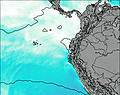
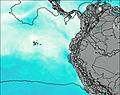
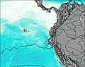
This table gives the weather forecast for Carihuairazo at the specific elevation of 5028 m. Our advanced weather models allow us to provide distinct weather forecasts for several elevations of Carihuairazo. To see the weather forecasts for the other elevations, use the tab navigation above the table. For a wider overview of the weather, consult the Weather Map of Ecuador.
| Weather Station | Temp. | Weather | Wind | Gusts | Cloud / Visibility |
|---|---|---|---|---|---|
lightning 8km SW of La Mana | |||||
lightning 35km N of Velasco Ibarra | |||||
Quito New International Airport | |||||
Cuenc / ariscal Airport | |||||
AEP Yuracrucito | |||||
Ipiale / an Luis Airport | |||||
Puerto Asis |
* NOTE: not all weather observatories update at the same frequency which is the reason why some locations may show data from stations that are further away than known closer ones.