– Lat/Long: 16.33° S 68.13° W

BlChacaltaya – Climbing, Hiking & Mountaineering information

Placeholder

Chacaltaya mountain guide

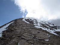
Chacaltaya photo

Chacaltaya

Photo credit: DiverDave

View towards Milluni, Chacaltaya photo

Chacaltaya

Photo credit: Carina Isabel Moreno Rivadeneira

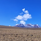
View from Chacaltaya towards the Altiplano photo

Chacaltaya

Photo credit: Carina Isabel Moreno Rivadeneira

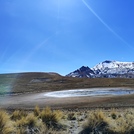
View towards the east from Chacaltaya photo

Chacaltaya

Photo credit: Carina Isabel Moreno Rivadeneira

  • Elevation: 5395 m
  • Difficulty: Walk up
  • Best months to climb: January, February, April, October, November, December
  • Convenient center: La Paz

Chacaltaya Climbing Notes

Robert Hessels from NETHERLANDS writes:

Chacaltaya, the former highest ski resort in the world, is a very easy climb.

We took a jeep up to the (remaining of) the old ski lodge, at 5,300 meters. This ride takes about 1,5h from La Paz and almost all tour agencies in La Paz offer this daytrip, usually in combination with the Valle de la Luna which is worth a visit.

From this trailhead, you walk up to the first peak, then down, and up again to the summit which is at 5,421 meters (17,785 ft). This walk took us 45 minutes, and we are beginning mountaineers with little experience. It is important to be well acclimatised though, which we achieved being in the high part of Bolivia (3,000-5,000) meters for ten days.

Chacaltaya used to have a big glacier, but unfortunately this melted away years ago. Today we were surprised, as was our guide, to see a fair amount of snow on the mountain. This made it slightly more difficult but more beautiful too. Along the way you have a great view of Huayna Potosi, if the sky is clear.

We booked through Travel Tracks and paid BOL 100 each for the whole day. We can really recommend this agency. Our guide, Nelson, was a nice guy and really knowledgeable.

2012-04-03

Click here to submit your own climbing note for Chacaltaya

Chacaltaya Location Map

Select Chacaltaya Location Map Detail:


Latest Gallery Images for Chacaltaya

visit the
gallery
or click to view
Mount Chacaltaya Chacaltaya view from below (south)

Upload your photo of Chacaltaya

Select a mountain summit from the menu
Select a Mountain Summit
Surf breaks located close to Chacaltaya Mountain peaks around Chacaltaya Roads and rivers around Chacaltaya

Use this relief map to navigate to mountain peaks in the area of Chacaltaya.

10 other mountain peaks closest to Chacaltaya:

1. Charquini (5392 m) 2.0 km
2. Huayna Potosi (6094 m) 8.2 km
3. Condoriri (5648 m) 22.3 km
4. Muela del Diablo (3825 m) 25.9 km
5. Cerro Mullu Apachita (5368 m) 30.0 km
6. Mururata (5871 m) 39.3 km
7. Chachacomani (6074 m) 46.7 km
8. Illimani (6460 m) 50.1 km
9. Nevado Chearoco (6127 m) 54.9 km
10. Illampu (6362 m) 68.1 km