
– Lat/Long: 0.38° S 78.25° W
 Chacana
Weather Forecast, EcuadorIssued: 12 am Sat 29 Mar Local TimeUpdates in: hr min sUpdate imminent
Chacana Weather Forecast, Ecuador
Issued: 12 am Sat 29 Mar Local Time
Updates in:
Update imminent hr min s

Issued: 12 am Sat 29 Mar Local Time
Updates in:
Update imminent hr min s
Days 1–4 Weather SummaryModerate rain (total 12mm), heaviest on Sat afternoon giving way to a moderate fall of snow, heaviest on Mon morning. Temperatures will be slightly above freezing (max 4°C on Sat morning, min 1°C on Fri night). Wind will be generally light. | Days 5–7 Weather SummaryModerate rain (total 17mm) heaviest on Tue afternoon, then becoming colder with a dusting of snow on Tue night. Temperatures will be slightly above freezing (max 3°C on Tue morning, min 1°C on Mon night). Wind will be generally light. | Days 8–10 Weather SummaryModerate rain (total 18mm), heaviest on Fri afternoon giving way to a moderate fall of snow, heaviest on Fri night. Freeze-thaw conditions (max 4°C on Fri morning, min 0°C on Sat night). Wind will be generally light. | Days 11–13 Weather SummaryA light covering of new snow mostly falling on Tue afternoon. Becoming milder with moderate rain (total 17mm) heaviest on Wed morning. Freeze-thaw conditions (max 5°C on Tue morning, min 0°C on Sun night). Wind will be generally light. | |||||||||||||||||||||||||||||||||
Saturday 29 | Sunday 30 | Monday 31 | Tuesday 1 | Wednesday 2 | Thursday 3 | Friday 4 | Saturday 5 | Sunday 6 | Monday 7 | Tuesday 8 | Wed 9 | |||||||||||||||||||||||||
night | AM | PM | night | AM | PM | night | AM | PM | night | AM | PM | night | AM | PM | night | AM | PM | night | AM | PM | night | AM | PM | night | AM | PM | night | AM | PM | night | AM | PM | night | AM | PM | |
some clouds | light rain | risk tstorm | rain shwrs | light rain | light snow | light snow | light snow | light snow | cloudy | light rain | rain shwrs | light snow | light snow | light rain | light snow | light rain | risk tstorm | rain shwrs | risk tstorm | risk tstorm | mod. snow | light snow | light rain | some clouds | rain shwrs | snow shwrs | some clouds | rain shwrs | snow shwrs | some clouds | rain shwrs | light snow | some clouds | mod. rain | light snow | |
km/h | ||||||||||||||||||||||||||||||||||||
 |  |  |  |  |  |  |  |  |  |  |  |  | ||||||||||||||||||||||||
— | — | — | — | — | 1.0 | 2.0 | 5 | 3 | — | — | — | 1.0 | 1.0 | — | 2.0 | — | — | — | — | — | 10 | 2.0 | — | — | — | 1.0 | — | — | 1.0 | — | — | 3 | — | — | 1.0 | |
— | 1.9 | 5 | 0.3 | 3 | 2 | — | — | — | — | 1.9 | 4 | 0.9 | 0.9 | 4 | — | 1.7 | 4 | 0.6 | 3 | 6 | 1.2 | 2 | 0.5 | — | 1.2 | 3 | — | 1.5 | 2 | — | 0.6 | 3 | — | 6 | 3 | |
max°C | 2 | 4 | 3 | 2 | 3 | 2 | 1 | 2 | 2 | 1 | 3 | 3 | 2 | 3 | 3 | 2 | 3 | 3 | 2 | 4 | 4 | 2 | 2 | 3 | 1 | 4 | 3 | 2 | 4 | 4 | 2 | 5 | 4 | 1 | 3 | 3 |
min°C | 1 | 3 | 2 | 1 | 3 | 2 | 1 | 1 | 1 | 1 | 3 | 3 | 1 | 2 | 2 | 1 | 3 | 2 | 1 | 4 | 3 | 1 | 1 | 2 | 0 | 4 | 2 | 0 | 4 | 2 | 0 | 4 | 2 | 1 | 2 | 2 |
-3 | 0 | 0 | -1 | 0 | 0 | -1 | 0 | 1 | 1 | 3 | 3 | -2 | -1 | 0 | -1 | 0 | -1 | -3 | 1 | 0 | -1 | -2 | 1 | -4 | 1 | -1 | 0 | 4 | 2 | 0 | 4 | 2 | -2 | -1 | -2 | |
4900 | 5250 | 5200 | 4900 | 5150 | 5050 | 4850 | 4900 | 4950 | 4900 | 5150 | 5150 | 5000 | 5000 | 5100 | 5000 | 5100 | 5150 | 4850 | 5200 | 5250 | 4950 | 4900 | 5100 | 4700 | 5200 | 5150 | 4750 | 5250 | 5200 | 4750 | 5150 | 5250 | 4750 | 5150 | 5100 | |
Cloud base (m) | 4850 | 4850 | 4200 | 4350 | 4150 | 4250 | 4300 | 4300 | 4950 | 4300 | 6350 | 5350 | 4600 | 4800 | 5000 | 5100 | 5300 | 6400 | 4750 | 4200 | 4150 | |||||||||||||||
— | 6:13 | — | — | 6:13 | — | — | 6:13 | — | — | 6:13 | — | — | 6:13 | — | — | 6:13 | — | — | 6:11 | — | — | 6:11 | — | — | 6:11 | — | — | 6:11 | — | — | 6:11 | — | — | 6:11 | — | |
— | — | 6:20 | — | — | 6:20 | — | — | 6:20 | — | — | 6:19 | — | — | 6:19 | — | — | 6:19 | — | — | 6:19 | — | — | 6:17 | — | — | 6:17 | — | — | 6:17 | — | — | 6:16 | — | — | 6:16 | |
Chacana Weather (Days 0-3):
The weather forecast for Chacana is: Moderate rain (total 12mm), heaviest on Sat afternoon giving way to a moderate fall of snow, heaviest on Mon morning. Temperatures will be slightly above freezing (max 4°C on Sat morning, min 1°C on Fri night). Wind will be generally light.
Chacana Weather (Days 3-6):
Moderate rain (total 17mm) heaviest on Tue afternoon, then becoming colder with a dusting of snow on Tue night. Temperatures will be slightly above freezing (max 3°C on Tue morning, min 1°C on Mon night). Wind will be generally light.
Chacana Weather (Days 6-9):
Moderate rain (total 18mm), heaviest on Fri afternoon giving way to a moderate fall of snow, heaviest on Fri night. Freeze-thaw conditions (max 4°C on Fri morning, min 0°C on Sat night). Wind will be generally light.
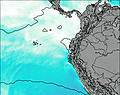
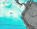
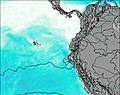
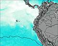
This table gives the weather forecast for Chacana at the specific elevation of 4643 m. Our advanced weather models allow us to provide distinct weather forecasts for several elevations of Chacana. To see the weather forecasts for the other elevations, use the tab navigation above the table. For a wider overview of the weather, consult the Weather Map of Ecuador.
| Weather Station | Temp. | Weather | Wind | Gusts | Cloud / Visibility |
|---|---|---|---|---|---|
Quito New International Airport | |||||
AEP Yuracrucito | |||||
Ipiale / an Luis Airport | |||||
Puerto Asis | |||||
Pasto-Antonio Nariño Airport | |||||
Tumac / a Florid | |||||
lightning 119km W of Muisne |
* NOTE: not all weather observatories update at the same frequency which is the reason why some locations may show data from stations that are further away than known closer ones.

