
– Lat/Long: 36.38° N 50.99° E
 چالون
چالون
Weather Forecast, IranIssued: 8 am Sat 29 Mar Local TimeUpdates in: hr min sUpdate imminent
چالون Weather Forecast, Iran
Issued: 8 am Sat 29 Mar Local Time
Updates in:
Update imminent hr min s

Issued: 8 am Sat 29 Mar Local Time
Updates in:
Update imminent hr min s
Days 1–3 Weather SummaryLight rain (total 5mm), mostly falling on Sat afternoon. Very mild (max 10°C on Sun afternoon, min 6°C on Sat morning). Wind will be generally light. | Days 4–6 Weather SummaryLight rain (total 6mm), mostly falling on Thu afternoon. Very mild (max 12°C on Wed afternoon, min 7°C on Thu night). Winds increasing (calm on Tue morning, strong winds from the SW by Thu afternoon). | Days 7–9 Weather SummaryHeavy rain (total 33mm), heaviest during Sat afternoon. Mild temperatures (max 8°C on Fri night, min 5°C on Sun night). Wind will be generally light. | Days 10–12 Weather SummaryModerate rain (total 10mm), heaviest on Mon afternoon. Very mild (max 10°C on Wed morning, min 5°C on Mon night). Wind will be generally light. | |||||||||||||||||||||||||||||||||
Saturday 29 | Sunday 30 | Monday 31 | Tuesday 1 | Wednesday 2 | Thursday 3 | Friday 4 | Saturday 5 | Sunday 6 | Monday 7 | Tuesday 8 | Wednesday 9 | |||||||||||||||||||||||||
AM | PM | night | AM | PM | night | AM | PM | night | AM | PM | night | AM | PM | night | AM | PM | night | AM | PM | night | AM | PM | night | AM | PM | night | AM | PM | night | AM | PM | night | AM | PM | night | |
rain shwrs | rain shwrs | clear | some clouds | rain shwrs | some clouds | rain shwrs | light rain | rain shwrs | some clouds | rain shwrs | some clouds | light rain | rain shwrs | rain shwrs | rain shwrs | risk tstorm | clear | rain shwrs | rain shwrs | rain shwrs | light rain | rain shwrs | rain shwrs | rain shwrs | rain shwrs | rain shwrs | rain shwrs | light rain | rain shwrs | some clouds | clear | clear | light rain | rain shwrs | rain shwrs | |
km/h | ||||||||||||||||||||||||||||||||||||
 |  |  |  |  |  |  |  |  |  |  | ||||||||||||||||||||||||||
— | — | — | — | — | — | — | — | — | — | — | — | — | — | — | — | — | — | — | — | — | — | — | — | — | — | — | — | — | — | — | — | — | — | — | — | |
0.3 | 1.7 | — | — | 0.1 | — | 0.6 | 1.4 | 0.4 | — | 0.1 | — | 0.2 | 0.3 | 0.4 | 2 | 3 | — | 0.1 | 0.3 | 0.5 | 5 | 16 | 1.3 | 1.0 | 7 | 2 | 0.4 | 5 | 2 | — | — | — | 0.1 | 1.8 | 0.9 | |
max°C | 7 | 7 | 7 | 9 | 10 | 8 | 8 | 8 | 8 | 10 | 10 | 10 | 11 | 12 | 11 | 10 | 12 | 9 | 7 | 7 | 8 | 7 | 7 | 8 | 8 | 8 | 7 | 8 | 7 | 7 | 8 | 9 | 9 | 10 | 6 | 6 |
min°C | 6 | 7 | 6 | 8 | 9 | 8 | 7 | 7 | 8 | 9 | 10 | 10 | 10 | 11 | 9 | 8 | 10 | 7 | 7 | 7 | 6 | 6 | 6 | 7 | 8 | 7 | 5 | 6 | 6 | 5 | 6 | 9 | 8 | 8 | 5 | 5 |
6 | 6 | 4 | 7 | 8 | 6 | 4 | 6 | 6 | 9 | 10 | 9 | 8 | 8 | 5 | 5 | 8 | 4 | 4 | 5 | 3 | 2 | 3 | 4 | 4 | 3 | 2 | 3 | 3 | 2 | 3 | 7 | 6 | 6 | 3 | 2 | |
3350 | 3500 | 3500 | 3550 | 3750 | 3750 | 3600 | 3600 | 3700 | 3650 | 3850 | 3950 | 4100 | 4150 | 4100 | 3850 | 4050 | 3700 | 3550 | 3550 | 3700 | 3500 | 3400 | 3750 | 3650 | 3500 | 3650 | 3450 | 3450 | 3500 | 3450 | 3750 | 3900 | 3950 | 3300 | 3550 | |
Cloud base (m) | 3700 | 3500 | 4550 | 5800 | 8100 | 4950 | 5300 | 4350 | 9050 | 4050 | 3300 | 2600 | 3550 | 3400 | 3050 | 2700 | 2550 | |||||||||||||||||||
5:56 | — | — | 5:54 | — | — | 5:54 | — | — | 5:52 | — | — | 5:50 | — | — | 5:48 | — | — | 5:48 | — | — | 5:46 | — | — | 5:45 | — | — | 5:43 | — | — | 5:41 | — | — | 5:41 | — | — | |
— | 6:24 | — | — | 6:25 | — | — | 6:27 | — | — | 6:27 | — | — | 6:28 | — | — | 6:29 | — | — | 6:30 | — | — | 6:30 | — | — | 6:31 | — | — | 6:32 | — | — | 6:32 | — | — | 6:34 | — | |
چالون Weather (Days 0-3):
The weather forecast for چالون is: Light rain (total 5mm), mostly falling on Sat afternoon. Very mild (max 10°C on Sun afternoon, min 6°C on Sat morning). Wind will be generally light.
چالون Weather (Days 3-6):
Light rain (total 6mm), mostly falling on Thu afternoon. Very mild (max 12°C on Wed afternoon, min 7°C on Thu night). Winds increasing (calm on Tue morning, strong winds from the SW by Thu afternoon).
چالون Weather (Days 6-9):
Heavy rain (total 33mm), heaviest during Sat afternoon. Mild temperatures (max 8°C on Fri night, min 5°C on Sun night). Wind will be generally light.
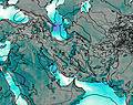
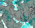
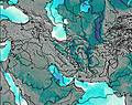
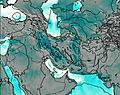
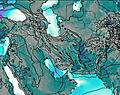
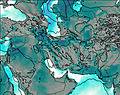
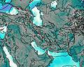
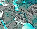
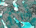
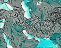
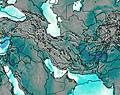
This table gives the weather forecast for چالون at the specific elevation of 2500 m. Our advanced weather models allow us to provide distinct weather forecasts for several elevations of چالون. To see the weather forecasts for the other elevations, use the tab navigation above the table. For a wider overview of the weather, consult the Weather Map of Iran.
| Weather Station | Temp. | Weather | Wind | Gusts | Cloud / Visibility |
|---|---|---|---|---|---|
Noshahr Airport | |||||
Ramsar Airport | |||||
Kara / ayam Airport | |||||
Tehra / ehrabad Airport | |||||
Ghazvin Airport | |||||
Tehran Imam Khomeini International Airport | |||||
Rasht Airport | |||||
Sary Dashte Naz Airport | |||||
Zanjan Airport | |||||
Hamadan Airport |
* NOTE: not all weather observatories update at the same frequency which is the reason why some locations may show data from stations that are further away than known closer ones.

