
– Lat/Long: 47.17° N 66.67° W
 Christmas Mountains
Weather Forecast, CanadaIssued: 1 pm Fri 18 Apr Local TimeUpdates in: hr min sUpdate imminent
Christmas Mountains Weather Forecast, Canada
Issued: 1 pm Fri 18 Apr Local Time
Updates in:
Update imminent hr min s

Issued: 1 pm Fri 18 Apr Local Time
Updates in:
Update imminent hr min s
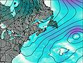
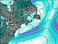
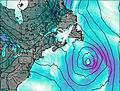
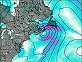
Days 1–4 Weather SummaryLight rain (total 8mm) at first, then becoming colder with a dusting of snow on Sat night. Freeze-thaw conditions (max 11°C on Sat afternoon, min -4°C on Sun morning). Winds increasing (moderate winds from the SW on Fri night, severe gales from the NW by Sun afternoon). | Days 5–7 Weather SummaryA light covering of new snow mostly falling on Tue afternoon. Freeze-thaw conditions (max 2°C on Mon afternoon, min -2°C on Thu morning). Winds increasing (calm on Mon night, fresh winds from the S by Tue afternoon). | ||||||||||||||||
Fri 18 | Saturday 19 | Sunday 20 | Monday 21 | Tuesday 22 | Wednesday 23 | ||||||||||||
PM | night | AM | PM | night | AM | PM | night | AM | PM | night | AM | PM | night | AM | PM | night | |
cloudy | light rain | light rain | light rain | light snow | light snow | cloudy | cloudy | some clouds | some clouds | some clouds | light snow | light snow | light snow | cloudy | light snow | light snow | |
km/h | |||||||||||||||||
 |  |  |  |  |  | ||||||||||||
— | — | — | — | 1.0 | 1.0 | — | — | — | — | — | 1.0 | 3 | 2.0 | — | 1.0 | 2.0 | |
— | 0.9 | 1.2 | 3 | 2 | — | — | — | — | — | — | — | — | — | — | — | — | |
max°C | 4 | 4 | 7 | 11 | 11 | -4 | -1 | -1 | 0 | 2 | 1 | 0 | 1 | 0 | 1 | 1 | 0 |
min°C | 2 | 2 | 5 | 9 | 0 | -4 | -3 | -3 | -2 | 2 | 0 | 0 | 0 | 0 | 1 | 1 | -1 |
-4 | -3 | 0 | 5 | -8 | -14 | -14 | -12 | -10 | -3 | 0 | -5 | -7 | -5 | -1 | -2 | -6 | |
1350 | 1650 | 2800 | 3150 | 2400 | 350 | 550 | 350 | 750 | 1000 | 750 | 750 | 900 | 800 | 1000 | 850 | 650 | |
Cloud base (m) | 3000 | 600 | 350 | 350 | 300 | 300 | 350 | 400 | 400 | 850 | 550 | 350 | 350 | 350 | 350 | 350 | 350 |
— | — | 5:31 | — | — | 5:30 | — | — | 5:28 | — | — | 5:26 | — | — | 5:24 | — | — | |
7:19 | — | — | 7:20 | — | — | 7:21 | — | — | 7:22 | — | — | 7:23 | — | — | 7:25 | — | |
Loading...
Christmas Mountains Weather (Days 0-3):
The weather forecast for Christmas Mountains is: Light rain (total 8mm) at first, then becoming colder with a dusting of snow on Sat night. Freeze-thaw conditions (max 11°C on Sat afternoon, min -4°C on Sun morning). Winds increasing (moderate winds from the SW on Fri night, severe gales from the NW by Sun afternoon).
Christmas Mountains Weather (Days 3-6):
A light covering of new snow mostly falling on Tue afternoon. Freeze-thaw conditions (max 2°C on Mon afternoon, min -2°C on Thu morning). Winds increasing (calm on Mon night, fresh winds from the S by Tue afternoon).
This table gives the weather forecast for Christmas Mountains at the specific elevation of 750 m. Our advanced weather models allow us to provide distinct weather forecasts for several elevations of Christmas Mountains. To see the weather forecasts for the other elevations, use the tab navigation above the table. For a wider overview of the weather, consult the Weather Map of New-Brunswick.
| Weather Station | Temp. | Weather | Wind | Gusts | Cloud / Visibility |
|---|---|---|---|---|---|
Doaktown Auto Rcs- NB | |||||
Bathurst Airport | |||||
RedPines-NB | |||||
Charlo Airport | |||||
Charlo Auto- NB | |||||
* NOTE: not all weather observatories update at the same frequency which is the reason why some locations may show data from stations that are further away than known closer ones.

