
– Lat/Long: 39.70° N 45.54° E
 Dar-alages
Weather Forecast, ArmeniaIssued: 3 am Sat 19 Apr Local TimeUpdates in: hr min sUpdate imminent
Dar-alages Weather Forecast, Armenia
Issued: 3 am Sat 19 Apr Local Time
Updates in:
Update imminent hr min s

Issued: 3 am Sat 19 Apr Local Time
Updates in:
Update imminent hr min s
Days 1–3 Weather SummaryA dusting of new snow. Freeze-thaw conditions (max 1°C on Mon morning, min -6°C on Sat morning). Winds increasing (calm on Sat morning, strong winds from the WSW by Mon night). | Days 4–6 Weather SummaryA dusting of new snow. Freeze-thaw conditions (max 4°C on Thu afternoon, min -2°C on Tue night). Winds increasing (fresh winds from the WSW on Tue night, near gales from the SW by Wed night). | |||||||||||||||||
Saturday 19 | Sunday 20 | Monday 21 | Tuesday 22 | Wednesday 23 | Thursday 24 | |||||||||||||
AM | PM | night | AM | PM | night | AM | PM | night | AM | PM | night | AM | PM | night | AM | PM | night | |
clear | clear | snow shwrs | some clouds | some clouds | some clouds | some clouds | some clouds | clear | some clouds | some clouds | snow shwrs | some clouds | risk tstorm | snow shwrs | clear | risk tstorm | some clouds | |
km/h | ||||||||||||||||||
 |  |  |  |  |  | |||||||||||||
— | — | 2.0 | — | — | — | — | — | — | — | — | 2.0 | — | — | 1.0 | — | — | — | |
— | — | — | — | — | — | — | — | — | — | — | — | — | 0.6 | — | — | 0.1 | — | |
max°C | -5 | -3 | -3 | -3 | -1 | 0 | 1 | 1 | 1 | 1 | 2 | 0 | 2 | 3 | 1 | 2 | 4 | 3 |
min°C | -6 | -3 | -5 | -4 | -1 | 0 | 0 | 1 | 0 | 0 | 1 | -2 | 0 | 2 | 1 | 0 | 3 | 1 |
-6 | -7 | -12 | -11 | -7 | -7 | -7 | -5 | -6 | -7 | -6 | -10 | -7 | -4 | -6 | -8 | -3 | -5 | |
2550 | 2900 | 2850 | 2750 | 3200 | 3250 | 3350 | 3500 | 3400 | 3350 | 3550 | 3100 | 3350 | 3650 | 3500 | 3350 | 3750 | 3600 | |
Cloud base (m) | 2850 | 3150 | 3650 | 2200 | 2800 | 3800 | 4200 | 3650 | 6550 | 3650 | 3700 | 3100 | 3800 | 3450 | 3800 | 4000 | 4800 | |
6:13 | — | — | 6:13 | — | — | 6:11 | — | — | 6:09 | — | — | 6:09 | — | — | 6:07 | — | — | |
— | 7:38 | — | — | 7:39 | — | — | 7:40 | — | — | 7:42 | — | — | 7:43 | — | — | 7:44 | — | |
Loading...
Dar-alages Weather (Days 0-3):
The weather forecast for Dar-alages is: A dusting of new snow. Freeze-thaw conditions (max 1°C on Mon morning, min -6°C on Sat morning). Winds increasing (calm on Sat morning, strong winds from the WSW by Mon night).
Dar-alages Weather (Days 3-6):
A dusting of new snow. Freeze-thaw conditions (max 4°C on Thu afternoon, min -2°C on Tue night). Winds increasing (fresh winds from the WSW on Tue night, near gales from the SW by Wed night).
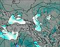
This table gives the weather forecast for Dar-alages at the specific elevation of 3329 m. Our advanced weather models allow us to provide distinct weather forecasts for several elevations of Dar-alages. To see the weather forecasts for the other elevations, use the tab navigation above the table. For a wider overview of the weather, consult the Weather Map of Armenia.
* NOTE: not all weather observatories update at the same frequency which is the reason why some locations may show data from stations that are further away than known closer ones.

