
– Lat/Long: 45.50° N 148.85° E
 Demon
Demon
Weather Forecast, RussiaIssued: 10 pm Tue 22 Apr Local TimeUpdates in: hr min sUpdate imminent
Demon Weather Forecast, Russia
Issued: 10 pm Tue 22 Apr Local Time
Updates in:
Update imminent hr min s

Issued: 10 pm Tue 22 Apr Local Time
Updates in:
Update imminent hr min s
Days 1–4 Weather SummarySome drizzle, heaviest during Fri afternoon. Freeze-thaw conditions (max 5°C on Fri morning, min -2°C on Tue night). Winds decreasing (near gales from the NNW on Tue night, calm by Thu afternoon). | Days 5–7 Weather SummaryLight rain (total 9mm) at first, then becoming colder with a dusting of snow on Fri night. Freeze-thaw conditions (max 4°C on Fri night, min -4°C on Sun night). Winds decreasing (gales from the S on Fri night, calm by Sun morning). | ||||||||||||||||||
Wednesday 23 | Thursday 24 | Friday 25 | Saturday 26 | Sunday 27 | Monday 28 | ||||||||||||||
night | AM | PM | night | AM | PM | night | AM | PM | night | AM | PM | night | AM | PM | night | AM | PM | night | |
some clouds | cloudy | clear | clear | clear | clear | clear | cloudy | light rain | light snow | clear | some clouds | cloudy | some clouds | cloudy | cloudy | clear | some clouds | some clouds | |
km/h | |||||||||||||||||||
 |  |  |  |  |  |  | |||||||||||||
— | — | — | — | — | — | — | — | — | 2.0 | — | — | — | — | — | — | — | — | — | |
— | — | — | — | — | — | — | — | 1.1 | 9 | — | — | — | — | — | — | — | — | — | |
max°C | 0 | -1 | 0 | 1 | 2 | 3 | 4 | 5 | 4 | 4 | 0 | -1 | -1 | -1 | -2 | -3 | -3 | -2 | 0 |
min°C | -2 | -1 | 0 | 0 | 1 | 3 | 3 | 4 | 4 | 2 | 0 | -1 | -2 | -2 | -2 | -4 | -3 | -2 | -1 |
-11 | -6 | -7 | -5 | -3 | 3 | 1 | 0 | -2 | -4 | -4 | -5 | -7 | -2 | -2 | -9 | -10 | -6 | -3 | |
0 | 950 | 1200 | 1350 | 2200 | 2450 | 2450 | 2350 | 2350 | 2100 | 1100 | 1000 | 900 | 900 | 900 | 300 | 450 | 800 | 1000 | |
Cloud base (m) | 250 | 2050 | 2000 | 600 | 300 | 850 | 250 | 200 | 250 | 550 | 700 | 600 | 400 | 250 | 250 | 250 | 300 | ||
— | 6:05 | — | — | 6:03 | — | — | 6:03 | — | — | 6:01 | — | — | 5:58 | — | — | 5:58 | — | — | |
— | — | — | 8:00 | — | — | 8:00 | — | — | 8:02 | — | — | 8:04 | — | — | 8:05 | — | — | 8:06 | |
Loading...
Demon Weather (Days 0-3):
The weather forecast for Demon is: Some drizzle, heaviest during Fri afternoon. Freeze-thaw conditions (max 5°C on Fri morning, min -2°C on Tue night). Winds decreasing (near gales from the NNW on Tue night, calm by Thu afternoon).
Demon Weather (Days 3-6):
Light rain (total 9mm) at first, then becoming colder with a dusting of snow on Fri night. Freeze-thaw conditions (max 4°C on Fri night, min -4°C on Sun night). Winds decreasing (gales from the S on Fri night, calm by Sun morning).
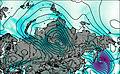
This table gives the weather forecast for Demon at the specific elevation of 1205 m. Our advanced weather models allow us to provide distinct weather forecasts for several elevations of Demon. To see the weather forecasts for the other elevations, use the tab navigation above the table. For a wider overview of the weather, consult the Weather Map of Russia.

