
– Lat/Long: 58.73° N 133.84° W
 Devils Paw
Weather Forecast, CanadaIssued: 9 pm Mon 28 Apr Local TimeUpdates in: hr min sUpdate imminent
Devils Paw Weather Forecast, Canada
Issued: 9 pm Mon 28 Apr Local Time
Updates in:
Update imminent hr min s

Issued: 9 pm Mon 28 Apr Local Time
Updates in:
Update imminent hr min s
Days 1–4 Weather SummaryA heavy fall of snow, heaviest during Wed night. Temperatures will be below freezing (max 0°C on Thu afternoon, min -6°C on Tue night). Wind will be generally light. | Days 5–7 Weather SummaryA moderate fall of snow, heaviest on Thu night. Temperatures will be below freezing (max 0°C on Thu night, min -7°C on Sat night). Wind will be generally light. | ||||||||||||||||||
Tuesday 29 | Wednesday 30 | Thursday 1 | Friday 2 | Saturday 3 | Sunday 4 | ||||||||||||||
night | AM | PM | night | AM | PM | night | AM | PM | night | AM | PM | night | AM | PM | night | AM | PM | night | |
mod. snow | light snow | light snow | mod. snow | cloudy | cloudy | mod. snow | mod. snow | light snow | mod. snow | mod. snow | snow shwrs | some clouds | some clouds | some clouds | snow shwrs | cloudy | light snow | heavy snow | |
km/h | |||||||||||||||||||
 |  |  |  |  |  |  | |||||||||||||
8 | 4 | 5 | 6 | — | — | 9 | 9 | 5 | 6 | 6 | 2.0 | — | — | — | 2.0 | — | 2.0 | 14 | |
— | — | — | — | — | — | — | — | — | — | — | — | — | — | — | — | — | — | — | |
max°C | -3 | -3 | -4 | -4 | -4 | -3 | -2 | -1 | 0 | 0 | -2 | -4 | -5 | -5 | -4 | -5 | -5 | -4 | -4 |
min°C | -4 | -4 | -4 | -6 | -5 | -4 | -2 | -1 | 0 | -1 | -3 | -5 | -6 | -5 | -5 | -7 | -6 | -5 | -4 |
-11 | -11 | -11 | -12 | -11 | -9 | -5 | -5 | -4 | -6 | -9 | -11 | -11 | -9 | -10 | -13 | -12 | -11 | -11 | |
900 | 950 | 950 | 700 | 700 | 950 | 1150 | 1200 | 1400 | 1450 | 1150 | 950 | 550 | 700 | 850 | 450 | 650 | 800 | 800 | |
Cloud base (m) | 700 | 700 | 750 | 750 | 750 | 700 | 1500 | 700 | 700 | 700 | 700 | 700 | 700 | 1850 | 850 | 750 | 700 | 700 | 700 |
— | 5:05 | — | — | 5:01 | — | — | 5:00 | — | — | 4:56 | — | — | 4:54 | — | — | 4:52 | — | — | |
— | — | 8:40 | — | — | 8:44 | — | — | 8:45 | — | — | 8:47 | — | — | 8:51 | — | — | 8:52 | — | |
Loading...
Devils Paw Weather (Days 0-3):
The weather forecast for Devils Paw is: A heavy fall of snow, heaviest during Wed night. Temperatures will be below freezing (max 0°C on Thu afternoon, min -6°C on Tue night). Wind will be generally light.
Devils Paw Weather (Days 3-6):
A moderate fall of snow, heaviest on Thu night. Temperatures will be below freezing (max 0°C on Thu night, min -7°C on Sat night). Wind will be generally light.
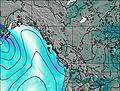
This table gives the weather forecast for Devils Paw at the specific elevation of 1500 m. Our advanced weather models allow us to provide distinct weather forecasts for several elevations of Devils Paw. To see the weather forecasts for the other elevations, use the tab navigation above the table. For a wider overview of the weather, consult the Weather Map of British-Columbia.

