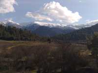
Djebel Chélia guide
- Elevation: 2328 m
- Difficulty:
- Best months to climb:
- Convenient center:
Djebel Chélia Climbing Notes
B Mohamed from ALGERIA writes:
I visited the region where the summit Chélia is located several times. I usually stayed in a nearby hotel which belongs to the forestry guards; visitors are allowed into this hotel prices quite reasonable 25 EUros not including dinner or lunch. The last time I stayed in the hotel was by the end of February 2015. The weather was terrible. Strong wind and very low temperature. I always had the desire to limb up to the summit. I thought I was dangerous. I was totally mistaken. I returned on the 1st of April 2015 I did climb up to the summit but I did not reach the highest peak because of melting thick snow packs. I missed the peak by few hundreds of meters. conclusion: It is easy to climb Mount Chelia. It is not physically demanding; unless you chose a very steep path. It is safe; Mount Cheli is in the center of a well guarded National park
Bennadji Mohamed from Biskra Algeria
2015-04-04 |
Click here to read 1 more climbing note for Djebel Chélia or submit your own
|

Select Djebel Chélia Location Map Detail:
Use this relief map to navigate to mountain peaks in the area of Djebel Chélia.
10 other mountain peaks closest to Djebel Chélia:


 Like us
 Follow us
 Follow us