– Lat/Long: 36.89° N 49.70° E
 Dorfak
Weather Forecast, IranIssued: 8 am Wed 16 Apr Local TimeUpdates in: hr min sUpdate imminent
Dorfak Weather Forecast, Iran
Issued: 8 am Wed 16 Apr Local Time
Updates in:
Update imminent hr min s

Issued: 8 am Wed 16 Apr Local Time
Updates in:
Update imminent hr min s
Days 1–3 Weather SummaryA heavy fall of snow, heaviest during Wed night. Temperatures will be below freezing (max -2°C on Fri night, min -8°C on Wed night). Winds decreasing (fresh winds from the NNE on Thu night, calm by Fri night). | Days 4–6 Weather SummaryMostly dry. Freeze-thaw conditions (max 8°C on Mon afternoon, min -2°C on Sat morning). Winds increasing (light winds from the WNW on Sat night, fresh winds from the SW by Mon night). | |||||||||||||||||
Wednesday 16 | Thursday 17 | Friday 18 | Saturday 19 | Sunday 20 | Monday 21 | |||||||||||||
AM | PM | night | AM | PM | night | AM | PM | night | AM | PM | night | AM | PM | night | AM | PM | night | |
snow shwrs | snow shwrs | mod. snow | light snow | snow shwrs | some clouds | some clouds | some clouds | clear | clear | clear | clear | clear | clear | some clouds | some clouds | clear | some clouds | |
km/h | ||||||||||||||||||
 |  |  |  |  |  | |||||||||||||
2.0 | 5 | 10 | 2.0 | 1.0 | — | — | — | — | — | — | — | — | — | — | — | — | — | |
— | — | — | — | — | — | — | — | — | — | — | — | — | — | — | — | — | — | |
max°C | -5 | -5 | -7 | -6 | -6 | -6 | -4 | -3 | -2 | -1 | 0 | 1 | 3 | 5 | 6 | 6 | 8 | 8 |
min°C | -5 | -5 | -8 | -7 | -7 | -7 | -5 | -3 | -2 | -2 | -1 | 0 | 2 | 4 | 5 | 6 | 8 | 8 |
-13 | -12 | -16 | -15 | -16 | -16 | -11 | -3 | -5 | -5 | -5 | -3 | -1 | 0 | 1 | 2 | 5 | 5 | |
2100 | 1850 | 1450 | 1550 | 1700 | 1650 | 1600 | 2100 | 2100 | 2300 | 2650 | 2850 | 3050 | 3350 | 3550 | 3550 | 3750 | 3800 | |
Cloud base (m) | 550 | 500 | 450 | 500 | 700 | 1750 | 750 | 800 | 1600 | 1650 | 1850 | 7100 | 7250 | 7100 | 6800 | 5150 | ||
5:35 | — | — | 5:33 | — | — | 5:33 | — | — | 5:31 | — | — | 5:30 | — | — | 5:28 | — | — | |
— | 6:45 | — | — | 6:46 | — | — | 6:47 | — | — | 6:49 | — | — | 6:50 | — | — | 6:50 | — | |
Loading...
Dorfak Weather (Days 0-3):
The weather forecast for Dorfak is: A heavy fall of snow, heaviest during Wed night. Temperatures will be below freezing (max -2°C on Fri night, min -8°C on Wed night). Winds decreasing (fresh winds from the NNE on Thu night, calm by Fri night).
Dorfak Weather (Days 3-6):
Mostly dry. Freeze-thaw conditions (max 8°C on Mon afternoon, min -2°C on Sat morning). Winds increasing (light winds from the WNW on Sat night, fresh winds from the SW by Mon night).
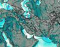
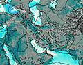
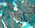
This table gives the weather forecast for Dorfak at the specific elevation of 2731 m. Our advanced weather models allow us to provide distinct weather forecasts for several elevations of Dorfak. To see the weather forecasts for the other elevations, use the tab navigation above the table. For a wider overview of the weather, consult the Weather Map of Iran.
| Weather Station | Temp. | Weather | Wind | Gusts | Cloud / Visibility |
|---|---|---|---|---|---|
Rasht Airport | |||||
Ghazvin Airport | |||||
Ramsar Airport | |||||
Zanjan Airport | |||||
hy2b51E37N | |||||
hy2b50E38N | |||||
hy2b51E38N | |||||
Noshahr Airport | |||||
Kara / ayam Airport | |||||
hy2b52E37N |
* NOTE: not all weather observatories update at the same frequency which is the reason why some locations may show data from stations that are further away than known closer ones.
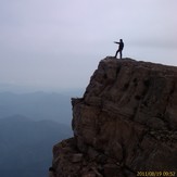
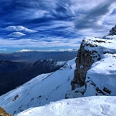
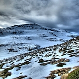
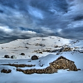
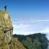
Dorfak Photos
View all
photos (8476) |
Alborz photos (8516) |
photos from mountains in Iran (11692) |
all photos
 Upload new photo
 See 170 more Dorfak photos
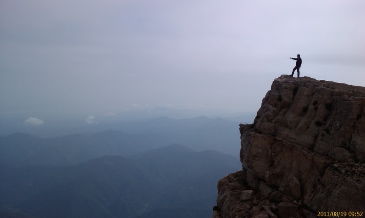
naser ramezani dorfak
North wall
hossein fallah.91/09/14
hossein fallah.91/09/14
hossein fallah.91/09/14
hossein fallah.91/09/14
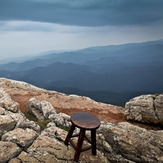
BEST LOCATION FOR VIEWING GILAN

