– Lat/Long: 52.21° N 3.67° W
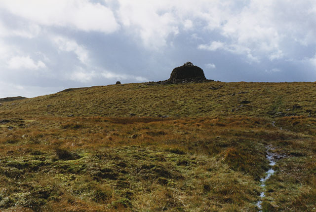
 Drygarn Fawr
Weather Forecast, United KingdomIssued: 12 pm Sat 19 Apr Local TimeUpdates in: hr min sUpdate imminent
Drygarn Fawr Weather Forecast, United Kingdom
Issued: 12 pm Sat 19 Apr Local Time
Updates in:
Update imminent hr min s

Issued: 12 pm Sat 19 Apr Local Time
Updates in:
Update imminent hr min s
Days 1–3 Weather SummaryLight rain (total 6mm), mostly falling on Sun night. Mild temperatures (max 9°C on Sun morning, min 3°C on Mon night). Winds decreasing (strong winds from the ESE on Sat morning, light winds from the E by Sat night). | Days 4–6 Weather SummaryModerate rain (total 11mm), heaviest on Tue night. Mild temperatures (max 8°C on Thu morning, min 5°C on Tue night). Winds decreasing (fresh winds from the S on Tue night, light winds from the SSW by Thu night). | |||||||||||||||||
Saturday 19 | Sunday 20 | Monday 21 | Tuesday 22 | Wednesday 23 | Thursday 24 | |||||||||||||
AM | PM | night | AM | PM | night | AM | PM | night | AM | PM | night | AM | PM | night | AM | PM | night | |
rain shwrs | rain shwrs | some clouds | clear | some clouds | light rain | light rain | rain shwrs | some clouds | light rain | rain shwrs | mod. rain | light rain | light rain | light rain | light rain | light rain | light rain | |
km/h | ||||||||||||||||||
 |  |  |  |  |  | |||||||||||||
— | — | — | — | — | — | — | — | — | — | — | — | — | — | — | — | — | — | |
2 | 0.1 | — | — | — | 2 | 1.4 | 0.3 | — | 0.1 | 0.1 | 6 | 0.7 | 0.1 | 0.3 | 0.3 | 0.4 | 3 | |
max°C | 7 | 7 | 7 | 9 | 8 | 7 | 7 | 7 | 4 | 7 | 7 | 7 | 7 | 7 | 6 | 8 | 8 | 7 |
min°C | 6 | 7 | 4 | 7 | 8 | 5 | 5 | 6 | 3 | 6 | 7 | 5 | 7 | 6 | 5 | 6 | 8 | 7 |
0 | 2 | 1 | 4 | 5 | 2 | 2 | 3 | 0 | 3 | 3 | 1 | 5 | 3 | 3 | 3 | 6 | 5 | |
1950 | 2050 | 2100 | 2150 | 1850 | 1900 | 1500 | 1450 | 1450 | 1400 | 1500 | 1550 | 2000 | 2100 | 1700 | 1500 | 1950 | 2250 | |
Cloud base (m) | 300 | 750 | 1750 | 2400 | 2650 | 450 | 300 | 650 | 2300 | 750 | 400 | 350 | 300 | 400 | 400 | 700 | 550 | |
6:09 | — | — | 6:07 | — | — | 6:05 | — | — | 6:03 | — | — | 6:01 | — | — | 5:58 | — | — | |
— | 8:17 | — | — | 8:20 | — | — | 8:22 | — | — | 8:22 | — | — | 8:24 | — | — | 8:27 | — | |
Loading...
Drygarn Fawr Weather (Days 0-3):
The weather forecast for Drygarn Fawr is: Light rain (total 6mm), mostly falling on Sun night. Mild temperatures (max 9°C on Sun morning, min 3°C on Mon night). Winds decreasing (strong winds from the ESE on Sat morning, light winds from the E by Sat night).
Drygarn Fawr Weather (Days 3-6):
Moderate rain (total 11mm), heaviest on Tue night. Mild temperatures (max 8°C on Thu morning, min 5°C on Tue night). Winds decreasing (fresh winds from the S on Tue night, light winds from the SSW by Thu night).
This table gives the weather forecast for Drygarn Fawr at the specific elevation of 645 m. Our advanced weather models allow us to provide distinct weather forecasts for several elevations of Drygarn Fawr. To see the weather forecasts for the other elevations, use the tab navigation above the table. For a wider overview of the weather, consult the Weather Map of United Kingdom.
Drygarn Fawr Photos
View all
Radnor Hills photos (4) |
Cambrian Mountains photos (326) |
photos from mountains in United Kingdom (1953) |
all photos
 Upload new photo
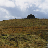
Drygarn Fawr

