– Lat/Long: 41.94° S 146.05° E
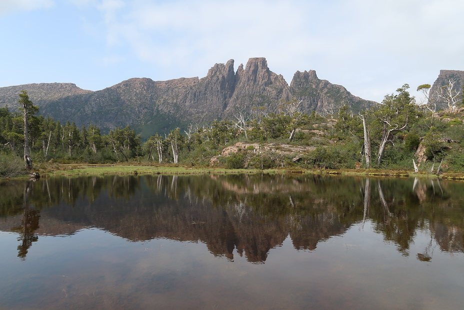
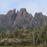
 Du Cane Range
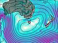
Weather Forecast, AustraliaIssued: 3 am Sat 19 Apr Local TimeUpdates in: hr min sUpdate imminent
Du Cane Range Weather Forecast, Australia
Issued: 3 am Sat 19 Apr Local Time
Updates in:
Update imminent hr min s

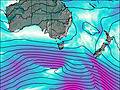
Issued: 3 am Sat 19 Apr Local Time
Updates in:
Update imminent hr min s
Days 1–3 Weather SummaryModerate rain (total 14mm), heaviest on Sat night. Very mild (max 10°C on Mon morning, min 6°C on Sat morning). Winds decreasing (fresh winds from the N on Sat night, calm by Mon afternoon). | Days 4–6 Weather SummaryLight rain (total 6mm) at first, then becoming colder with a dusting of snow on Thu night. Freeze-thaw conditions (max 9°C on Tue afternoon, min -1°C on Thu night). Winds increasing (calm on Tue morning, near gales from the NW by Thu night). | |||||||||||||||||
Saturday 19 | Sunday 20 | Monday 21 | Tuesday 22 | Wednesday 23 | Thursday 24 | |||||||||||||
AM | PM | night | AM | PM | night | AM | PM | night | AM | PM | night | AM | PM | night | AM | PM | night | |
some clouds | light rain | mod. rain | light rain | risk tstorm | rain shwrs | rain shwrs | rain shwrs | some clouds | some clouds | clear | rain shwrs | rain shwrs | rain shwrs | rain shwrs | light rain | light rain | light snow | |
km/h | ||||||||||||||||||
 |  |  |  |  |  | |||||||||||||
— | — | — | — | — | — | — | — | — | — | — | — | — | — | — | — | — | 2.0 | |
— | 0.8 | 9 | 0.6 | 2 | 0.4 | 0.1 | 0.4 | — | — | — | 0.6 | 0.4 | 0.6 | 0.4 | 0.3 | 0.9 | 3 | |
max°C | 9 | 8 | 9 | 8 | 8 | 9 | 10 | 9 | 9 | 8 | 9 | 6 | 6 | 6 | 6 | 6 | 7 | 7 |
min°C | 6 | 8 | 8 | 7 | 8 | 7 | 9 | 9 | 7 | 7 | 7 | 5 | 5 | 6 | 5 | 5 | 7 | -1 |
2 | 4 | 4 | 3 | 4 | 4 | 8 | 9 | 4 | 5 | 6 | 2 | 2 | 6 | 0 | -1 | 1 | -9 | |
3000 | 3000 | 2850 | 2900 | 2900 | 2850 | 3050 | 3150 | 2950 | 2900 | 2900 | 2850 | 2900 | 2900 | 3000 | 3100 | 2750 | 2600 | |
Cloud base (m) | 700 | 1650 | 550 | 650 | 850 | 1750 | 2450 | 1950 | 850 | 2600 | 1950 | 700 | 1600 | 850 | 600 | 600 | 600 | |
6:50 | — | — | 6:50 | — | — | 6:52 | — | — | 6:52 | — | — | 6:54 | — | — | 6:54 | — | — | |
— | 5:38 | — | — | 5:37 | — | — | 5:36 | — | — | 5:34 | — | — | 5:32 | — | — | 5:30 | — | |
Loading...
Du Cane Range Weather (Days 0-3):
The weather forecast for Du Cane Range is: Moderate rain (total 14mm), heaviest on Sat night. Very mild (max 10°C on Mon morning, min 6°C on Sat morning). Winds decreasing (fresh winds from the N on Sat night, calm by Mon afternoon).
Du Cane Range Weather (Days 3-6):
Light rain (total 6mm) at first, then becoming colder with a dusting of snow on Thu night. Freeze-thaw conditions (max 9°C on Tue afternoon, min -1°C on Thu night). Winds increasing (calm on Tue morning, near gales from the NW by Thu night).
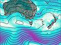
This table gives the weather forecast for Du Cane Range at the specific elevation of 1520 m. Our advanced weather models allow us to provide distinct weather forecasts for several elevations of Du Cane Range. To see the weather forecasts for the other elevations, use the tab navigation above the table. For a wider overview of the weather, consult the Weather Map of Tasmania.
Du Cane Range Photos
View all
Central Highlands (Tasmania) photos (32) |
Other ranges of Australia photos (81) |
photos from mountains in Australia (235) |
all photos
 Upload new photo
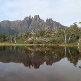
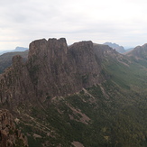
Mount Geryon
Mount Geryon
Mount Geryon

