– Lat/Long: 45.92° N 7.88° E
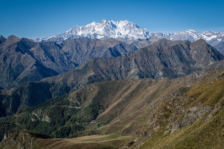
 Dufourspitze
Weather Forecast, SwitzerlandIssued: 1 am Wed 16 Apr Local TimeUpdates in: hr min sUpdate imminent
Dufourspitze Weather Forecast, Switzerland
Issued: 1 am Wed 16 Apr Local Time
Updates in:
Update imminent hr min s

Issued: 1 am Wed 16 Apr Local Time
Updates in:
Update imminent hr min s
Days 1–3 Weather SummaryA heavy fall of snow, heaviest during Wed night. Extremely cold (max -13°C on Thu morning, min -16°C on Thu night). Winds decreasing (near gales from the SSE on Wed afternoon, light winds from the NNW by Thu night). | Days 4–6 Weather SummaryA heavy fall of snow, heaviest during Sun morning. Extremely cold (max -13°C on Mon night, min -18°C on Sun night). Winds decreasing (strong winds from the S on Sun morning, light winds from the SW by Mon night). | |||||||||||||||||
Wednesday 16 | Thursday 17 | Friday 18 | Saturday 19 | Sunday 20 | Monday 21 | |||||||||||||
AM | PM | night | AM | PM | night | AM | PM | night | AM | PM | night | AM | PM | night | AM | PM | night | |
heavy snow | heavy snow | heavy snow | heavy snow | heavy snow | mod. snow | mod. snow | snow shwrs | clear | clear | snow shwrs | snow shwrs | heavy snow | heavy snow | snow shwrs | light snow | light snow | clear | |
km/h | ||||||||||||||||||
 |  |  |  |  |  | |||||||||||||
26 | 60 | 145 | 47 | 27 | 10 | 6 | 2.0 | — | — | 2.0 | 11 | 23 | 12 | 3 | 5 | 2.0 | — | |
— | — | — | — | — | — | — | — | — | — | — | — | — | — | — | — | — | — | |
max°C | -15 | -14 | -14 | -13 | -14 | -15 | -16 | -15 | -14 | -15 | -15 | -15 | -16 | -16 | -17 | -16 | -15 | -13 |
min°C | -15 | -14 | -14 | -14 | -14 | -16 | -16 | -16 | -15 | -15 | -15 | -16 | -16 | -16 | -18 | -16 | -15 | -15 |
-29 | -27 | -27 | -26 | -25 | -23 | -25 | -26 | -25 | -26 | -26 | -28 | -28 | -29 | -31 | -29 | -26 | -22 | |
2350 | 2500 | 2400 | 2550 | 2500 | 2100 | 2150 | 2250 | 2000 | 2200 | 2300 | 2150 | 2200 | 2250 | 1950 | 2250 | 2350 | 2150 | |
Cloud base (m) | 2350 | 2350 | 2350 | 2350 | 2350 | 2400 | 2400 | 2350 | 2400 | 2350 | 2350 | 2350 | 2400 | 2350 | 2400 | 2400 | 2400 | 2700 |
6:41 | — | — | 6:39 | — | — | 6:37 | — | — | 6:35 | — | — | 6:33 | — | — | 6:33 | — | — | |
— | — | 8:15 | — | — | 8:16 | — | — | 8:17 | — | — | 8:19 | — | — | 8:21 | — | — | 8:22 | |
Loading...
Dufourspitze Weather (Days 0-3):
The weather forecast for Dufourspitze is: A heavy fall of snow, heaviest during Wed night. Extremely cold (max -13°C on Thu morning, min -16°C on Thu night). Winds decreasing (near gales from the SSE on Wed afternoon, light winds from the NNW by Thu night).
Dufourspitze Weather (Days 3-6):
A heavy fall of snow, heaviest during Sun morning. Extremely cold (max -13°C on Mon night, min -18°C on Sun night). Winds decreasing (strong winds from the S on Sun morning, light winds from the SW by Mon night).
This table gives the weather forecast for Dufourspitze at the specific elevation of 4634 m. Our advanced weather models allow us to provide distinct weather forecasts for several elevations of Dufourspitze. To see the weather forecasts for the other elevations, use the tab navigation above the table. For a wider overview of the weather, consult the Weather Map of Switzerland.
| Weather Station | Temp. | Weather | Wind | Gusts | Cloud / Visibility |
|---|---|---|---|---|---|
lightning 13km ESE of Zermatt | |||||
lightning 18km S of Saas-Fee | |||||
lightning 22km W of Varallo | |||||
ZFC: Gornergrat N. | |||||
lightning 21km NNW of Sagliano Micca | |||||
ZFC: Riffelberg | |||||
lightning 22km ENE of Ayas | |||||
ZFC: Gornergr. North | |||||
lightning 21km NW of Coggiola |
* NOTE: not all weather observatories update at the same frequency which is the reason why some locations may show data from stations that are further away than known closer ones.
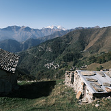
Dufourspitze Photos
View all
Pennine Alps photos (197) |
Alps photos (1456) |
photos from mountains in Switzerland (643) |
all photos
 Upload new photo
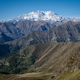
Monte Rosa Massif
Monte Rosa Massif

