
– Lat/Long: 40.59° N 110.79° W
 East Grandaddy Mountain
Weather Forecast, United StatesIssued: 11 pm Mon 28 Apr Local TimeUpdates in: hr min sUpdate imminent
East Grandaddy Mountain Weather Forecast, United States
Issued: 11 pm Mon 28 Apr Local Time
Updates in:
Update imminent hr min s

Issued: 11 pm Mon 28 Apr Local Time
Updates in:
Update imminent hr min s
Days 1–4 Weather SummaryA dusting of snow on Mon night. Freezing level rising with drizzle on Tue afternoon. Freeze-thaw conditions (max 5°C on Thu afternoon, min -3°C on Mon night). Wind will be generally light. | Days 5–7 Weather SummaryModerate rain (total 11mm) heaviest on Sat night, then becoming colder with a dusting of snow on Sat night. Freeze-thaw conditions (max 9°C on Fri afternoon, min -1°C on Sun morning). Winds increasing (calm on Fri afternoon, fresh winds from the SSE by Sun morning). | ||||||||||||||||||
Tuesday 29 | Wednesday 30 | Thursday 1 | Friday 2 | Saturday 3 | Sunday 4 | ||||||||||||||
night | AM | PM | night | AM | PM | night | AM | PM | night | AM | PM | night | AM | PM | night | AM | PM | night | |
snow shwrs | some clouds | light rain | some clouds | light snow | light snow | some clouds | clear | light rain | rain shwrs | clear | clear | clear | rain shwrs | risk tstorm | snow shwrs | snow shwrs | snow shwrs | snow shwrs | |
km/h | |||||||||||||||||||
 |  |  |  |  |  |  | |||||||||||||
1.0 | — | — | — | 1.0 | 2.0 | — | — | — | — | — | — | — | — | — | 1.0 | 1.0 | 1.0 | 1.0 | |
— | — | 1.3 | — | — | — | — | — | 0.3 | 0.1 | — | — | — | 0.5 | 2 | 7 | — | 0.4 | — | |
max°C | -3 | 2 | 3 | 0 | 1 | 2 | -1 | 2 | 5 | 2 | 5 | 9 | 6 | 6 | 8 | 2 | 1 | 2 | -2 |
min°C | -3 | -1 | 2 | 0 | 0 | 0 | -3 | -1 | 5 | 1 | 2 | 7 | 4 | 4 | 5 | 1 | -1 | 1 | -3 |
-3 | -3 | -2 | -4 | -2 | -4 | -3 | -1 | 5 | -2 | 0 | 6 | 2 | 1 | 2 | -5 | -8 | -5 | -7 | |
2500 | 2900 | 3400 | 3100 | 3050 | 3250 | 2750 | 2900 | 3650 | 3300 | 3350 | 3950 | 3650 | 3600 | 3950 | 3350 | 3150 | 3150 | 2750 | |
Cloud base (m) | 3050 | 6450 | 4100 | 3350 | 3100 | 3150 | 2750 | 4300 | 6000 | 4200 | 3050 | 2800 | |||||||
— | 6:24 | — | — | 6:22 | — | — | 6:22 | — | — | 6:20 | — | — | 6:18 | — | — | 6:18 | — | — | |
— | — | 8:15 | — | — | 8:16 | — | — | 8:17 | — | — | 8:19 | — | — | 8:20 | — | — | 8:21 | — | |
Loading...
East Grandaddy Mountain Weather (Days 0-3):
The weather forecast for East Grandaddy Mountain is: A dusting of snow on Mon night. Freezing level rising with drizzle on Tue afternoon. Freeze-thaw conditions (max 5°C on Thu afternoon, min -3°C on Mon night). Wind will be generally light.
East Grandaddy Mountain Weather (Days 3-6):
Moderate rain (total 11mm) heaviest on Sat night, then becoming colder with a dusting of snow on Sat night. Freeze-thaw conditions (max 9°C on Fri afternoon, min -1°C on Sun morning). Winds increasing (calm on Fri afternoon, fresh winds from the SSE by Sun morning).
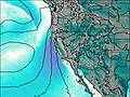
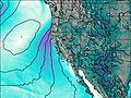
This table gives the weather forecast for East Grandaddy Mountain at the specific elevation of 3000 m. Our advanced weather models allow us to provide distinct weather forecasts for several elevations of East Grandaddy Mountain. To see the weather forecasts for the other elevations, use the tab navigation above the table. For a wider overview of the weather, consult the Weather Map of Utah.
| Weather Station | Temp. | Weather | Wind | Gusts | Cloud / Visibility |
|---|---|---|---|---|---|
* NOTE: not all weather observatories update at the same frequency which is the reason why some locations may show data from stations that are further away than known closer ones.

