
– Lat/Long: 37.39° N 104.92° W
 East Spanish Peak
Weather Forecast, United StatesIssued: 11 am Mon 31 Mar Local TimeUpdates in: hr min sUpdate imminent
East Spanish Peak Weather Forecast, United States
Issued: 11 am Mon 31 Mar Local Time
Updates in:
Update imminent hr min s

Issued: 11 am Mon 31 Mar Local Time
Updates in:
Update imminent hr min s
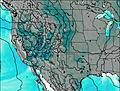
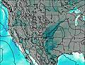
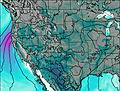
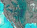
Days 1–3 Weather SummaryLight rain (total 2mm) at first, then becoming colder with a dusting of snow on Wed night. Freeze-thaw conditions (max 14°C on Mon afternoon, min -2°C on Tue night). Winds decreasing (near gales from the WSW on Tue afternoon, light winds from the ENE by Wed night). | Days 4–6 Weather SummaryA light covering of new snow on Thu morning turning to drizzle on Thu morning. Freeze-thaw conditions (max 4°C on Thu afternoon, min -4°C on Fri night). Wind will be generally light. | |||||||||||||||||
Monday 31 | Tuesday 1 | Wednesday 2 | Thursday 3 | Friday 4 | Saturday 5 | |||||||||||||
AM | PM | night | AM | PM | night | AM | PM | night | AM | PM | night | AM | PM | night | AM | PM | night | |
clear | clear | rain shwrs | rain shwrs | rain shwrs | clear | clear | some clouds | light snow | snow shwrs | light rain | some clouds | some clouds | light snow | light snow | light snow | cloudy | some clouds | |
km/h | ||||||||||||||||||
 |  |  |  |  |  | |||||||||||||
— | — | — | — | — | — | — | — | 3 | 2.0 | — | — | — | 2.0 | 3 | 2.0 | — | — | |
— | — | 0.1 | 1.2 | 0.6 | — | — | — | 0.1 | 0.8 | 0.5 | — | — | — | — | — | — | — | |
max°C | 12 | 14 | 11 | 6 | 7 | 1 | 4 | 7 | 4 | 2 | 4 | -1 | 1 | 0 | -2 | -2 | -1 | -4 |
min°C | 7 | 13 | 6 | 5 | 5 | -2 | 1 | 6 | -2 | -2 | 2 | -2 | 0 | -1 | -4 | -3 | -1 | -4 |
4 | 10 | 0 | -1 | -1 | -10 | -5 | 3 | -6 | -6 | 0 | -2 | -5 | -5 | -10 | -9 | -6 | -4 | |
3000 | 3750 | 3450 | 2800 | 2850 | 1900 | 2150 | 2800 | 2400 | 1750 | 2500 | 1500 | 2250 | 2000 | 1550 | 1550 | 1900 | 1100 | |
Cloud base (m) | 8150 | 6000 | 2750 | 3750 | 5400 | 5050 | 2450 | 4650 | 2450 | 2900 | 2450 | 2450 | 2450 | 2450 | 2500 | |||
6:47 | — | — | 6:45 | — | — | 6:43 | — | — | 6:41 | — | — | 6:41 | — | — | 6:39 | — | — | |
— | 7:21 | — | — | 7:22 | — | — | 7:22 | — | — | 7:22 | — | — | 7:23 | — | — | 7:24 | — | |
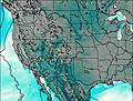
East Spanish Peak Weather (Days 0-3):
The weather forecast for East Spanish Peak is: Light rain (total 2mm) at first, then becoming colder with a dusting of snow on Wed night. Freeze-thaw conditions (max 14°C on Mon afternoon, min -2°C on Tue night). Winds decreasing (near gales from the WSW on Tue afternoon, light winds from the ENE by Wed night).
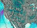
East Spanish Peak Weather (Days 3-6):
A light covering of new snow on Thu morning turning to drizzle on Thu morning. Freeze-thaw conditions (max 4°C on Thu afternoon, min -4°C on Fri night). Wind will be generally light.
This table gives the weather forecast for East Spanish Peak at the specific elevation of 2000 m. Our advanced weather models allow us to provide distinct weather forecasts for several elevations of East Spanish Peak. To see the weather forecasts for the other elevations, use the tab navigation above the table. For a wider overview of the weather, consult the Weather Map of Colorado.
| Weather Station | Temp. | Weather | Wind | Gusts | Cloud / Visibility |
|---|---|---|---|---|---|
La Veta Pass Airport | |||||
Trinida / erry Stokes Airport | |||||
Alamosa Airport | |||||
* NOTE: not all weather observatories update at the same frequency which is the reason why some locations may show data from stations that are further away than known closer ones.

