– Lat/Long: 47.28° N 9.41° E
 Ebenalp
Weather Forecast, SwitzerlandIssued: 7 pm Thu 24 Apr Local TimeUpdates in: hr min sUpdate imminent
Ebenalp Weather Forecast, Switzerland
Issued: 7 pm Thu 24 Apr Local Time
Updates in:
Update imminent hr min s

Issued: 7 pm Thu 24 Apr Local Time
Updates in:
Update imminent hr min s
Days 1–4 Weather SummaryModerate rain (total 10mm), heaviest on Fri afternoon. Very mild (max 12°C on Sun afternoon, min 4°C on Thu night). Wind will be generally light. | Days 5–7 Weather SummarySome drizzle, heaviest during Mon afternoon. Very mild (max 16°C on Tue afternoon, min 9°C on Sun night). Wind will be generally light. | ||||||||||||||||||
Friday 25 | Saturday 26 | Sunday 27 | Monday 28 | Tuesday 29 | Wednesday 30 | ||||||||||||||
night | AM | PM | night | AM | PM | night | AM | PM | night | AM | PM | night | AM | PM | night | AM | PM | night | |
rain shwrs | light rain | light rain | some clouds | clear | clear | some clouds | some clouds | rain shwrs | rain shwrs | clear | risk tstorm | risk tstorm | clear | clear | clear | clear | clear | clear | |
km/h | |||||||||||||||||||
 |  |  |  |  |  |  | |||||||||||||
— | — | — | — | — | — | — | — | — | — | — | — | — | — | — | — | — | — | — | |
3 | 3 | 4 | — | — | — | — | — | 0.6 | 0.2 | — | 1.1 | 0.6 | — | — | — | — | — | — | |
max°C | 6 | 5 | 5 | 5 | 7 | 11 | 9 | 11 | 12 | 11 | 12 | 14 | 12 | 12 | 16 | 13 | 13 | 16 | 14 |
min°C | 4 | 4 | 4 | 4 | 4 | 11 | 8 | 8 | 12 | 9 | 9 | 14 | 10 | 10 | 15 | 11 | 11 | 15 | 11 |
3 | 2 | 3 | 3 | 3 | 10 | 7 | 8 | 11 | 9 | 9 | 13 | 10 | 10 | 15 | 11 | 11 | 14 | 11 | |
1750 | 1650 | 1750 | 1850 | 2500 | 2750 | 2700 | 2700 | 2750 | 2700 | 2750 | 3000 | 3050 | 3150 | 3250 | 3350 | 3200 | 3250 | 3300 | |
Cloud base (m) | 750 | 700 | 700 | 1550 | 1550 | 2350 | 3050 | 2050 | 2600 | 2600 | 2150 | 950 | 2400 | 9250 | 1600 | ||||
— | 6:16 | — | — | 6:15 | — | — | 6:13 | — | — | 6:11 | — | — | 6:09 | — | — | 6:07 | — | — | |
— | — | — | 8:23 | — | — | 8:24 | — | — | 8:27 | — | — | 8:28 | — | — | 8:30 | — | — | 8:30 | |
Loading...
Ebenalp Weather (Days 0-3):
The weather forecast for Ebenalp is: Moderate rain (total 10mm), heaviest on Fri afternoon. Very mild (max 12°C on Sun afternoon, min 4°C on Thu night). Wind will be generally light.
Ebenalp Weather (Days 3-6):
Some drizzle, heaviest during Mon afternoon. Very mild (max 16°C on Tue afternoon, min 9°C on Sun night). Wind will be generally light.
This table gives the weather forecast for Ebenalp at the specific elevation of 1000 m. Our advanced weather models allow us to provide distinct weather forecasts for several elevations of Ebenalp. To see the weather forecasts for the other elevations, use the tab navigation above the table. For a wider overview of the weather, consult the Weather Map of Switzerland.
Ebenalp Photos
View all
Glarus Alps photos (60) |
Alps photos (1456) |
photos from mountains in Switzerland (643) |
all photos
 Upload new photo
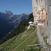
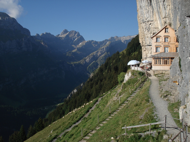
Ascher-Inn
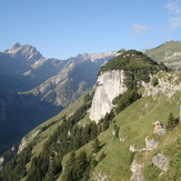
Ebenalp
Ebenalp
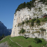
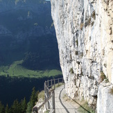
Wildkirchli path
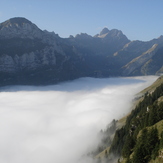
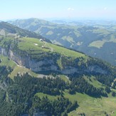
Ebenalp
Ebenalp
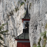
Wildkirchli

