
– Lat/Long: 44.92° N 6.37° E
 Ecrins
Weather Forecast, FranceIssued: 7 pm Sun 07 Sep Local TimeUpdates in: hr min sUpdate imminent
Issued: 7 pm Sun 07 Sep Local Time
Updates in:
Update imminent hr min s

Issued: 7 pm Sun 07 Sep Local Time
Updates in:
Update imminent hr min s
Days 1–4 Weather SummaryA moderate fall of snow, heaviest on Mon night. Freeze-thaw conditions (max 2°C on Sun night, min -5°C on Wed morning). Winds increasing (light winds from the WSW on Sun night, fresh winds from the SW by Tue afternoon). | Days 5–7 Weather SummaryA dusting of new snow. Temperatures will be below freezing (max -2°C on Thu afternoon, min -6°C on Wed night). Mainly fresh winds. | ||||||||||||||||||
Monday 8 | Tuesday 9 | Wednesday 10 | Thursday 11 | Friday 12 | Saturday 13 | ||||||||||||||
night | AM | PM | night | AM | PM | night | AM | PM | night | AM | PM | night | AM | PM | night | AM | PM | night | |
some clouds | light snow | some clouds | snow shwrs | mod. snow | snow shwrs | some clouds | some clouds | snow shwrs | snow shwrs | clear | clear | clear | clear | clear | clear | clear | clear | some clouds | |
km/h | |||||||||||||||||||
 |  |  |  |  |  |  | |||||||||||||
— | 1 | — | 6 | 6 | 2 | — | — | 2 | 1 | — | — | — | — | — | — | — | — | — | |
— | — | — | — | — | — | — | — | — | — | — | — | — | — | — | — | — | — | — | |
max°C | 2 | -1 | -2 | -2 | -3 | -3 | -4 | -4 | -4 | -5 | -3 | -2 | -2 | -2 | -3 | -3 | -4 | -3 | -3 |
min°C | 0 | -2 | -2 | -4 | -3 | -4 | -4 | -5 | -5 | -6 | -5 | -2 | -2 | -3 | -3 | -4 | -4 | -3 | -5 |
-5 | -6 | -7 | -10 | -10 | -10 | -9 | -12 | -12 | -14 | -13 | -9 | -9 | -10 | -9 | -11 | -11 | -10 | -12 | |
4350 | 3750 | 3800 | 3650 | 3500 | 3500 | 3450 | 3300 | 3300 | 3100 | 3550 | 3750 | 3700 | 3700 | 3650 | 3650 | 3400 | 3650 | 3400 | |
Cloud base (m) | 2350 | 2750 | 2550 | 2300 | 2700 | 2900 | 6300 | 3100 | 2750 | 2650 | 7350 | 3300 | 4500 | ||||||
— | 7:03 | — | — | 7:05 | — | — | 7:05 | — | — | 7:07 | — | — | 7:07 | — | — | 7:09 | — | — | |
— | — | 7:59 | — | — | 7:58 | — | — | 7:55 | — | — | 7:53 | — | — | 7:52 | — | — | 7:50 | — | |
Loading...
Ecrins Weather (Days 0-3):
The weather forecast for Ecrins is: A moderate fall of snow, heaviest on Mon night. Freeze-thaw conditions (max 2°C on Sun night, min -5°C on Wed morning). Winds increasing (light winds from the WSW on Sun night, fresh winds from the SW by Tue afternoon).
Ecrins Weather (Days 3-6):
A dusting of new snow. Temperatures will be below freezing (max -2°C on Thu afternoon, min -6°C on Wed night). Mainly fresh winds.
This table gives the weather forecast for Ecrins at the specific elevation of 4101 m. Our advanced weather models allow us to provide distinct weather forecasts for several elevations of Ecrins. To see the weather forecasts for the other elevations, use the tab navigation above the table. For a wider overview of the weather, consult the Weather Map of France.
Ecrins Photos
View all
Dauphine Alps photos (34) |
Alps photos (1476) |
photos from mountains in France (297) |
all photos
 Upload new photo
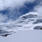

Barre des écrins from Pic de Roche Faurio