
– Lat/Long: 8.53° N 71.09° W
 El Toro
Weather Forecast, VenezuelaIssued: 1 pm Fri 18 Apr Local TimeUpdates in: hr min sUpdate imminent
El Toro Weather Forecast, Venezuela
Issued: 1 pm Fri 18 Apr Local Time
Updates in:
Update imminent hr min s

Issued: 1 pm Fri 18 Apr Local Time
Updates in:
Update imminent hr min s
Days 1–4 Weather SummaryA heavy fall of snow, heaviest during Fri night. Freeze-thaw conditions (max 2°C on Fri afternoon, min 0°C on Sat night). Wind will be generally light. | Days 5–7 Weather SummaryA moderate fall of snow, heaviest on Tue night. Freeze-thaw conditions (max 1°C on Tue afternoon, min 0°C on Mon afternoon). Wind will be generally light. | ||||||||||||||||
Fri 18 | Saturday 19 | Sunday 20 | Monday 21 | Tuesday 22 | Wednesday 23 | ||||||||||||
PM | night | AM | PM | night | AM | PM | night | AM | PM | night | AM | PM | night | AM | PM | night | |
snow shwrs | snow shwrs | mod. snow | mod. snow | cloudy | some clouds | snow shwrs | snow shwrs | light snow | some clouds | snow shwrs | light snow | snow shwrs | snow shwrs | light snow | snow shwrs | some clouds | |
km/h | |||||||||||||||||
 |  |  |  |  |  | ||||||||||||
3 | 15 | 8 | 7 | — | — | 2.0 | 5 | 5 | — | 1.0 | 1.0 | 2.0 | 9 | 1.0 | 1.0 | — | |
— | — | — | — | — | — | — | — | — | — | — | — | — | — | — | — | — | |
max°C | 2 | 1 | 1 | 1 | 1 | 1 | 1 | 1 | 0 | 0 | 0 | 0 | 1 | 1 | 0 | 1 | 1 |
min°C | 2 | 1 | 1 | 1 | 0 | 1 | 1 | 0 | 0 | 0 | 0 | 0 | 1 | 0 | 0 | 1 | 0 |
-1 | -1 | -3 | -3 | -3 | -2 | -3 | -4 | -3 | -4 | -4 | -3 | -3 | -4 | -4 | -2 | -3 | |
5000 | 4850 | 4850 | 4900 | 4800 | 4900 | 4900 | 4750 | 4750 | 4800 | 4750 | 4750 | 4850 | 4800 | 4750 | 4850 | 4800 | |
Cloud base (m) | 2800 | 2800 | 2800 | 2800 | 2850 | 2800 | 3250 | 2800 | 2950 | 2850 | 2800 | 2800 | 2800 | 2800 | 2850 | 2850 | |
— | — | 6:33 | — | — | 6:31 | — | — | 6:31 | — | — | 6:31 | — | — | 6:31 | — | — | |
6:52 | — | — | 6:52 | — | — | 6:52 | — | — | 6:52 | — | — | 6:52 | — | — | 6:52 | — | |
Loading...
El Toro Weather (Days 0-3):
The weather forecast for El Toro is: A heavy fall of snow, heaviest during Fri night. Freeze-thaw conditions (max 2°C on Fri afternoon, min 0°C on Sat night). Wind will be generally light.
El Toro Weather (Days 3-6):
A moderate fall of snow, heaviest on Tue night. Freeze-thaw conditions (max 1°C on Tue afternoon, min 0°C on Mon afternoon). Wind will be generally light.
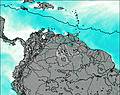
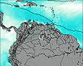
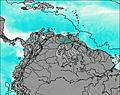
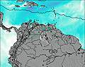
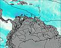
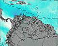
This table gives the weather forecast for El Toro at the specific elevation of 4729 m. Our advanced weather models allow us to provide distinct weather forecasts for several elevations of El Toro. To see the weather forecasts for the other elevations, use the tab navigation above the table. For a wider overview of the weather, consult the Weather Map of Venezuela.
| Weather Station | Temp. | Weather | Wind | Gusts | Cloud / Visibility |
|---|---|---|---|---|---|
lightning 29km NNW of Puerto Santander | |||||
Guanare Airport | |||||
AraucaSantiagoPerez | |||||
Arauc / antiago Pérez Quiroz Airport | |||||
Cúcut / amilo Daza International Airport | |||||
CucutaCamiloDaza | |||||
lightning 115km ENE of Guasdalito | |||||
lightning 44km E of Rosario | |||||
lightning 48km WSW of Cabimas |
* NOTE: not all weather observatories update at the same frequency which is the reason why some locations may show data from stations that are further away than known closer ones.

