
– Lat/Long: 46.97° N 11.24° E
 Feuerstein (Stubai Alps)
Weather Forecast, ItalyIssued: 7 am Thu 24 Apr Local TimeUpdates in: hr min sUpdate imminent
Feuerstein (Stubai Alps) Weather Forecast, Italy
Issued: 7 am Thu 24 Apr Local Time
Updates in:
Update imminent hr min s

Issued: 7 am Thu 24 Apr Local Time
Updates in:
Update imminent hr min s
Days 1–3 Weather SummaryA dusting of new snow. Freeze-thaw conditions (max 1°C on Sat afternoon, min -4°C on Thu night). Wind will be generally light. | Days 4–6 Weather SummaryLight rain (total 4mm) at first, then becoming colder with a dusting of snow on Mon night. Freeze-thaw conditions (max 4°C on Mon afternoon, min -1°C on Tue night). Wind will be generally light. | |||||||||||||||||
Thursday 24 | Friday 25 | Saturday 26 | Sunday 27 | Monday 28 | Tuesday 29 | |||||||||||||
AM | PM | night | AM | PM | night | AM | PM | night | AM | PM | night | AM | PM | night | AM | PM | night | |
cloudy | light snow | light snow | some clouds | some clouds | some clouds | some clouds | cloudy | cloudy | cloudy | rain shwrs | some clouds | some clouds | light rain | snow shwrs | some clouds | rain shwrs | clear | |
km/h | ||||||||||||||||||
 |  |  |  |  |  | |||||||||||||
— | 1.0 | 3 | — | — | — | — | — | — | — | — | — | — | — | 1.0 | — | — | — | |
— | — | — | — | — | — | — | — | — | — | 0.3 | — | — | 1.6 | 2 | — | 0.1 | — | |
max°C | -3 | -2 | -2 | -3 | -2 | -3 | -1 | 1 | 0 | 1 | 3 | 2 | 2 | 4 | 2 | 0 | 3 | 1 |
min°C | -3 | -2 | -4 | -4 | -2 | -3 | -2 | 0 | 0 | 0 | 1 | 0 | 0 | 3 | 0 | 0 | 2 | -1 |
-7 | -5 | -8 | -8 | -6 | -8 | -4 | -2 | -2 | -3 | -2 | -2 | 0 | 3 | -3 | -4 | -2 | -5 | |
2050 | 2250 | 1900 | 2050 | 2200 | 1850 | 2350 | 2600 | 2500 | 2600 | 2800 | 2550 | 2700 | 2950 | 2600 | 2550 | 2800 | 2400 | |
Cloud base (m) | 2150 | 2150 | 2150 | 2150 | 2200 | 2150 | 2150 | 2550 | 2200 | 2150 | 2700 | 2300 | 2550 | 2950 | 2250 | 2250 | 3000 | |
6:11 | — | — | 6:09 | — | — | 6:07 | — | — | 6:07 | — | — | 6:05 | — | — | 6:03 | — | — | |
— | — | 8:15 | — | — | 8:15 | — | — | 8:16 | — | — | 8:19 | — | — | 8:20 | — | — | 8:21 | |
Loading...
Feuerstein (Stubai Alps) Weather (Days 0-3):
The weather forecast for Feuerstein (Stubai Alps) is: A dusting of new snow. Freeze-thaw conditions (max 1°C on Sat afternoon, min -4°C on Thu night). Wind will be generally light.
Feuerstein (Stubai Alps) Weather (Days 3-6):
Light rain (total 4mm) at first, then becoming colder with a dusting of snow on Mon night. Freeze-thaw conditions (max 4°C on Mon afternoon, min -1°C on Tue night). Wind will be generally light.
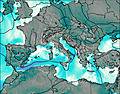
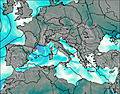
This table gives the weather forecast for Feuerstein (Stubai Alps) at the specific elevation of 2500 m. Our advanced weather models allow us to provide distinct weather forecasts for several elevations of Feuerstein (Stubai Alps). To see the weather forecasts for the other elevations, use the tab navigation above the table. For a wider overview of the weather, consult the Weather Map of Italy.
| Weather Station | Temp. | Weather | Wind | Gusts | Cloud / Visibility |
|---|---|---|---|---|---|
Jochdohlen SP | |||||
Brenner Neu | |||||
Jochdohlen LP | |||||
BrunnenkogelOetztalerAlpen | |||||
Patscherkofel | |||||
Innsbruck -Flughafen | |||||
Hochoetz |
* NOTE: not all weather observatories update at the same frequency which is the reason why some locations may show data from stations that are further away than known closer ones.

