– Lat/Long: 33.68° N 111.32° W
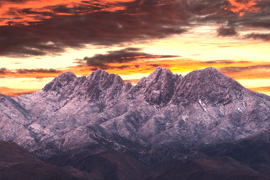
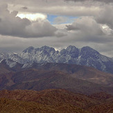
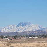
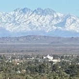
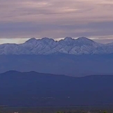
 Four Peaks
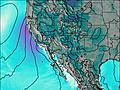
Weather Forecast, United StatesIssued: 4 am Sun 11 May Local TimeUpdates in: hr min sUpdate imminent
Issued: 4 am Sun 11 May Local Time
Updates in:
Update imminent hr min s

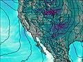
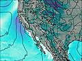
Issued: 4 am Sun 11 May Local Time
Updates in:
Update imminent hr min s
Days 1–3 Weather SummaryMostly dry. Very mild (max 18°C on Sun afternoon, min 7°C on Tue night). Winds increasing (light winds from the S on Sun morning, near gales from the SW by Tue afternoon). | Days 4–6 Weather SummaryMostly dry. Very mild (max 13°C on Fri afternoon, min 7°C on Wed morning). Winds decreasing (strong winds from the SW on Wed morning, calm by Fri night). | |||||||||||||||||
Sunday 11 | Monday 12 | Tuesday 13 | Wednesday 14 | Thursday 15 | Friday 16 | |||||||||||||
AM | PM | night | AM | PM | night | AM | PM | night | AM | PM | night | AM | PM | night | AM | PM | night | |
clear | some clouds | some clouds | some clouds | some clouds | clear | some clouds | some clouds | clear | clear | clear | clear | clear | clear | clear | clear | clear | clear | |
km/h | ||||||||||||||||||
 |  |  |  |  |  | |||||||||||||
— | — | — | — | — | — | — | — | — | — | — | — | — | — | — | — | — | — | |
— | — | — | — | — | — | — | — | — | — | — | — | — | — | — | — | — | — | |
max°C | 15 | 18 | 17 | 15 | 16 | 15 | 12 | 13 | 11 | 8 | 10 | 10 | 9 | 11 | 12 | 11 | 13 | 13 |
min°C | 14 | 17 | 15 | 15 | 16 | 12 | 12 | 13 | 7 | 7 | 9 | 8 | 8 | 11 | 10 | 9 | 12 | 10 |
12 | 16 | 14 | 13 | 14 | 8 | 8 | 9 | 2 | 2 | 5 | 6 | 6 | 9 | 8 | 7 | 10 | 8 | |
4350 | 4550 | 4400 | 4400 | 4350 | 4250 | 4050 | 4100 | 3650 | 3600 | 3700 | 3450 | 3350 | 3700 | 3650 | 3550 | 3950 | 3900 | |
Cloud base (m) | 9150 | 6900 | 7150 | 6950 | 6200 | 5750 | 5350 | 9350 | 8550 | 8900 | ||||||||
5:26 | — | — | 5:26 | — | — | 5:24 | — | — | 5:24 | — | — | 5:24 | — | — | 5:22 | — | — | |
— | 7:15 | — | — | 7:16 | — | — | 7:16 | — | — | 7:17 | — | — | 7:19 | — | — | 7:20 | — | |
Loading...
Four Peaks Weather (Days 0-3):
The weather forecast for Four Peaks is: Mostly dry. Very mild (max 18°C on Sun afternoon, min 7°C on Tue night). Winds increasing (light winds from the S on Sun morning, near gales from the SW by Tue afternoon).
Four Peaks Weather (Days 3-6):
Mostly dry. Very mild (max 13°C on Fri afternoon, min 7°C on Wed morning). Winds decreasing (strong winds from the SW on Wed morning, calm by Fri night).
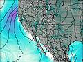
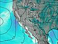
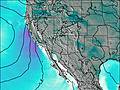
This table gives the weather forecast for Four Peaks at the specific elevation of 2334 m. Our advanced weather models allow us to provide distinct weather forecasts for several elevations of Four Peaks. To see the weather forecasts for the other elevations, use the tab navigation above the table. For a wider overview of the weather, consult the Weather Map of Arizona.
| Weather Station | Temp. | Weather | Wind | Gusts | Cloud / Visibility |
|---|---|---|---|---|---|
Chandle / esa Airport | |||||
South Mt. - AZHPA |
* NOTE: not all weather observatories update at the same frequency which is the reason why some locations may show data from stations that are further away than known closer ones.
Four Peaks Photos
View all
Southwest Basins and Ranges photos (26) |
Intermountain West photos (146) |
photos from mountains in United States (2895) |
all photos
 Upload new photo
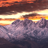
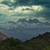
2019 4 Peaks Snow Sunrise
Four Peaks from Ellsworth Rd
Four Peaks
January snow
Why no snow on the tip of four peaks?
Snow on Four Peaks