
– Lat/Long: 42.27° S 145.83° E
 Frenchman's Cap
Weather Forecast, AustraliaIssued: 4 am Mon 31 Mar Local TimeUpdates in: hr min sUpdate imminent
Frenchman's Cap Weather Forecast, Australia
Issued: 4 am Mon 31 Mar Local Time
Updates in:
Update imminent hr min s

Issued: 4 am Mon 31 Mar Local Time
Updates in:
Update imminent hr min s
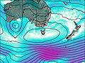
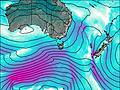
Days 1–3 Weather SummaryMostly dry. Very mild (max 16°C on Tue afternoon, min 5°C on Mon morning). Wind will be generally light. | Days 4–6 Weather SummaryHeavy rain (total 51mm), heaviest during Fri night. Very mild (max 11°C on Thu morning, min 3°C on Sat morning). Winds increasing (calm on Thu night, strong winds from the WNW by Sat night). | Days 7–9 Weather SummaryHeavy rain (total 24mm), heaviest during Mon morning. Mild temperatures (max 9°C on Sun morning, min 3°C on Mon morning). Winds decreasing (near gales from the W on Sun night, light winds from the WNW by Tue night). | Days 10–12 Weather SummaryLight rain (total 4mm), mostly falling on Wed afternoon. Very mild (max 15°C on Fri afternoon, min 8°C on Wed morning). Wind will be generally light. | |||||||||||||||||||||||||||||||||
Monday 31 | Tuesday 1 | Wednesday 2 | Thursday 3 | Friday 4 | Saturday 5 | Sunday 6 | Monday 7 | Tuesday 8 | Wednesday 9 | Thursday 10 | Friday 11 | |||||||||||||||||||||||||
AM | PM | night | AM | PM | night | AM | PM | night | AM | PM | night | AM | PM | night | AM | PM | night | AM | PM | night | AM | PM | night | AM | PM | night | AM | PM | night | AM | PM | night | AM | PM | night | |
clear | clear | clear | clear | some clouds | some clouds | clear | some clouds | some clouds | some clouds | rain shwrs | rain shwrs | cloudy | rain shwrs | heavy rain | heavy rain | rain shwrs | mod. rain | light rain | light rain | mod. rain | mod. rain | rain shwrs | light rain | light rain | rain shwrs | rain shwrs | light rain | light rain | light rain | rain shwrs | rain shwrs | rain shwrs | some clouds | light rain | rain shwrs | |
km/h | ||||||||||||||||||||||||||||||||||||
 |  |  |  |  |  |  |  |  |  |  |  | |||||||||||||||||||||||||
— | — | — | — | — | — | — | — | — | — | — | — | — | — | — | — | — | — | — | — | — | — | — | — | — | — | — | — | — | — | — | — | — | — | — | — | |
— | — | — | — | — | — | — | — | — | — | 1.9 | 0.5 | — | 0.1 | 26 | 14 | 3 | 5 | 1.7 | 1.9 | 8 | 7 | 2 | 0.9 | 0.7 | 1.5 | 0.6 | 0.7 | 1.1 | 0.2 | 0.1 | 0.6 | 0.1 | — | 0.9 | 0.1 | |
max°C | 11 | 15 | 9 | 12 | 16 | 10 | 13 | 15 | 10 | 11 | 11 | 8 | 8 | 9 | 8 | 3 | 6 | 9 | 9 | 9 | 9 | 4 | 5 | 6 | 7 | 9 | 8 | 10 | 10 | 10 | 12 | 14 | 12 | 13 | 15 | 12 |
min°C | 5 | 14 | 7 | 6 | 16 | 8 | 8 | 15 | 8 | 8 | 10 | 4 | 5 | 9 | 4 | 3 | 4 | 5 | 9 | 9 | 6 | 3 | 5 | 5 | 6 | 8 | 7 | 8 | 9 | 9 | 10 | 12 | 9 | 11 | 12 | 9 |
4 | 14 | 6 | 5 | 16 | 8 | 8 | 15 | 8 | 7 | 9 | 4 | 5 | 7 | 2 | -1 | 0 | 1 | 4 | 4 | 0 | -4 | 0 | 0 | 3 | 5 | 5 | 5 | 7 | 8 | 10 | 11 | 7 | 9 | 11 | 7 | |
2750 | 2850 | 2950 | 3200 | 3350 | 3200 | 2900 | 2900 | 2550 | 2150 | 2000 | 1250 | 1400 | 1700 | 1600 | 1050 | 1150 | 1950 | 1900 | 1950 | 1550 | 950 | 1150 | 1300 | 1500 | 3150 | 3200 | 2550 | 2450 | 2850 | 2700 | 2800 | 3100 | 3300 | 3150 | 3450 | |
Cloud base (m) | 9250 | 6850 | 6250 | 2000 | 1550 | 750 | 800 | 750 | 750 | 250 | 300 | 550 | 300 | 400 | 300 | 300 | 400 | 600 | 450 | 350 | 450 | 650 | 500 | 600 | 350 | 750 | 550 | 900 | 1600 | 650 | 8850 | |||||
7:30 | — | — | 7:31 | — | — | 7:31 | — | — | 7:33 | — | — | 7:33 | — | — | 7:35 | — | — | 6:35 | — | — | 7:37 | — | — | 7:39 | — | — | 7:39 | — | — | 7:41 | — | — | 7:41 | — | — | |
— | 7:09 | — | — | 7:07 | — | — | 7:06 | — | — | 7:05 | — | — | 7:02 | — | — | 7:00 | — | — | 6:00 | — | — | 6:58 | — | — | 6:55 | — | — | 6:54 | — | — | 6:52 | — | — | 6:52 | — | |
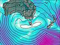
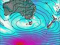
Frenchman's Cap Weather (Days 0-3):
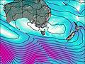
The weather forecast for Frenchman's Cap is: Mostly dry. Very mild (max 16°C on Tue afternoon, min 5°C on Mon morning). Wind will be generally light.
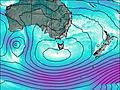
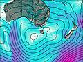
Frenchman's Cap Weather (Days 3-6):
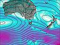
Heavy rain (total 51mm), heaviest during Fri night. Very mild (max 11°C on Thu morning, min 3°C on Sat morning). Winds increasing (calm on Thu night, strong winds from the WNW by Sat night).
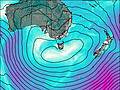
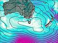
Frenchman's Cap Weather (Days 6-9):
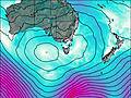
Heavy rain (total 24mm), heaviest during Mon morning. Mild temperatures (max 9°C on Sun morning, min 3°C on Mon morning). Winds decreasing (near gales from the W on Sun night, light winds from the WNW by Tue night).
This table gives the weather forecast for Frenchman's Cap at the specific elevation of 500 m. Our advanced weather models allow us to provide distinct weather forecasts for several elevations of Frenchman's Cap. To see the weather forecasts for the other elevations, use the tab navigation above the table. For a wider overview of the weather, consult the Weather Map of Tasmania.

