Fuji-san Guide
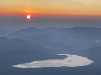
Fuji-san
Photo credit: Maarten Scherrenburg
- Elevation: 3776
- Difficulty: Walk up
- Best months to climb: June, July, August, September
- Convenient center: Fuji, Japan
Fuji-san climbers Notes
Eugen from GERMANY writes:
Hi,
I was not able to climb to the top (26th of Feb., as announced previously) and had to return cause of a hurricane wind at 3500 m elevation (the last but one Tori gate). There is a lot of snow between 5th and 6th station now, and lots of iceburn. The wind forecast at this site was too optimistic. It was about 40 kmh, whereas in reality (in the afternoon) I could not stand the wind sometimes. The temperatures were really chilling: my gloves (very good ones) did not save my hands. It felt like -30 C or less. At the last Tori gate, my both iPhones gave up and their battery died due to cold.
If you climb now take snowshoes with you. They are sometimes very helpful. Crampons is a must. My tracking watch Garmin Fenix 6 Pro had often problems with GPS signal. This made navigation and backtracking some times not easy. I lost my path on the way back several times.
Otherwise, Fuji-san is indeed a house of Kami (mountain gods). A very inspiring (but sometimes also terrifying) experience!
I wish other people good luck! My advice: stay at Sato Goya hut (very neat people) and don't sleep in tents at night. The wind at nights achieves hurricane strength, and lots of snow are coming down. Imagine that you are wet due to the ascent and have to sleep there ... No good thought...
Best,
Eugen Spodarev
2023-02-28 |
Click here to read 34 more climbing notes for Fuji-san or submit your own
|

Select Fuji-san Location Map Detail:
Use this relief map to navigate to mountain peaks in the area of Fuji-san.
10 other mountain peaks closest to Fuji-san:


