– Lat/Long: 1.22° N 77.37° W
 Galeras
Weather Forecast, ColombiaIssued: 12 pm Mon 31 Mar Local TimeUpdates in: hr min sUpdate imminent
Galeras Weather Forecast, Colombia
Issued: 12 pm Mon 31 Mar Local Time
Updates in:
Update imminent hr min s

Issued: 12 pm Mon 31 Mar Local Time
Updates in:
Update imminent hr min s
Days 1–3 Weather SummaryHeavy rain (total 50mm), heaviest during Tue night. Mild temperatures (max 8°C on Mon morning, min 7°C on Mon morning). Wind will be generally light. | Days 4–6 Weather SummaryHeavy rain (total 43mm), heaviest during Sat night. Very mild (max 10°C on Sat afternoon, min 7°C on Thu night). Wind will be generally light. | Days 7–9 Weather SummaryHeavy rain (total 42mm), heaviest during Tue afternoon. Mild temperatures (max 9°C on Mon morning, min 7°C on Sun morning). Wind will be generally light. | Days 10–12 Weather SummaryHeavy rain (total 39mm), heaviest during Wed afternoon. Very mild (max 10°C on Thu morning, min 7°C on Wed afternoon). Wind will be generally light. | |||||||||||||||||||||||||||||||||
Monday 31 | Tuesday 1 | Wednesday 2 | Thursday 3 | Friday 4 | Saturday 5 | Sunday 6 | Monday 7 | Tuesday 8 | Wednesday 9 | Thursday 10 | Friday 11 | |||||||||||||||||||||||||
AM | PM | night | AM | PM | night | AM | PM | night | AM | PM | night | AM | PM | night | AM | PM | night | AM | PM | night | AM | PM | night | AM | PM | night | AM | PM | night | AM | PM | night | AM | PM | night | |
mod. rain | light rain | rain shwrs | rain shwrs | rain shwrs | heavy rain | rain shwrs | mod. rain | rain shwrs | light rain | risk tstorm | rain shwrs | rain shwrs | risk tstorm | rain shwrs | risk tstorm | risk tstorm | rain shwrs | light rain | light rain | some clouds | rain shwrs | risk tstorm | mod. rain | risk tstorm | risk tstorm | rain shwrs | risk tstorm | risk tstorm | mod. rain | rain shwrs | risk tstorm | rain shwrs | rain shwrs | risk tstorm | rain shwrs | |
km/h | ||||||||||||||||||||||||||||||||||||
 |  |  |  |  |  |  |  |  |  |  |  | |||||||||||||||||||||||||
— | — | — | — | — | — | — | — | — | — | — | — | — | — | — | — | — | — | — | — | — | — | — | — | — | — | — | — | — | — | — | — | — | — | — | — | |
8 | 3 | 4 | 6 | 1.3 | 16 | 6 | 6 | 0.4 | 2 | 7 | 2 | 3 | 10 | 1.1 | 2 | 4 | 11 | 1.0 | 1.0 | — | 1.5 | 9 | 9 | 3 | 10 | 8 | 4 | 12 | 8 | 0.9 | 1.5 | 0.4 | 0.9 | 8 | 4 | |
max°C | 8 | 8 | 7 | 7 | 8 | 8 | 7 | 8 | 8 | 9 | 8 | 8 | 9 | 8 | 8 | 8 | 10 | 8 | 7 | 8 | 8 | 9 | 9 | 7 | 9 | 9 | 8 | 8 | 8 | 8 | 10 | 9 | 8 | 10 | 9 | 8 |
min°C | 7 | 8 | 7 | 7 | 8 | 7 | 7 | 7 | 7 | 8 | 8 | 7 | 8 | 8 | 7 | 8 | 8 | 7 | 7 | 8 | 7 | 8 | 8 | 7 | 8 | 8 | 7 | 8 | 7 | 7 | 9 | 9 | 7 | 9 | 8 | 8 |
7 | 8 | 7 | 6 | 8 | 7 | 7 | 6 | 6 | 7 | 8 | 7 | 7 | 7 | 6 | 6 | 6 | 5 | 6 | 7 | 6 | 6 | 8 | 5 | 6 | 8 | 6 | 8 | 7 | 6 | 9 | 9 | 7 | 9 | 8 | 7 | |
4800 | 4900 | 4800 | 4800 | 5000 | 4850 | 4850 | 4900 | 4900 | 4950 | 4950 | 4850 | 4950 | 5000 | 4850 | 4850 | 5100 | 4850 | 4750 | 4900 | 4800 | 4850 | 5000 | 4800 | 4900 | 5000 | 4800 | 4950 | 4950 | 4850 | 4950 | 5100 | 4850 | 5000 | 5000 | 4900 | |
Cloud base (m) | 2750 | 2750 | 2950 | 2750 | 3350 | 2750 | 3000 | 2750 | 2900 | 3050 | 3100 | 2750 | 3300 | 2950 | 2900 | 3100 | 3500 | 2900 | 2750 | 2950 | 2950 | 3250 | 2800 | 2900 | 3300 | 3150 | 3400 | 2750 | 2750 | 2800 | 3650 | 5300 | 3150 | 2850 | ||
6:09 | — | — | 6:09 | — | — | 6:09 | — | — | 6:07 | — | — | 6:07 | — | — | 6:07 | — | — | 6:07 | — | — | 6:07 | — | — | 6:07 | — | — | 6:07 | — | — | 6:05 | — | — | 6:05 | — | — | |
— | 6:16 | — | — | 6:15 | — | — | 6:15 | — | — | 6:15 | — | — | 6:15 | — | — | 6:15 | — | — | 6:15 | — | — | 6:15 | — | — | 6:15 | — | — | 6:14 | — | — | 6:14 | — | — | 6:14 | — | |
Galeras Weather (Days 0-3):
The weather forecast for Galeras is: Heavy rain (total 50mm), heaviest during Tue night. Mild temperatures (max 8°C on Mon morning, min 7°C on Mon morning). Wind will be generally light.
Galeras Weather (Days 3-6):
Heavy rain (total 43mm), heaviest during Sat night. Very mild (max 10°C on Sat afternoon, min 7°C on Thu night). Wind will be generally light.
Galeras Weather (Days 6-9):
Heavy rain (total 42mm), heaviest during Tue afternoon. Mild temperatures (max 9°C on Mon morning, min 7°C on Sun morning). Wind will be generally light.
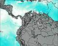
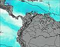
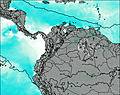
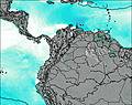
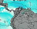
This table gives the weather forecast for Galeras at the specific elevation of 3500 m. Our advanced weather models allow us to provide distinct weather forecasts for several elevations of Galeras. To see the weather forecasts for the other elevations, use the tab navigation above the table. For a wider overview of the weather, consult the Weather Map of Colombia.
| Weather Station | Temp. | Weather | Wind | Gusts | Cloud / Visibility |
|---|---|---|---|---|---|
Pasto-Antonio Nariño Airport | |||||
Ipiale / an Luis Airport | |||||
Tulca / l Rosal Airport | |||||
Puerto Asis | |||||
AEP Yuracrucito | |||||
Lago Agrio Airport (Nueva Loja) | |||||
Guapi | |||||
Popaya / uillerm | |||||
Tumac / a Florid |
* NOTE: not all weather observatories update at the same frequency which is the reason why some locations may show data from stations that are further away than known closer ones.
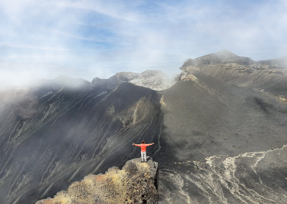
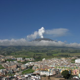
Galeras Photos
View all
Colombian Andes photos (18) |
Andes photos (970) |
photos from mountains in Colombia (21) |
all photos
 Upload new photo
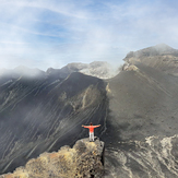
CRATER VOLCAN GALERAS
Galeras

