– Lat/Long: 1.38° N 127.53° E
 Gamkonora – Climbing, Hiking & Mountaineering information

Gamkonora guide
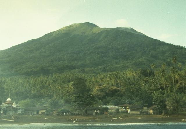
- Elevation: 5364 ft
- Difficulty:
- Best months to climb:
- Convenient center:
Gamkonora Climbing NotesBe the first to submit your climbing note! Please submit any useful information about climbing Gamkonora that may be useful to other climbers. Consider things such as access and accommodation at the base of Gamkonora, as well as the logistics of climbing to the summit. |

| Select a
mountain summit from the menu |
||
|
Select a Mountain Summit
|
||


Use this relief map to navigate to mountain peaks in the area of Gamkonora.
10 other mountain peaks closest to Gamkonora:
| 1. | Ibu (4347 ft) | 9.7 miles |
| 2. | Todoko-Ranu (3212 ft) | 9.9 miles |
| 3. | Tobaru (3396 ft) | 19.8 miles |
| 4. | Jailolo (3708 ft) | 20.6 miles |
| 5. | Dukono (3566 ft) | 32.2 miles |
| 6. | Mount Hiri (2067 ft) | 37.6 miles |
| 7. | Tarakan (volcano) (1043 ft) | 37.6 miles |
| 8. | Gamalama (5627 ft) | 42.6 miles |
| 9. | Mare Island (Indonesia) (1011 ft) | 56.8 miles |
| 10. | Moti Island (3117 ft) | 65.0 miles |

