– Lat/Long: 53.10° N 4.03° W
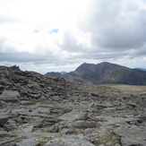
 Glyder Fawr
Weather Forecast, United KingdomIssued: 6 pm Fri 18 Apr Local TimeUpdates in: hr min sUpdate imminent
Glyder Fawr Weather Forecast, United Kingdom
Issued: 6 pm Fri 18 Apr Local Time
Updates in:
Update imminent hr min s

Issued: 6 pm Fri 18 Apr Local Time
Updates in:
Update imminent hr min s
Days 1–4 Weather SummaryModerate rain (total 18mm), heaviest on Sun night. Mild temperatures (max 6°C on Fri night, min 2°C on Mon morning). Winds decreasing (near gales from the SSE on Fri afternoon, light winds from the SSE by Sat night). | Days 5–7 Weather SummaryLight rain (total 6mm), mostly falling on Tue night. Mild temperatures (max 5°C on Tue night, min 2°C on Mon night). Winds increasing (light winds from the WSW on Mon night, near gales from the E by Tue night). | ||||||||||||||||
Fri 18 | Saturday 19 | Sunday 20 | Monday 21 | Tuesday 22 | Wednesday 23 | ||||||||||||
PM | night | AM | PM | night | AM | PM | night | AM | PM | night | AM | PM | night | AM | PM | night | |
light rain | light rain | light rain | light rain | some clouds | some clouds | some clouds | mod. rain | light rain | rain shwrs | some clouds | light rain | light rain | light rain | rain shwrs | rain shwrs | light rain | |
km/h | |||||||||||||||||
 |  |  |  |  |  | ||||||||||||
— | — | — | — | — | — | — | — | — | — | — | — | — | — | — | — | — | |
4 | 1.4 | 1.1 | 1.0 | — | — | — | 8 | 3 | 0.7 | — | 0.5 | 0.3 | 4 | 0.2 | 0.1 | 0.2 | |
max°C | 5 | 6 | 6 | 5 | 5 | 6 | 6 | 6 | 3 | 3 | 3 | 3 | 4 | 5 | 5 | 5 | 3 |
min°C | 5 | 5 | 5 | 4 | 4 | 6 | 6 | 3 | 2 | 3 | 2 | 3 | 4 | 4 | 4 | 4 | 2 |
-2 | -1 | -1 | -2 | 2 | 4 | 3 | -2 | -2 | -2 | -3 | -2 | -1 | -2 | -2 | -2 | -4 | |
2000 | 2150 | 2000 | 2000 | 2000 | 2050 | 1950 | 2000 | 1350 | 1450 | 1350 | 1450 | 1600 | 1700 | 1650 | 1600 | 1500 | |
Cloud base (m) | 400 | 250 | 250 | 550 | 650 | 2000 | 2150 | 400 | 250 | 250 | 700 | 400 | 300 | 350 | 250 | 750 | 300 |
— | — | 6:09 | — | — | 6:07 | — | — | 6:05 | — | — | 6:01 | — | — | 6:00 | — | — | |
8:20 | — | — | 8:22 | — | — | 8:23 | — | — | 8:24 | — | — | 8:27 | — | — | 8:29 | — | |
Loading...
Glyder Fawr Weather (Days 0-3):
The weather forecast for Glyder Fawr is: Moderate rain (total 18mm), heaviest on Sun night. Mild temperatures (max 6°C on Fri night, min 2°C on Mon morning). Winds decreasing (near gales from the SSE on Fri afternoon, light winds from the SSE by Sat night).
Glyder Fawr Weather (Days 3-6):
Light rain (total 6mm), mostly falling on Tue night. Mild temperatures (max 5°C on Tue night, min 2°C on Mon night). Winds increasing (light winds from the WSW on Mon night, near gales from the E by Tue night).
This table gives the weather forecast for Glyder Fawr at the specific elevation of 999 m. Our advanced weather models allow us to provide distinct weather forecasts for several elevations of Glyder Fawr. To see the weather forecasts for the other elevations, use the tab navigation above the table. For a wider overview of the weather, consult the Weather Map of United Kingdom.
| Weather Station | Temp. | Weather | Wind | Gusts | Cloud / Visibility |
|---|---|---|---|---|---|
CapelCurigNO 3 | |||||
Caernarfon Airport | |||||
Valley RAF Airport | |||||
Valley |
* NOTE: not all weather observatories update at the same frequency which is the reason why some locations may show data from stations that are further away than known closer ones.
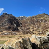
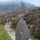
Glyder Fawr Photos
View all
Snowdonia photos (175) |
Cambrian Mountains photos (326) |
photos from mountains in United Kingdom (1953) |
all photos
 Upload new photo
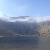
Devils Kitchen between Y Garn and Glyder Fawr
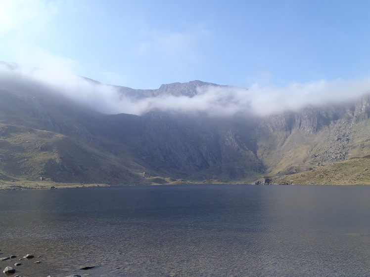
Glyder Fawr from Cwm Idwal
Glyder Fawr
Glyder Fawr

