
– Lat/Long: 52.37° N 117.46° W
 Gong Peak
Weather Forecast, CanadaIssued: 11 pm Sat 29 Mar Local TimeUpdates in: 3hr 24min 20sUpdate imminent
Issued: 11 pm Sat 29 Mar Local Time
Updates in:
Update imminent 3hr 24min 20s

Issued: 11 pm Sat 29 Mar Local Time
Updates in:
Update imminent 3hr 24min 20s
Days 1–4 Weather SummaryA dusting of new snow. Freeze-thaw conditions (max 3°C on Sun afternoon, min -6°C on Sat night). Wind will be generally light. | Days 5–7 Weather SummaryA dusting of new snow. Freeze-thaw conditions (max 4°C on Fri afternoon, min -4°C on Tue night). Wind will be generally light. | Days 8–10 Weather SummaryMostly dry. Freeze-thaw conditions (max 12°C on Mon afternoon, min 0°C on Fri night). Wind will be generally light. | Days 11–13 Weather SummaryLight rain (total 6mm), mostly falling on Wed night. Very mild (max 13°C on Tue afternoon, min 6°C on Wed night). Wind will be generally light. | |||||||||||||||||||||||||||||||||
Sunday 30 | Monday 31 | Tuesday 1 | Wednesday 2 | Thursday 3 | Friday 4 | Saturday 5 | Sunday 6 | Monday 7 | Tuesday 8 | Wednesday 9 | Thu 10 | |||||||||||||||||||||||||
night | AM | PM | night | AM | PM | night | AM | PM | night | AM | PM | night | AM | PM | night | AM | PM | night | AM | PM | night | AM | PM | night | AM | PM | night | AM | PM | night | AM | PM | night | AM | PM | |
some clouds | clear | some clouds | some clouds | cloudy | light rain | cloudy | cloudy | light snow | snow shwrs | cloudy | cloudy | some clouds | some clouds | some clouds | some clouds | some clouds | clear | some clouds | some clouds | clear | clear | clear | some clouds | clear | clear | clear | clear | clear | clear | some clouds | some clouds | rain shwrs | light rain | rain shwrs | rain shwrs | |
mph | ||||||||||||||||||||||||||||||||||||
 |  |  |  |  |  |  |  |  |  |  |  |  | ||||||||||||||||||||||||
— | — | — | — | — | — | — | — | 1 | 0.4 | — | — | — | — | — | — | — | — | — | — | — | — | — | — | — | — | — | — | — | — | — | — | — | — | — | — | |
— | — | — | — | — | 0.00 | — | — | — | — | — | — | — | — | — | — | — | — | — | — | — | — | — | — | — | — | — | — | — | — | — | — | 0.02 | 0.1 | 0.06 | 0.04 | |
max°F | 30 | 34 | 37 | 27 | 34 | 36 | 32 | 34 | 34 | 28 | 30 | 32 | 28 | 32 | 36 | 30 | 36 | 39 | 34 | 41 | 45 | 39 | 46 | 48 | 45 | 50 | 54 | 50 | 52 | 55 | 52 | 52 | 54 | 48 | 48 | 52 |
min°F | 21 | 27 | 36 | 23 | 28 | 36 | 28 | 30 | 34 | 25 | 27 | 32 | 27 | 28 | 34 | 27 | 30 | 37 | 32 | 36 | 45 | 37 | 41 | 48 | 43 | 45 | 52 | 46 | 46 | 55 | 45 | 46 | 54 | 43 | 43 | 50 |
18 | 23 | 32 | 18 | 28 | 34 | 28 | 27 | 30 | 25 | 23 | 27 | 27 | 28 | 30 | 23 | 27 | 34 | 32 | 36 | 43 | 34 | 39 | 48 | 41 | 43 | 52 | 46 | 46 | 55 | 45 | 46 | 52 | 43 | 43 | 48 | |
3800 | 3100 | 5900 | 2800 | 3800 | 5700 | 4100 | 4400 | 5600 | 3300 | 3300 | 4900 | 3600 | 3800 | 5200 | 3900 | 4400 | 6200 | 5100 | 6600 | 9400 | 10700 | 11600 | 11600 | 12100 | 11600 | 11200 | 11200 | 10700 | 10200 | 9800 | 9500 | 9800 | 8900 | 8200 | 9000 | |
Cloud base (ft) | 7500 | 7500 | 7700 | 7700 | 7500 | 7900 | 7900 | 7500 | 7500 | 7900 | 7500 | 8700 | 8500 | 7500 | 8500 | 9400 | 7500 | 8400 | 8000 | — | — | — | 31300 | — | 30800 | — | — | 30200 | 29900 | — | 28200 | — | 10500 | 9400 | 7700 | 10000 |
— | 7:28 | — | — | 7:26 | — | — | 7:24 | — | — | 7:22 | — | — | 7:20 | — | — | 7:18 | — | — | 7:15 | — | — | 7:13 | — | — | 7:11 | — | — | 7:07 | — | — | 7:05 | — | — | 7:03 | — | |
— | — | 8:20 | — | — | 8:21 | — | — | 8:22 | — | — | 8:24 | — | — | 8:27 | — | — | 8:28 | — | — | 8:30 | — | — | 8:31 | — | — | 8:34 | — | — | 8:35 | — | — | 8:37 | — | — | 8:38 | |
Gong Peak Weather (Days 0-3):
The weather forecast for Gong Peak is: A dusting of new snow. Freeze-thaw conditions (max 3°C on Sun afternoon, min -6°C on Sat night). Wind will be generally light.
Gong Peak Weather (Days 3-6):
A dusting of new snow. Freeze-thaw conditions (max 4°C on Fri afternoon, min -4°C on Tue night). Wind will be generally light.
Gong Peak Weather (Days 6-9):
Mostly dry. Freeze-thaw conditions (max 12°C on Mon afternoon, min 0°C on Fri night). Wind will be generally light.
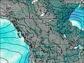
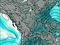
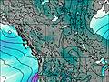
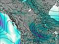
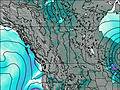
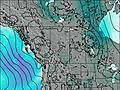
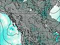
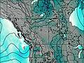
This table gives the weather forecast for Gong Peak at the specific elevation of 1500 m. Our advanced weather models allow us to provide distinct weather forecasts for several elevations of Gong Peak. To see the weather forecasts for the other elevations, use the tab navigation above the table. For a wider overview of the weather, consult the Weather Map of Alberta.
| Weather Station | Temp. | Weather | Wind | Gusts | Cloud / Visibility |
|---|---|---|---|---|---|
Jasper Warden- Alta | |||||
Jasper Warden Airport | |||||
Nordegg Cs- Alta | |||||
Blue River Cs- BC | |||||
Mount 7 | |||||
Willow Creek 1- Alta | |||||
Yoho Park- BC | |||||
* NOTE: not all weather observatories update at the same frequency which is the reason why some locations may show data from stations that are further away than known closer ones.

