– Lat/Long: 40.33° N 20.75° E
 Gramos
Weather Forecast, AlbaniaIssued: 7 pm Fri 18 Apr Local TimeUpdates in: hr min sUpdate imminent
Gramos Weather Forecast, Albania
Issued: 7 pm Fri 18 Apr Local Time
Updates in:
Update imminent hr min s

Issued: 7 pm Fri 18 Apr Local Time
Updates in:
Update imminent hr min s
Days 1–4 Weather SummaryLight rain (total 5mm), mostly falling on Mon afternoon. Freeze-thaw conditions (max 5°C on Sun morning, min -1°C on Fri night). Winds decreasing (fresh winds from the NW on Fri night, calm by Sun night). | Days 5–7 Weather SummaryModerate rain (total 12mm) heaviest on Wed afternoon, then becoming colder with a dusting of snow on Wed afternoon. Temperatures will be slightly above freezing (max 3°C on Mon night, min 1°C on Wed afternoon). Wind will be generally light. | ||||||||||||||||||
Saturday 19 | Sunday 20 | Monday 21 | Tuesday 22 | Wednesday 23 | Thursday 24 | ||||||||||||||
night | AM | PM | night | AM | PM | night | AM | PM | night | AM | PM | night | AM | PM | night | AM | PM | night | |
clear | clear | clear | some clouds | some clouds | cloudy | some clouds | light rain | risk tstorm | rain shwrs | light rain | risk tstorm | snow shwrs | rain shwrs | light snow | snow shwrs | some clouds | rain shwrs | some clouds | |
km/h | |||||||||||||||||||
 |  |  |  |  |  |  | |||||||||||||
— | — | — | — | — | — | — | — | — | — | — | — | 1.0 | — | 2.0 | 1.0 | — | — | — | |
— | — | — | — | — | — | — | 0.3 | 5 | 3 | 1.4 | 1.9 | — | 1.0 | 3 | — | — | 2.0 | — | |
max°C | 0 | 2 | 4 | 4 | 5 | 5 | 5 | 4 | 4 | 3 | 3 | 3 | 2 | 3 | 3 | 1 | 2 | 3 | 2 |
min°C | -1 | 0 | 4 | 4 | 4 | 5 | 4 | 4 | 4 | 2 | 2 | 3 | 2 | 2 | 1 | 1 | 1 | 2 | 0 |
-6 | -6 | 0 | 0 | 2 | 3 | 4 | 2 | 3 | 2 | -2 | 3 | 0 | 2 | -2 | -3 | -3 | -3 | -6 | |
2450 | 2950 | 3150 | 3300 | 3350 | 3100 | 3100 | 3000 | 3000 | 2850 | 2850 | 2850 | 2850 | 2850 | 2700 | 2600 | 2700 | 2900 | 2750 | |
Cloud base (m) | 8800 | 6950 | 6700 | 6350 | 6150 | 2200 | 2350 | 2750 | 2800 | 3450 | 3800 | 2050 | 1500 | 2150 | 2150 | 2350 | |||
— | 5:52 | — | — | 5:52 | — | — | 5:50 | — | — | 5:48 | — | — | 5:48 | — | — | 5:46 | — | — | |
— | — | 7:19 | — | — | 7:20 | — | — | 7:21 | — | — | 7:22 | — | — | 7:22 | — | — | 7:23 | — | |
Loading...
Gramos Weather (Days 0-3):
The weather forecast for Gramos is: Light rain (total 5mm), mostly falling on Mon afternoon. Freeze-thaw conditions (max 5°C on Sun morning, min -1°C on Fri night). Winds decreasing (fresh winds from the NW on Fri night, calm by Sun night).
Gramos Weather (Days 3-6):
Moderate rain (total 12mm) heaviest on Wed afternoon, then becoming colder with a dusting of snow on Wed afternoon. Temperatures will be slightly above freezing (max 3°C on Mon night, min 1°C on Wed afternoon). Wind will be generally light.
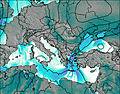
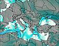
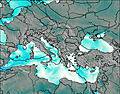
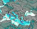
This table gives the weather forecast for Gramos at the specific elevation of 2523 m. Our advanced weather models allow us to provide distinct weather forecasts for several elevations of Gramos. To see the weather forecasts for the other elevations, use the tab navigation above the table. For a wider overview of the weather, consult the Weather Map of Albania.
| Weather Station | Temp. | Weather | Wind | Gusts | Cloud / Visibility |
|---|---|---|---|---|---|
Ioannina (Airport) | |||||
Pretor | |||||
Kozani Airport | |||||
* NOTE: not all weather observatories update at the same frequency which is the reason why some locations may show data from stations that are further away than known closer ones.
Gramos Photos
View all
Pindos photos (113) |
Balkan Peninsula photos (1021) |
photos from mountains in Albania (23) |
all photos
 Upload new photo
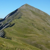
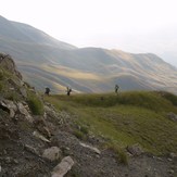
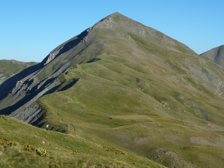
Gramos
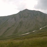
Grammos 2520m
Grammos 2520m
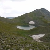
Gistova lake Grammos

