– Lat/Long: 54.49° N 3.21° W
 Green Gable
Weather Forecast, United KingdomIssued: 6 pm Thu 24 Apr Local TimeUpdates in: hr min sUpdate imminent
Green Gable Weather Forecast, United Kingdom
Issued: 6 pm Thu 24 Apr Local Time
Updates in:
Update imminent hr min s

Issued: 6 pm Thu 24 Apr Local Time
Updates in:
Update imminent hr min s
Days 1–4 Weather SummaryMostly dry. Mild temperatures (max 8°C on Sun morning, min 4°C on Thu night). Winds increasing (light winds from the SE on Thu night, fresh winds from the SW by Sun morning). | Days 5–7 Weather SummaryMostly dry. Very mild (max 14°C on Wed morning, min 7°C on Sun night). Winds decreasing (fresh winds from the SW on Sun afternoon, calm by Tue afternoon). | ||||||||||||||||
Thu 24 | Friday 25 | Saturday 26 | Sunday 27 | Monday 28 | Tuesday 29 | ||||||||||||
PM | night | AM | PM | night | AM | PM | night | AM | PM | night | AM | PM | night | AM | PM | night | |
rain shwrs | some clouds | cloudy | cloudy | cloudy | light rain | some clouds | some clouds | light rain | cloudy | some clouds | some clouds | some clouds | some clouds | clear | rain shwrs | clear | |
km/h | |||||||||||||||||
 |  |  |  |  |  | ||||||||||||
— | — | — | — | — | — | — | — | — | — | — | — | — | — | — | — | — | |
0.1 | — | — | — | — | 0.1 | — | — | 0.2 | — | — | — | — | — | — | 0.1 | — | |
max°C | 7 | 5 | 6 | 7 | 6 | 6 | 7 | 6 | 8 | 8 | 8 | 11 | 11 | 10 | 13 | 13 | 11 |
min°C | 7 | 4 | 6 | 7 | 5 | 6 | 7 | 5 | 7 | 8 | 7 | 9 | 11 | 10 | 12 | 13 | 11 |
5 | 2 | 3 | 4 | 1 | 3 | 4 | 0 | 3 | 4 | 4 | 7 | 10 | 10 | 11 | 13 | 10 | |
1600 | 1850 | 1800 | 1650 | 1700 | 1800 | 1900 | 2250 | 2200 | 2350 | 2650 | 2600 | 2700 | 2900 | 3050 | 3200 | 3250 | |
Cloud base (m) | 900 | 8550 | 900 | 2250 | 900 | 550 | 1000 | 350 | 450 | 300 | 300 | 6200 | 950 | ||||
— | — | 5:48 | — | — | 5:46 | — | — | 5:43 | — | — | 5:41 | — | — | 5:39 | — | — | |
8:31 | — | — | 8:34 | — | — | 8:35 | — | — | 8:37 | — | — | 8:38 | — | — | 8:40 | — | |
Loading...
Green Gable Weather (Days 0-3):
The weather forecast for Green Gable is: Mostly dry. Mild temperatures (max 8°C on Sun morning, min 4°C on Thu night). Winds increasing (light winds from the SE on Thu night, fresh winds from the SW by Sun morning).
Green Gable Weather (Days 3-6):
Mostly dry. Very mild (max 14°C on Wed morning, min 7°C on Sun night). Winds decreasing (fresh winds from the SW on Sun afternoon, calm by Tue afternoon).
This table gives the weather forecast for Green Gable at the specific elevation of 801 m. Our advanced weather models allow us to provide distinct weather forecasts for several elevations of Green Gable. To see the weather forecasts for the other elevations, use the tab navigation above the table. For a wider overview of the weather, consult the Weather Map of United Kingdom.
| Weather Station | Temp. | Weather | Wind | Gusts | Cloud / Visibility |
|---|---|---|---|---|---|
STBeesHead NO 2 | |||||
Shap | |||||
WalneyIsland | |||||
* NOTE: not all weather observatories update at the same frequency which is the reason why some locations may show data from stations that are further away than known closer ones.
Green Gable Photos
View all
photos (649) |
Lake District photos (658) |
photos from mountains in United Kingdom (1957) |
all photos
 Upload new photo
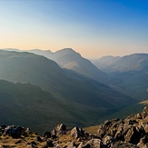
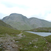
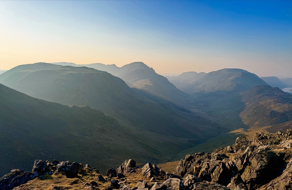
View from Green Gable
View from Green Gable
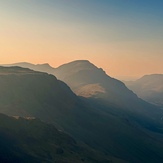
View from Green Gable
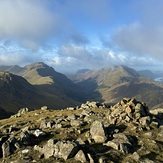
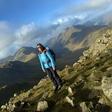
On Green Gable
Green Gable

