– Lat/Long: 49.58° N 57.78° W
 Gros Morne
Weather Forecast, CanadaIssued: 8 pm Tue 22 Apr Local TimeUpdates in: hr min sUpdate imminent
Gros Morne Weather Forecast, Canada
Issued: 8 pm Tue 22 Apr Local Time
Updates in:
Update imminent hr min s

Issued: 8 pm Tue 22 Apr Local Time
Updates in:
Update imminent hr min s
Days 1–4 Weather SummaryA dusting of new snow. Freeze-thaw conditions (max 1°C on Wed morning, min -2°C on Tue night). Winds decreasing (fresh winds from the ESE on Wed night, calm by Thu night). | Days 5–7 Weather SummaryA dusting of new snow. Freeze-thaw conditions (max 2°C on Mon morning, min -2°C on Fri night). Winds increasing (calm on Sat morning, strong winds from the NNE by Sun night). | ||||||||||||||||||
Wednesday 23 | Thursday 24 | Friday 25 | Saturday 26 | Sunday 27 | Monday 28 | ||||||||||||||
night | AM | PM | night | AM | PM | night | AM | PM | night | AM | PM | night | AM | PM | night | AM | PM | night | |
cloudy | cloudy | cloudy | light snow | some clouds | clear | some clouds | cloudy | cloudy | some clouds | some clouds | cloudy | cloudy | cloudy | cloudy | clear | some clouds | light snow | light snow | |
km/h | |||||||||||||||||||
 |  |  |  |  |  |  | |||||||||||||
— | — | — | 1.0 | — | — | — | — | — | — | — | — | — | — | — | — | — | 1.0 | 1.0 | |
— | — | — | — | — | — | — | — | — | — | — | — | — | — | — | — | — | 0.4 | — | |
max°C | -1 | 1 | 1 | -1 | 0 | 1 | -1 | 1 | 1 | -1 | 0 | 1 | 0 | 0 | 1 | 1 | 2 | 2 | 1 |
min°C | -2 | 0 | 0 | -2 | -1 | 1 | -1 | 0 | 0 | -2 | -1 | 1 | -1 | 0 | 1 | -1 | -1 | 1 | -2 |
-2 | -4 | -6 | -9 | -6 | -3 | -1 | -3 | -4 | -5 | -1 | -2 | -7 | -7 | -6 | -9 | -8 | -6 | -7 | |
400 | 800 | 900 | 200 | 600 | 900 | 600 | 850 | 900 | 500 | 700 | 950 | 700 | 700 | 950 | 850 | 700 | 1050 | 950 | |
Cloud base (m) | 350 | 2150 | 2250 | 300 | 550 | 1950 | 300 | 2700 | 3000 | 2500 | 350 | 550 | 300 | 250 | 250 | 300 | 300 | 500 | 250 |
— | 6:13 | — | — | 6:11 | — | — | 6:09 | — | — | 6:07 | — | — | 6:05 | — | — | 6:03 | — | — | |
— | — | 8:24 | — | — | 8:27 | — | — | 8:28 | — | — | 8:30 | — | — | 8:30 | — | — | 8:32 | — | |
Loading...
Gros Morne Weather (Days 0-3):
The weather forecast for Gros Morne is: A dusting of new snow. Freeze-thaw conditions (max 1°C on Wed morning, min -2°C on Tue night). Winds decreasing (fresh winds from the ESE on Wed night, calm by Thu night).
Gros Morne Weather (Days 3-6):
A dusting of new snow. Freeze-thaw conditions (max 2°C on Mon morning, min -2°C on Fri night). Winds increasing (calm on Sat morning, strong winds from the NNE by Sun night).
This table gives the weather forecast for Gros Morne at the specific elevation of 807 m. Our advanced weather models allow us to provide distinct weather forecasts for several elevations of Gros Morne. To see the weather forecasts for the other elevations, use the tab navigation above the table. For a wider overview of the weather, consult the Weather Map of Newfoundland.
| Weather Station | Temp. | Weather | Wind | Gusts | Cloud / Visibility |
|---|---|---|---|---|---|
Rocky Harbour- Nfld | |||||
Deer Lake Airport | |||||
Stephenville Airport | |||||
Stephenville Airport | |||||
Badger(Aut)-Nfld | |||||
Chevery Airport |
* NOTE: not all weather observatories update at the same frequency which is the reason why some locations may show data from stations that are further away than known closer ones.
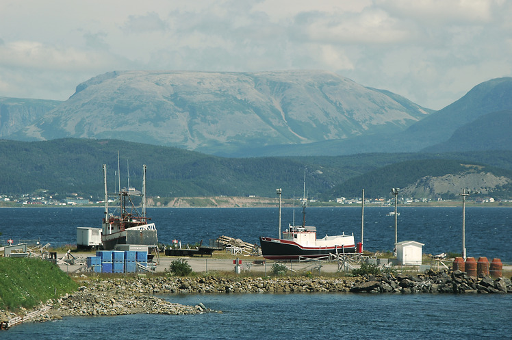
Gros Morne Photos
View all
Appalachians photos (861) |
photos from mountains in Canada (441) |
all photos
 Upload new photo
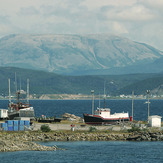
Gros Morne

