– Lat/Long: 47.55° N 11.78° E
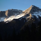
 Guffert
Weather Forecast, AustriaIssued: 7 am Mon 21 Apr Local TimeUpdates in: hr min sUpdate imminent
Guffert Weather Forecast, Austria
Issued: 7 am Mon 21 Apr Local Time
Updates in:
Update imminent hr min s

Issued: 7 am Mon 21 Apr Local Time
Updates in:
Update imminent hr min s
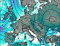
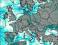
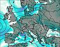
Days 1–3 Weather SummaryMild with light rain (total 6mm) on Wed night Becoming colder with a light covering of snow, mostly falling on Wed night. Freeze-thaw conditions (max 4°C on Wed afternoon, min -2°C on Wed night). Winds increasing (calm on Tue afternoon, fresh winds from the WNW by Wed night). | Days 4–6 Weather SummaryA light covering of new snow mostly falling on Thu night. Freeze-thaw conditions (max 5°C on Sat afternoon, min -3°C on Thu morning). Wind will be generally light. | |||||||||||||||||
Monday 21 | Tuesday 22 | Wednesday 23 | Thursday 24 | Friday 25 | Saturday 26 | |||||||||||||
AM | PM | night | AM | PM | night | AM | PM | night | AM | PM | night | AM | PM | night | AM | PM | night | |
some clouds | light rain | cloudy | some clouds | rain shwrs | rain shwrs | rain shwrs | risk tstorm | mod. snow | cloudy | light snow | snow shwrs | light snow | light snow | some clouds | clear | clear | clear | |
km/h | ||||||||||||||||||
 |  |  |  |  |  | |||||||||||||
— | — | — | — | — | — | — | — | 7 | — | 1.0 | 3 | 3 | 1.0 | — | — | — | — | |
— | 0.5 | — | — | 0.3 | 0.3 | 0.2 | 2 | 1.9 | — | — | — | — | — | — | — | — | — | |
max°C | 1 | 2 | 1 | 1 | 3 | 2 | 3 | 4 | 3 | -3 | -1 | -2 | -3 | -2 | 1 | 3 | 5 | 4 |
min°C | 1 | 2 | 0 | 0 | 2 | 1 | 2 | 4 | -2 | -3 | -2 | -3 | -3 | -2 | -1 | 1 | 5 | 2 |
-2 | -1 | 0 | 0 | 2 | 1 | 0 | 4 | -10 | -8 | -8 | -10 | -10 | -8 | -4 | 1 | 5 | -1 | |
2400 | 2500 | 2250 | 2350 | 2600 | 2450 | 2600 | 2750 | 1850 | 1700 | 2000 | 1750 | 1700 | 1850 | 2200 | 2800 | 2800 | 2600 | |
Cloud base (m) | 1900 | 850 | 800 | 1700 | 2050 | 1650 | 2100 | 2150 | 800 | 800 | 850 | 850 | 800 | 800 | 950 | 2600 | 2850 | |
6:13 | — | — | 6:11 | — | — | 6:09 | — | — | 6:07 | — | — | 6:07 | — | — | 6:05 | — | — | |
— | — | 8:08 | — | — | 8:10 | — | — | 8:12 | — | — | 8:14 | — | — | 8:15 | — | — | 8:15 | |
Loading...
Guffert Weather (Days 0-3):
The weather forecast for Guffert is: Mild with light rain (total 6mm) on Wed night Becoming colder with a light covering of snow, mostly falling on Wed night. Freeze-thaw conditions (max 4°C on Wed afternoon, min -2°C on Wed night). Winds increasing (calm on Tue afternoon, fresh winds from the WNW by Wed night).
Guffert Weather (Days 3-6):
A light covering of new snow mostly falling on Thu night. Freeze-thaw conditions (max 5°C on Sat afternoon, min -3°C on Thu morning). Wind will be generally light.
This table gives the weather forecast for Guffert at the specific elevation of 2195 m. Our advanced weather models allow us to provide distinct weather forecasts for several elevations of Guffert. To see the weather forecasts for the other elevations, use the tab navigation above the table. For a wider overview of the weather, consult the Weather Map of Austria.
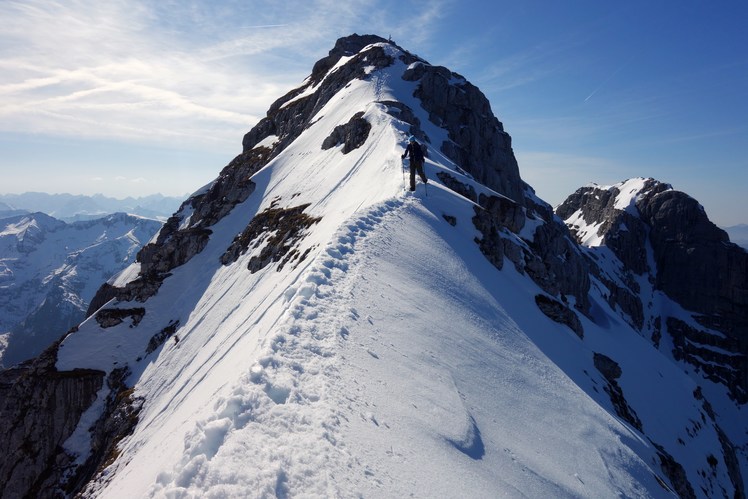
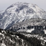
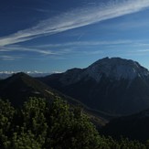
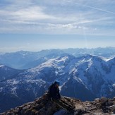
Guffert Photos
View all
Bavarian Alps photos (63) |
Alps photos (1456) |
photos from mountains in Austria (218) |
all photos
 Upload new photo
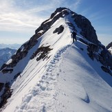
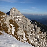

Guffert
Guffert
Guffert
Guffert
Guffert
Guffert
Guffert

