– Lat/Long: 40.65° N 140.88° E
 Hakkoda Group
Weather Forecast, JapanIssued: 8 pm Mon 31 Mar Local TimeUpdates in: hr min sUpdate imminent
Hakkoda Group Weather Forecast, Japan
Issued: 8 pm Mon 31 Mar Local Time
Updates in:
Update imminent hr min s

Issued: 8 pm Mon 31 Mar Local Time
Updates in:
Update imminent hr min s
Days 1–4 Weather SummaryA moderate fall of snow, heaviest on Wed morning. Temperatures will be below freezing (max 0°C on Tue afternoon, min -7°C on Mon night). Winds increasing (calm on Mon night, near gales from the ESE by Wed afternoon). | Days 5–7 Weather SummaryA light covering of new snow on Thu night turning to drizzle on Sun afternoon. Freeze-thaw conditions (max 6°C on Sun morning, min -3°C on Thu night). Winds decreasing (near gales from the W on Thu night, light winds from the SW by Sat afternoon). | Days 8–10 Weather SummarySome drizzle, heaviest during Tue morning. Freeze-thaw conditions (max 5°C on Wed afternoon, min 0°C on Mon morning). Winds decreasing (near gales from the WSW on Tue morning, light winds from the SSW by Wed afternoon). | Days 11–13 Weather SummaryHeavy rain (total 20mm), heaviest during Thu afternoon. Mild temperatures (max 7°C on Sat morning, min 3°C on Wed night). Mainly near gales. | |||||||||||||||||||||||||||||||||
Tuesday 1 | Wednesday 2 | Thursday 3 | Friday 4 | Saturday 5 | Sunday 6 | Monday 7 | Tuesday 8 | Wednesday 9 | Thursday 10 | Friday 11 | Sat 12 | |||||||||||||||||||||||||
night | AM | PM | night | AM | PM | night | AM | PM | night | AM | PM | night | AM | PM | night | AM | PM | night | AM | PM | night | AM | PM | night | AM | PM | night | AM | PM | night | AM | PM | night | AM | PM | |
clear | cloudy | cloudy | snow shwrs | light snow | light snow | light snow | cloudy | cloudy | snow shwrs | snow shwrs | some clouds | some clouds | clear | some clouds | some clouds | light rain | light rain | some clouds | some clouds | clear | some clouds | rain shwrs | rain shwrs | some clouds | clear | some clouds | some clouds | light rain | heavy rain | rain shwrs | clear | clear | clear | some clouds | clear | |
km/h | ||||||||||||||||||||||||||||||||||||
 |  |  |  |  |  |  |  |  |  |  |  |  | ||||||||||||||||||||||||
— | — | — | 1.0 | 4 | 3 | 5 | — | — | 3 | 2.0 | — | — | — | — | — | — | — | — | — | — | — | — | — | — | — | — | — | — | — | — | — | — | — | — | — | |
— | — | — | — | — | — | — | — | — | — | — | — | — | — | — | — | 0.1 | 0.9 | — | — | — | — | 1.5 | 0.1 | — | — | — | — | 5 | 13 | 2 | — | — | — | — | — | |
max°C | -5 | -1 | 0 | 0 | 0 | 0 | -1 | 0 | 0 | -1 | -3 | -2 | -1 | 2 | 3 | 3 | 6 | 4 | 2 | 1 | 2 | 3 | 4 | 2 | 2 | 3 | 5 | 4 | 5 | 5 | 4 | 5 | 6 | 5 | 7 | 7 |
min°C | -7 | -2 | -1 | -1 | -1 | -1 | -2 | -1 | 0 | -3 | -3 | -3 | -2 | 1 | 2 | 1 | 4 | 3 | 1 | 0 | 2 | 2 | 3 | 2 | 1 | 2 | 3 | 3 | 4 | 4 | 3 | 4 | 5 | 4 | 6 | 6 |
-11 | -6 | -3 | -5 | -9 | -9 | -8 | -5 | -7 | -12 | -12 | -12 | -9 | -4 | -2 | -6 | -2 | -3 | -6 | -8 | -4 | -4 | -4 | -5 | -4 | -1 | 0 | -1 | -2 | -1 | 0 | -1 | -1 | -2 | 1 | 0 | |
0 | 650 | 1000 | 600 | 950 | 950 | 700 | 800 | 1050 | 700 | 600 | 700 | 650 | 1150 | 1350 | 1150 | 1550 | 1650 | 1250 | 1050 | 1250 | 1600 | 1600 | 1300 | 1100 | 1250 | 1650 | 1850 | 1800 | 2000 | 1800 | 1650 | 1800 | 1900 | 1800 | 1850 | |
Cloud base (m) | 1650 | 6450 | 1600 | 450 | 400 | 350 | 350 | 350 | 300 | 350 | 350 | 400 | 400 | 800 | 2050 | 2200 | 700 | 350 | 550 | 2800 | 400 | 750 | 350 | 550 | 900 | 6050 | 1700 | 300 | 300 | 2800 | 6650 | 2200 | ||||
— | 5:20 | — | — | 5:18 | — | — | 5:16 | — | — | 5:16 | — | — | 5:13 | — | — | 5:11 | — | — | 5:11 | — | — | 5:09 | — | — | 5:07 | — | — | 5:05 | — | — | 5:03 | — | — | 5:03 | — | |
— | — | 6:00 | — | — | 6:00 | — | — | 6:01 | — | — | 6:02 | — | — | 6:04 | — | — | 6:05 | — | — | 6:06 | — | — | 6:07 | — | — | 6:07 | — | — | 6:08 | — | — | 6:10 | — | — | 6:12 | |
Hakkoda Group Weather (Days 0-3):
The weather forecast for Hakkoda Group is: A moderate fall of snow, heaviest on Wed morning. Temperatures will be below freezing (max 0°C on Tue afternoon, min -7°C on Mon night). Winds increasing (calm on Mon night, near gales from the ESE by Wed afternoon).
Hakkoda Group Weather (Days 3-6):
A light covering of new snow on Thu night turning to drizzle on Sun afternoon. Freeze-thaw conditions (max 6°C on Sun morning, min -3°C on Thu night). Winds decreasing (near gales from the W on Thu night, light winds from the SW by Sat afternoon).
Hakkoda Group Weather (Days 6-9):
Some drizzle, heaviest during Tue morning. Freeze-thaw conditions (max 5°C on Wed afternoon, min 0°C on Mon morning). Winds decreasing (near gales from the WSW on Tue morning, light winds from the SSW by Wed afternoon).
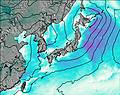
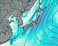
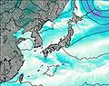
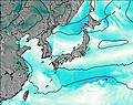
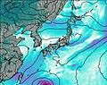
This table gives the weather forecast for Hakkoda Group at the specific elevation of 1000 m. Our advanced weather models allow us to provide distinct weather forecasts for several elevations of Hakkoda Group. To see the weather forecasts for the other elevations, use the tab navigation above the table. For a wider overview of the weather, consult the Weather Map of Japan.
| Weather Station | Temp. | Weather | Wind | Gusts | Cloud / Visibility |
|---|---|---|---|---|---|
Misawa Airport | |||||
Akita (buoy) | |||||
North Iwate (buoy) | |||||
Hakodate Airport |
* NOTE: not all weather observatories update at the same frequency which is the reason why some locations may show data from stations that are further away than known closer ones.
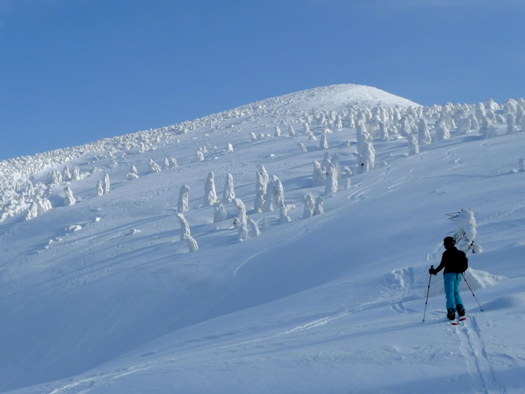
Hakkoda Group Photos
View all
Honshu photos (147) |
Japanese Archipelago photos (276) |
photos from mountains in Japan (358) |
all photos
 Upload new photo
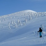
The Snow Monsters of Hakkoda

