
– Lat/Long: 40.80° N 73.64° W
 Harbor Hill
Weather Forecast, United StatesIssued: 7 am Tue 29 Apr Local TimeUpdates in: hr min sUpdate imminent
Harbor Hill Weather Forecast, United States
Issued: 7 am Tue 29 Apr Local Time
Updates in:
Update imminent hr min s

Issued: 7 am Tue 29 Apr Local Time
Updates in:
Update imminent hr min s
Days 1–3 Weather SummaryMostly dry. Very mild (max 19°C on Tue afternoon, min 10°C on Wed night). Winds decreasing (strong winds from the SSW on Tue afternoon, light winds from the ESE by Thu morning). | Days 4–6 Weather SummaryModerate rain (total 16mm), heaviest on Fri night. Warm (max 20°C on Fri afternoon, min 7°C on Sat night). Winds increasing (light winds from the SW on Fri night, strong winds from the NW by Sun afternoon). | |||||||||||||||||
Tuesday 29 | Wednesday 30 | Thursday 1 | Friday 2 | Saturday 3 | Sunday 4 | |||||||||||||
AM | PM | night | AM | PM | night | AM | PM | night | AM | PM | night | AM | PM | night | AM | PM | night | |
clear | clear | rain shwrs | some clouds | clear | some clouds | some clouds | clear | light rain | some clouds | rain shwrs | rain shwrs | light rain | light rain | rain shwrs | some clouds | clear | some clouds | |
km/h | ||||||||||||||||||
 |  |  |  |  |  | |||||||||||||
— | — | — | — | — | — | — | — | — | — | — | — | — | — | — | — | — | — | |
— | — | 0.3 | — | — | — | — | — | 0.5 | — | 1.8 | 6 | 4 | 3 | 2.0 | — | — | — | |
max°C | 17 | 19 | 19 | 14 | 19 | 18 | 14 | 15 | 14 | 16 | 20 | 18 | 16 | 17 | 15 | 11 | 17 | 15 |
min°C | 13 | 19 | 17 | 13 | 18 | 10 | 10 | 15 | 13 | 13 | 20 | 15 | 15 | 15 | 7 | 8 | 15 | 10 |
10 | 18 | 15 | 10 | 17 | 8 | 8 | 14 | 11 | 12 | 20 | 15 | 14 | 14 | 2 | 4 | 13 | 7 | |
3500 | 3900 | 3600 | 3650 | 3600 | 3500 | 3400 | 3700 | 3500 | 3450 | 3450 | 3350 | 3250 | 2900 | 1550 | 1450 | 2200 | 1750 | |
Cloud base (m) | 8950 | 5700 | 4350 | 9450 | 9500 | 3150 | 3500 | 2150 | 150 | 1750 | 300 | 100 | 650 | 200 | 6950 | 2100 | 1800 | |
5:56 | — | — | 5:54 | — | — | 5:52 | — | — | 5:52 | — | — | 5:50 | — | — | 5:48 | — | — | |
— | 7:47 | — | — | 7:49 | — | — | 7:50 | — | — | 7:51 | — | — | 7:52 | — | — | 7:52 | — | |
Loading...
Harbor Hill Weather (Days 0-3):
The weather forecast for Harbor Hill is: Mostly dry. Very mild (max 19°C on Tue afternoon, min 10°C on Wed night). Winds decreasing (strong winds from the SSW on Tue afternoon, light winds from the ESE by Thu morning).
Harbor Hill Weather (Days 3-6):
Moderate rain (total 16mm), heaviest on Fri night. Warm (max 20°C on Fri afternoon, min 7°C on Sat night). Winds increasing (light winds from the SW on Fri night, strong winds from the NW by Sun afternoon).
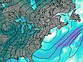
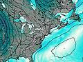
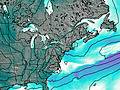
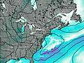
This table gives the weather forecast for Harbor Hill at the specific elevation of 106 m. Our advanced weather models allow us to provide distinct weather forecasts for several elevations of Harbor Hill. To see the weather forecasts for the other elevations, use the tab navigation above the table. For a wider overview of the weather, consult the Weather Map of New-York.
| Weather Station | Temp. | Weather | Wind | Gusts | Cloud / Visibility |
|---|---|---|---|---|---|
BUOY-KPTN6 | |||||
Farmingdale Airport | |||||
New York Cit / FK Airport | |||||
New York City La Guardia Airport | |||||
New Your Cit / entral Park Airport | |||||
Brookhaven Lab Airport | |||||
White Plains Airport | |||||
BUOY-BATN6 | |||||
* NOTE: not all weather observatories update at the same frequency which is the reason why some locations may show data from stations that are further away than known closer ones.

