– Lat/Long: 61.95° N 9.90° E
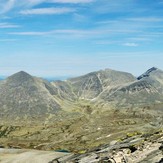
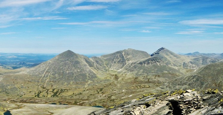
 Høgronden
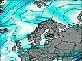
Weather Forecast, NorwayIssued: 7 pm Sat 05 Apr Local TimeUpdates in: 2hr 57min 26sUpdate imminent
Issued: 7 pm Sat 05 Apr Local Time
Updates in:
Update imminent 2hr 57min 26s

Issued: 7 pm Sat 05 Apr Local Time
Updates in:
Update imminent 2hr 57min 26s
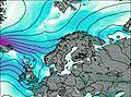
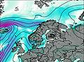
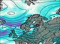
Days 1–4 Weather SummaryMostly dry. Temperatures will be below freezing (max 0°C on Tue afternoon, min -4°C on Sat night). Wind will be generally light. | Days 5–7 Weather SummaryMostly dry. Freeze-thaw conditions (max 2°C on Thu afternoon, min -6°C on Fri morning). Winds decreasing (strong winds from the WNW on Thu afternoon, light winds from the NNW by Fri morning). | Days 8–10 Weather SummaryMostly dry. Temperatures will be below freezing (max -2°C on Sat afternoon, min -8°C on Sat morning). Wind will be generally light. | Days 11–13 Weather SummaryA dusting of new snow. Temperatures will be below freezing (max -4°C on Mon night, min -6°C on Tue night). Wind will be generally light. | |||||||||||||||||||||||||||||||||
Sunday 6 | Monday 7 | Tuesday 8 | Wednesday 9 | Thursday 10 | Friday 11 | Saturday 12 | Sunday 13 | Monday 14 | Tuesday 15 | Wednesday 16 | Thu 17 | |||||||||||||||||||||||||
night | AM | PM | night | AM | PM | night | AM | PM | night | AM | PM | night | AM | PM | night | AM | PM | night | AM | PM | night | AM | PM | night | AM | PM | night | AM | PM | night | AM | PM | night | AM | PM | |
some clouds | some clouds | clear | some clouds | some clouds | some clouds | clear | clear | clear | some clouds | some clouds | some clouds | some clouds | clear | some clouds | some clouds | cloudy | some clouds | some clouds | some clouds | clear | some clouds | some clouds | cloudy | cloudy | cloudy | cloudy | cloudy | cloudy | light snow | light snow | some clouds | some clouds | some clouds | some clouds | cloudy | |
mph | ||||||||||||||||||||||||||||||||||||
 |  |  |  |  |  |  |  |  |  |  |  | |||||||||||||||||||||||||
— | — | — | — | — | — | — | — | — | — | — | — | — | — | — | — | — | — | — | — | — | — | — | — | — | — | — | — | — | 0.4 | 1 | — | — | — | — | — | |
— | — | — | — | — | — | — | — | — | — | — | — | — | — | — | — | — | — | — | — | — | — | — | — | — | — | — | — | — | — | — | — | — | — | — | — | |
max°F | 27 | 28 | 28 | 30 | 25 | 27 | 28 | 30 | 32 | 32 | 28 | 27 | 32 | 34 | 36 | 34 | 21 | 25 | 23 | 21 | 28 | 27 | 25 | 27 | 27 | 25 | 27 | 25 | 23 | 25 | 23 | 21 | 25 | 23 | 23 | 25 |
min°F | 25 | 27 | 27 | 25 | 25 | 25 | 27 | 28 | 32 | 32 | 27 | 25 | 27 | 34 | 36 | 25 | 21 | 25 | 19 | 18 | 25 | 25 | 25 | 27 | 25 | 23 | 27 | 23 | 23 | 25 | 21 | 21 | 23 | 23 | 23 | 25 |
18 | 19 | 19 | 18 | 18 | 25 | 27 | 25 | 27 | 25 | 16 | 14 | 18 | 23 | 25 | 12 | 10 | 18 | 12 | 12 | 25 | 21 | 18 | 19 | 18 | 14 | 19 | 16 | 16 | 16 | 10 | 12 | 12 | 12 | 10 | 12 | |
800 | 3400 | 3800 | 2000 | 2800 | 3400 | 3100 | 4300 | 5200 | 4900 | 3400 | 3300 | 4300 | 6200 | 6200 | 3900 | 2000 | 3100 | 1300 | 1800 | 3800 | 2500 | 3000 | 3300 | 2600 | 3000 | 3300 | 2800 | 2600 | 3000 | 2300 | 2500 | 3000 | 2500 | 2600 | 3300 | |
Cloud base (ft) | 3000 | 2600 | 3000 | 2600 | 2600 | 2600 | 3100 | 2600 | — | 5600 | 2600 | 5700 | 6600 | 6200 | 2600 | 2300 | 2500 | 5400 | 2500 | 2500 | 5600 | 2600 | 2300 | 2500 | 2300 | 2300 | 2500 | 2500 | 2500 | 2500 | 2500 | 2500 | 2600 | 2500 | 3300 | 5400 |
— | 6:28 | — | — | 6:24 | — | — | 6:20 | — | — | 6:18 | — | — | 6:15 | — | — | 6:11 | — | — | 6:07 | — | — | 6:05 | — | — | 6:01 | — | — | 5:58 | — | — | 5:56 | — | — | 5:52 | — | |
— | — | — | 8:19 | — | — | 8:21 | — | — | 8:23 | — | — | 8:27 | — | — | 8:30 | — | — | 8:31 | — | — | 8:35 | — | — | 8:37 | — | — | 8:39 | — | — | 8:43 | — | — | 8:45 | — | 8:49 | |
Høgronden Weather (Days 0-3):
The weather forecast for Høgronden is: Mostly dry. Temperatures will be below freezing (max 0°C on Tue afternoon, min -4°C on Sat night). Wind will be generally light.
Høgronden Weather (Days 3-6):
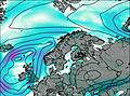
Mostly dry. Freeze-thaw conditions (max 2°C on Thu afternoon, min -6°C on Fri morning). Winds decreasing (strong winds from the WNW on Thu afternoon, light winds from the NNW by Fri morning).
Høgronden Weather (Days 6-9):
Mostly dry. Temperatures will be below freezing (max -2°C on Sat afternoon, min -8°C on Sat morning). Wind will be generally light.
This table gives the weather forecast for Høgronden at the specific elevation of 1500 m. Our advanced weather models allow us to provide distinct weather forecasts for several elevations of Høgronden. To see the weather forecasts for the other elevations, use the tab navigation above the table. For a wider overview of the weather, consult the Weather Map of Norway.