
– Lat/Long: 47.81° N 92.22° W
 Jasper Peak
Weather Forecast, United StatesIssued: 12 am Wed 01 Apr Local TimeUpdates in: hr min sUpdate imminent
Issued: 12 am Wed 01 Apr Local Time
Updates in:
Update imminent hr min s

Issued: 12 am Wed 01 Apr Local Time
Updates in:
Update imminent hr min s
Days 1–4 Weather SummaryA moderate fall of snow, heaviest on Thu afternoon. Temperatures will be below freezing (max 0°C on Fri morning, min -8°C on Tue night). Winds increasing (light winds from the NNE on Tue night, strong winds from the E by Thu morning). | Days 5–7 Weather SummaryA heavy fall of snow, heaviest during Sat afternoon. Temperatures will be below freezing (max -1°C on Sun morning, min -7°C on Sat night). Mainly fresh winds. | ||||||||||||||||||
Wednesday 1 | Thursday 2 | Friday 3 | Saturday 4 | Sunday 5 | Monday 6 | ||||||||||||||
night | AM | PM | night | AM | PM | night | AM | PM | night | AM | PM | night | AM | PM | night | AM | PM | night | |
some clouds | some clouds | cloudy | cloudy | light snow | mod. snow | light snow | cloudy | cloudy | light snow | mod. snow | mod. snow | light snow | some clouds | cloudy | some clouds | cloudy | light snow | some clouds | |
km/h | |||||||||||||||||||
 |  |  |  |  |  |  | |||||||||||||
— | — | — | — | 4 | 9 | 5 | — | — | 5 | 8 | 10 | 4 | — | — | — | — | 1 | — | |
— | — | — | — | — | — | — | — | — | — | — | — | — | — | — | — | — | — | — | |
max °C | -4 | -3 | -2 | -2 | -2 | -3 | -4 | 0 | 0 | -2 | -3 | -3 | -4 | -1 | -1 | -3 | -2 | -2 | -6 |
min °C | -8 | -5 | -4 | -5 | -2 | -4 | -6 | -2 | -1 | -3 | -4 | -3 | -7 | -3 | -1 | -4 | -3 | -2 | -15 |
-13 | -10 | -10 | -11 | -10 | -12 | -12 | -8 | -6 | -10 | -11 | -10 | -15 | -10 | -6 | -10 | -9 | -8 | -20 | |
0 | 0 | 200 | 0 | 0 | 0 | 0 | 0 | 450 | 0 | 0 | 0 | 0 | 0 | 450 | 0 | 0 | 300 | 0 | |
Cloud base (m) | 400 | 400 | 1700 | 500 | 500 | 300 | 350 | 350 | 350 | 350 | 300 | 300 | 350 | 350 | 850 | 350 | 350 | 350 | 400 |
— | 6:48 | — | — | 6:46 | — | — | 6:43 | — | — | 6:41 | — | — | 6:39 | — | — | 6:37 | — | — | |
— | — | 7:37 | — | — | 7:38 | — | — | 7:40 | — | — | 7:42 | — | — | 7:44 | — | — | 7:45 | — | |
Loading...
Jasper Peak Weather (Days 0-3):
The weather forecast for Jasper Peak is: A moderate fall of snow, heaviest on Thu afternoon. Temperatures will be below freezing (max 0°C on Fri morning, min -8°C on Tue night). Winds increasing (light winds from the NNE on Tue night, strong winds from the E by Thu morning).
Jasper Peak Weather (Days 3-6):
A heavy fall of snow, heaviest during Sat afternoon. Temperatures will be below freezing (max -1°C on Sun morning, min -7°C on Sat night). Mainly fresh winds.
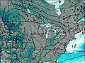
This table gives the weather forecast for Jasper Peak at the specific elevation of 520 m. Our advanced weather models allow us to provide distinct weather forecasts for several elevations of Jasper Peak. To see the weather forecasts for the other elevations, use the tab navigation above the table. For a wider overview of the weather, consult the Weather Map of Minnesota.
| Weather Station | Temp. | Weather | Wind | Gusts | Cloud / Visibility |
|---|---|---|---|---|---|
Ely Municipal Airport | |||||
Cook Muni Airport | |||||
Eveleth Municipal Airport | |||||
Orr Airport | |||||
Crane Lake Airport | |||||
* NOTE: not all weather observatories update at the same frequency which is the reason why some locations may show data from stations that are further away than known closer ones.