
– Lat/Long: 41.85° N 71.78° W
 Jerimoth Hill
Weather Forecast, United StatesIssued: 1 am Wed 01 Apr Local TimeUpdates in: hr min sUpdate imminent
Issued: 1 am Wed 01 Apr Local Time
Updates in:
Update imminent hr min s

Issued: 1 am Wed 01 Apr Local Time
Updates in:
Update imminent hr min s
Days 1–3 Weather SummaryLight rain (total 10mm) at first, then becoming colder with a dusting of snow on Thu morning. Very mild (max 19°C on Wed morning, min 1°C on Thu morning). Winds decreasing (fresh winds from the NE on Thu morning, light winds from the E by Thu night). | Days 4–6 Weather SummaryLight rain (total 4mm), mostly falling on Sun afternoon. Freeze-thaw conditions (max 19°C on Sat afternoon, min -1°C on Mon night). Winds increasing (light winds from the NE on Sat morning, fresh winds from the SSW by Sun morning). | |||||||||||||||||
Wednesday 1 | Thursday 2 | Friday 3 | Saturday 4 | Sunday 5 | Monday 6 | |||||||||||||
AM | PM | night | AM | PM | night | AM | PM | night | AM | PM | night | AM | PM | night | AM | PM | night | |
rain shwrs | light rain | mod. rain | light snow | some clouds | some clouds | cloudy | clear | clear | clear | some clouds | cloudy | light rain | light rain | some clouds | some clouds | some clouds | clear | |
km/h | ||||||||||||||||||
 |  |  |  |  |  | |||||||||||||
— | — | — | 2 | — | — | — | — | — | — | — | — | — | — | — | — | — | — | |
0.2 | 1.1 | 9 | — | — | — | — | — | — | — | — | — | 0.2 | 4 | — | — | — | — | |
max °C | 19 | 19 | 9 | 1 | 2 | 2 | 6 | 15 | 14 | 17 | 19 | 8 | 13 | 13 | 12 | 4 | 7 | 4 |
min °C | 14 | 16 | 2 | 1 | 2 | 1 | 3 | 14 | 13 | 13 | 13 | 6 | 12 | 13 | 2 | 2 | 7 | -1 |
13 | 15 | -4 | -5 | -4 | -5 | 0 | 12 | 11 | 12 | 11 | 3 | 9 | 10 | -3 | -3 | 3 | -4 | |
3250 | 3100 | 3000 | 3050 | 3350 | 3500 | 3650 | 3750 | 3550 | 3450 | 3550 | 3350 | 3250 | 3150 | 1000 | 700 | 900 | 200 | |
Cloud base (m) | 650 | 750 | 550 | 300 | 500 | 450 | 250 | 900 | 450 | 450 | 350 | 650 | 900 | |||||
6:30 | — | — | 6:28 | — | — | 6:26 | — | — | 6:24 | — | — | 6:22 | — | — | 6:22 | — | — | |
— | 7:12 | — | — | 7:13 | — | — | 7:14 | — | — | 7:15 | — | — | 7:15 | — | — | 7:16 | — | |
Loading...
Jerimoth Hill Weather (Days 0-3):
The weather forecast for Jerimoth Hill is: Light rain (total 10mm) at first, then becoming colder with a dusting of snow on Thu morning. Very mild (max 19°C on Wed morning, min 1°C on Thu morning). Winds decreasing (fresh winds from the NE on Thu morning, light winds from the E by Thu night).
Jerimoth Hill Weather (Days 3-6):
Light rain (total 4mm), mostly falling on Sun afternoon. Freeze-thaw conditions (max 19°C on Sat afternoon, min -1°C on Mon night). Winds increasing (light winds from the NE on Sat morning, fresh winds from the SSW by Sun morning).
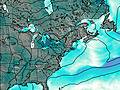
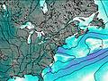
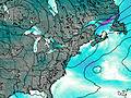
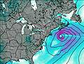
This table gives the weather forecast for Jerimoth Hill at the specific elevation of 247 m. Our advanced weather models allow us to provide distinct weather forecasts for several elevations of Jerimoth Hill. To see the weather forecasts for the other elevations, use the tab navigation above the table. For a wider overview of the weather, consult the Weather Map of Rhode-Island.
| Weather Station | Temp. | Weather | Wind | Gusts | Cloud / Visibility |
|---|---|---|---|---|---|
Pawtucket Airport | |||||
Providenc / heodore Francis Green State Airport | |||||
BUOY-FOXR1 | |||||
BUOY-PVDR1 | |||||
BUOY-CPTR1 | |||||
Nort Kingsto / uonset State Airport | |||||
BUOY-PDVR1 |
* NOTE: not all weather observatories update at the same frequency which is the reason why some locations may show data from stations that are further away than known closer ones.