– Lat/Long: 47.63° N 11.37° E
 Jochberg (mountain)
Weather Forecast, GermanyIssued: 7 pm Sun 20 Apr Local TimeUpdates in: hr min sUpdate imminent
Jochberg (mountain) Weather Forecast, Germany
Issued: 7 pm Sun 20 Apr Local Time
Updates in:
Update imminent hr min s

Issued: 7 pm Sun 20 Apr Local Time
Updates in:
Update imminent hr min s
Days 1–4 Weather SummaryLight rain (total 5mm), mostly falling on Sun night. Mild temperatures (max 7°C on Wed afternoon, min 3°C on Sun night). Wind will be generally light. | Days 5–7 Weather SummaryHeavy rain (total 21mm), mostly on Wed night. Becoming colder with a light covering of snow, mostly falling on Thu night. Mild temperatures (max 6°C on Wed night, min 1°C on Thu night). Wind will be generally light. | ||||||||||||||||||
Monday 21 | Tuesday 22 | Wednesday 23 | Thursday 24 | Friday 25 | Saturday 26 | ||||||||||||||
night | AM | PM | night | AM | PM | night | AM | PM | night | AM | PM | night | AM | PM | night | AM | PM | night | |
rain shwrs | rain shwrs | light rain | rain shwrs | rain shwrs | rain shwrs | rain shwrs | rain shwrs | light rain | heavy rain | light rain | light rain | light snow | light snow | snow shwrs | rain shwrs | clear | clear | clear | |
km/h | |||||||||||||||||||
 |  |  |  |  |  |  | |||||||||||||
— | — | — | — | — | — | — | — | — | — | — | — | 3 | 2.0 | 1.0 | — | — | — | — | |
0.6 | 0.1 | 0.3 | 1.2 | 0.4 | 0.6 | 0.1 | 0.4 | 1.1 | 12 | 4 | 1.2 | 1.0 | — | 1.6 | 2 | — | — | — | |
max°C | 5 | 5 | 5 | 4 | 5 | 6 | 6 | 6 | 7 | 6 | 4 | 4 | 3 | 1 | 3 | 3 | 3 | 6 | 5 |
min°C | 3 | 4 | 5 | 3 | 4 | 6 | 5 | 5 | 7 | 4 | 4 | 4 | 1 | 1 | 1 | 2 | 2 | 6 | 3 |
-1 | 4 | 4 | 1 | 4 | 5 | 2 | 3 | 5 | 1 | 0 | 2 | -3 | -4 | -2 | 2 | 2 | 4 | 0 | |
2400 | 2350 | 2400 | 2200 | 2250 | 2500 | 2400 | 2500 | 2700 | 2450 | 2200 | 2250 | 1800 | 1800 | 2000 | 1950 | 2150 | 2450 | 2200 | |
Cloud base (m) | 1500 | 1850 | 1650 | 600 | 1700 | 1800 | 2300 | 2100 | 1900 | 650 | 450 | 450 | 450 | 900 | 850 | 1900 | 1950 | 2150 | 8550 |
— | 6:15 | — | — | 6:13 | — | — | 6:11 | — | — | 6:09 | — | — | 6:07 | — | — | 6:05 | — | — | |
— | — | — | 8:10 | — | — | 8:13 | — | — | 8:14 | — | — | 8:15 | — | — | 8:16 | — | — | 8:17 | |
Loading...
Jochberg (mountain) Weather (Days 0-3):
The weather forecast for Jochberg (mountain) is: Light rain (total 5mm), mostly falling on Sun night. Mild temperatures (max 7°C on Wed afternoon, min 3°C on Sun night). Wind will be generally light.
Jochberg (mountain) Weather (Days 3-6):
Heavy rain (total 21mm), mostly on Wed night. Becoming colder with a light covering of snow, mostly falling on Thu night. Mild temperatures (max 6°C on Wed night, min 1°C on Thu night). Wind will be generally light.
This table gives the weather forecast for Jochberg (mountain) at the specific elevation of 1567 m. Our advanced weather models allow us to provide distinct weather forecasts for several elevations of Jochberg (mountain). To see the weather forecasts for the other elevations, use the tab navigation above the table. For a wider overview of the weather, consult the Weather Map of Germany.
| Weather Station | Temp. | Weather | Wind | Gusts | Cloud / Visibility |
|---|---|---|---|---|---|
Berg Brauneck LGGF | |||||
LGGF Test | |||||
LGGF Brauneck Tal | |||||
Blomberg | |||||
Laber | |||||
Wank | |||||
Kreuzeck | |||||
Osterfelder | |||||
* NOTE: not all weather observatories update at the same frequency which is the reason why some locations may show data from stations that are further away than known closer ones.
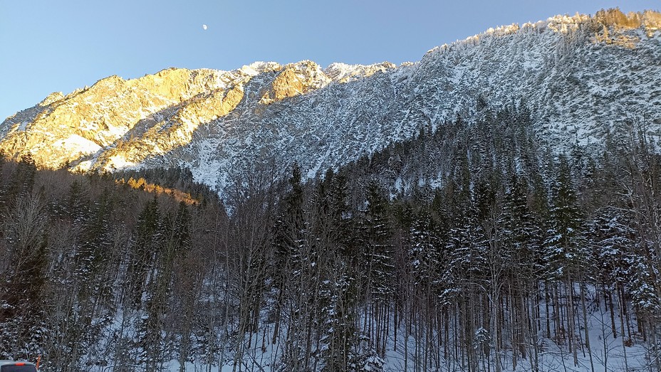
Jochberg (mountain) Photos
View all
Bavarian Alps photos (63) |
Alps photos (1456) |
photos from mountains in Germany (122) |
all photos
 Upload new photo
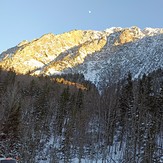

Jochberg
Jochberg
Jochberg (mountain)

