– Lat/Long: 46.53° N 7.97° E
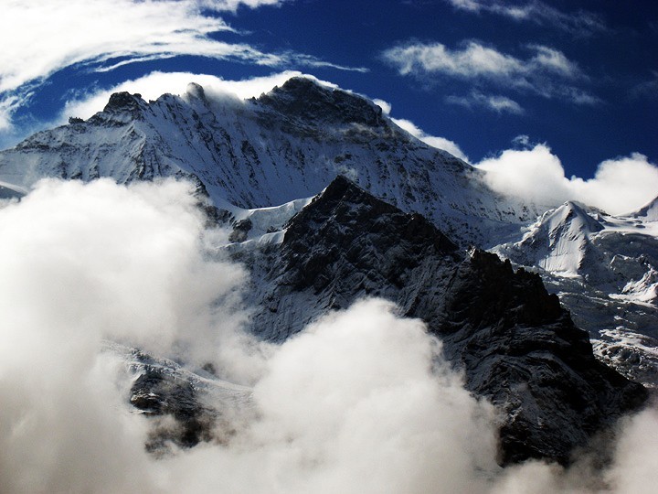
 Jungfrau
Weather Forecast, SwitzerlandIssued: 1 am Wed 23 Apr Local TimeUpdates in: hr min sUpdate imminent
Jungfrau Weather Forecast, Switzerland
Issued: 1 am Wed 23 Apr Local Time
Updates in:
Update imminent hr min s

Issued: 1 am Wed 23 Apr Local Time
Updates in:
Update imminent hr min s
Days 1–3 Weather SummaryHeavy rain (total 31mm), heaviest during Wed night. Mild temperatures (max 8°C on Wed afternoon, min 2°C on Wed night). Wind will be generally light. | Days 4–6 Weather SummarySome drizzle, heaviest during Sat afternoon. Very mild (max 11°C on Mon afternoon, min 5°C on Sat night). Wind will be generally light. | |||||||||||||||||
Wednesday 23 | Thursday 24 | Friday 25 | Saturday 26 | Sunday 27 | Monday 28 | |||||||||||||
AM | PM | night | AM | PM | night | AM | PM | night | AM | PM | night | AM | PM | night | AM | PM | night | |
some clouds | rain shwrs | heavy rain | rain shwrs | rain shwrs | rain shwrs | rain shwrs | rain shwrs | rain shwrs | clear | rain shwrs | rain shwrs | clear | light rain | rain shwrs | clear | some clouds | clear | |
km/h | ||||||||||||||||||
 |  |  |  |  |  | |||||||||||||
— | — | — | — | — | — | — | — | — | — | — | — | — | — | — | — | — | — | |
— | 3 | 26 | 0.1 | 0.5 | 1.1 | 0.1 | 0.3 | 0.1 | — | 0.5 | 0.1 | — | 0.5 | 0.3 | — | — | — | |
max°C | 7 | 8 | 5 | 3 | 5 | 4 | 4 | 6 | 5 | 9 | 9 | 8 | 9 | 9 | 7 | 9 | 11 | 9 |
min°C | 5 | 8 | 2 | 2 | 4 | 2 | 2 | 5 | 3 | 6 | 9 | 5 | 6 | 8 | 5 | 6 | 11 | 7 |
5 | 8 | 0 | 1 | 3 | 0 | 0 | 3 | 1 | 6 | 9 | 5 | 6 | 7 | 5 | 6 | 11 | 7 | |
2500 | 2600 | 1900 | 2050 | 2250 | 1900 | 2100 | 2350 | 2850 | 2850 | 2800 | 2550 | 2650 | 2700 | 2550 | 2900 | 3000 | 3300 | |
Cloud base (m) | 2800 | 2650 | 2700 | 2650 | 2650 | 2650 | 2700 | 2650 | 2600 | 2650 | 2800 | 2700 | 2650 | 2700 | 2700 | 2800 | ||
6:28 | — | — | 6:26 | — | — | 6:24 | — | — | 6:22 | — | — | 6:20 | — | — | 6:18 | — | — | |
— | — | 8:24 | — | — | 8:27 | — | — | 8:28 | — | — | 8:29 | — | — | 8:30 | — | — | 8:31 | |
Loading...
Jungfrau Weather (Days 0-3):
The weather forecast for Jungfrau is: Heavy rain (total 31mm), heaviest during Wed night. Mild temperatures (max 8°C on Wed afternoon, min 2°C on Wed night). Wind will be generally light.
Jungfrau Weather (Days 3-6):
Some drizzle, heaviest during Sat afternoon. Very mild (max 11°C on Mon afternoon, min 5°C on Sat night). Wind will be generally light.
This table gives the weather forecast for Jungfrau at the specific elevation of 1500 m. Our advanced weather models allow us to provide distinct weather forecasts for several elevations of Jungfrau. To see the weather forecasts for the other elevations, use the tab navigation above the table. For a wider overview of the weather, consult the Weather Map of Switzerland.
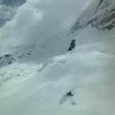
Jungfrau Photos
View all
Bernese Alps photos (163) |
Alps photos (1456) |
photos from mountains in Switzerland (643) |
all photos
 Upload new photo
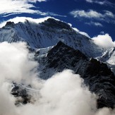
Jungfrau

