
– Lat/Long: 51.92° N 177.17° W
 Kanaga
Weather Forecast, United StatesIssued: 9 pm Mon 28 Apr Local TimeUpdates in: hr min sUpdate imminent
Kanaga Weather Forecast, United States
Issued: 9 pm Mon 28 Apr Local Time
Updates in:
Update imminent hr min s

Issued: 9 pm Mon 28 Apr Local Time
Updates in:
Update imminent hr min s
Days 1–4 Weather SummaryMostly dry. Temperatures will be below freezing (max -5°C on Wed night, min -10°C on Tue morning). Winds decreasing (gales from the NW on Tue morning, calm by Thu morning). | Days 5–7 Weather SummaryA dusting of new snow. Temperatures will be well below freezing (max -7°C on Thu night, min -9°C on Fri night). Mainly fresh winds. | ||||||||||||||||||
Tuesday 29 | Wednesday 30 | Thursday 1 | Friday 2 | Saturday 3 | Sunday 4 | ||||||||||||||
night | AM | PM | night | AM | PM | night | AM | PM | night | AM | PM | night | AM | PM | night | AM | PM | night | |
some clouds | cloudy | some clouds | some clouds | some clouds | clear | some clouds | some clouds | some clouds | cloudy | light snow | some clouds | some clouds | cloudy | clear | some clouds | clear | clear | clear | |
km/h | |||||||||||||||||||
 |  |  |  |  |  |  | |||||||||||||
— | — | — | — | — | — | — | — | — | — | 2.0 | — | — | — | — | — | — | — | — | |
— | — | — | — | — | — | — | — | — | — | — | — | — | — | — | — | — | — | — | |
max°C | -8 | -10 | -9 | -9 | -9 | -8 | -5 | -5 | -5 | -7 | -8 | -8 | -8 | -9 | -9 | -9 | -9 | -7 | -5 |
min°C | -9 | -10 | -9 | -10 | -9 | -8 | -6 | -5 | -6 | -8 | -8 | -8 | -9 | -9 | -9 | -9 | -9 | -8 | -7 |
-22 | -23 | -22 | -22 | -20 | -17 | -10 | -7 | -10 | -15 | -17 | -16 | -17 | -16 | -14 | -16 | -18 | -16 | -15 | |
400 | 250 | 300 | 250 | 250 | 300 | 350 | 300 | 450 | 350 | 150 | 200 | 250 | 200 | 250 | 250 | 250 | 350 | 400 | |
Cloud base (m) | 200 | 200 | 350 | 350 | 300 | 250 | 250 | 200 | 250 | 350 | 300 | 100 | 150 | 150 | 450 | 300 | 450 | 400 | 550 |
— | 8:22 | — | — | 8:21 | — | — | 8:18 | — | — | 8:17 | — | — | 8:15 | — | — | 8:12 | — | — | |
— | — | — | 11:08 | — | — | 11:10 | — | — | 11:13 | — | — | 11:14 | — | — | 11:15 | — | — | 11:17 | |
Loading...
Kanaga Weather (Days 0-3):
The weather forecast for Kanaga is: Mostly dry. Temperatures will be below freezing (max -5°C on Wed night, min -10°C on Tue morning). Winds decreasing (gales from the NW on Tue morning, calm by Thu morning).
Kanaga Weather (Days 3-6):
A dusting of new snow. Temperatures will be well below freezing (max -7°C on Thu night, min -9°C on Fri night). Mainly fresh winds.
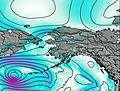
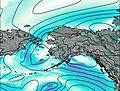
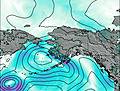
This table gives the weather forecast for Kanaga at the specific elevation of 1307 m. Our advanced weather models allow us to provide distinct weather forecasts for several elevations of Kanaga. To see the weather forecasts for the other elevations, use the tab navigation above the table. For a wider overview of the weather, consult the Weather Map of Alaska United States.
| Weather Station | Temp. | Weather | Wind | Gusts | Cloud / Visibility |
|---|---|---|---|---|---|
Adak Naval Air Station Airport | |||||
BUOY-ADKA2 | |||||
Atka Airport | |||||
BUOY-ATKA2 | |||||
SHIP3558 | |||||
SHIP4470 | |||||
SHIP3558 | |||||
SHIP7589 | |||||
SHIP2565 | |||||
SHIP5900 |
* NOTE: not all weather observatories update at the same frequency which is the reason why some locations may show data from stations that are further away than known closer ones.

