
– Lat/Long: 36.12° N 75.12° E
 Khiangyang Kish
Weather Forecast, PakistanIssued: 4 pm Tue 01 Apr Local TimeUpdates in: 33min 21sUpdate imminent
Issued: 4 pm Tue 01 Apr Local Time
Updates in:
Update imminent 33min 21s

Issued: 4 pm Tue 01 Apr Local Time
Updates in:
Update imminent 33min 21s
Days 1–4 Weather SummaryA dusting of new snow. Extremely cold (max -12°C on Fri morning, min -20°C on Tue night). Wind will be generally light. | Days 5–7 Weather SummaryMostly dry. Temperatures will be well below freezing (max -7°C on Sun afternoon, min -16°C on Fri night). Wind will be generally light. | Days 8–10 Weather SummaryA heavy fall of snow, heaviest during Wed night. Temperatures will be well below freezing (max -6°C on Mon afternoon, min -11°C on Mon night). Wind will be generally light. | Days 11–13 Weather SummaryA moderate fall of snow, heaviest on Fri afternoon. Temperatures will be below freezing (max -4°C on Sun afternoon, min -11°C on Fri night). Wind will be generally light. | |||||||||||||||||||||||||||||||||
Tue 1 | Wednesday 2 | Thursday 3 | Friday 4 | Saturday 5 | Sunday 6 | Monday 7 | Tuesday 8 | Wednesday 9 | Thursday 10 | Friday 11 | Saturday 12 | Sun 13 | ||||||||||||||||||||||||
PM | night | AM | PM | night | AM | PM | night | AM | PM | night | AM | PM | night | AM | PM | night | AM | PM | night | AM | PM | night | AM | PM | night | AM | PM | night | AM | PM | night | AM | PM | night | AM | |
clear | clear | clear | clear | some clouds | cloudy | cloudy | light snow | light snow | some clouds | some clouds | clear | clear | clear | clear | clear | clear | clear | some clouds | some clouds | cloudy | cloudy | heavy snow | mod. snow | light snow | snow shwrs | snow shwrs | light snow | light snow | light snow | snow shwrs | some clouds | clear | clear | clear | clear | |
mph | ||||||||||||||||||||||||||||||||||||
 |  |  |  |  |  |  |  |  |  |  |  |  | ||||||||||||||||||||||||
— | — | — | — | — | — | — | 1 | 0.4 | — | — | — | — | — | — | — | — | — | — | — | — | — | 4 | 2 | 2 | 3 | 0.4 | 1 | 1 | 2 | 2 | — | — | — | — | — | |
— | — | — | — | — | — | — | — | — | — | — | — | — | — | — | — | — | — | — | — | — | — | — | — | — | — | — | — | — | — | — | — | — | — | — | — | |
max°F | 9 | -0 | 7 | 7 | -0 | 9 | 9 | 5 | 10 | 14 | 7 | 16 | 18 | 10 | 18 | 19 | 12 | 19 | 21 | 14 | 19 | 21 | 19 | 21 | 21 | 19 | 19 | 19 | 18 | 19 | 21 | 16 | 23 | 23 | 18 | 23 |
min°F | 7 | -4 | 3 | 7 | -0 | 5 | 9 | 5 | 7 | 14 | 3 | 12 | 16 | 9 | 14 | 19 | 12 | 18 | 19 | 12 | 18 | 19 | 18 | 19 | 21 | 14 | 18 | 19 | 16 | 18 | 19 | 12 | 19 | 23 | 14 | 19 |
7 | -4 | -6 | -6 | -9 | -8 | -6 | -8 | 7 | 5 | 3 | 7 | 7 | 3 | 9 | 14 | 12 | 10 | 10 | 12 | 7 | 9 | 9 | 9 | 10 | 3 | 7 | 9 | 5 | 10 | 12 | 3 | 12 | 23 | 7 | 19 | |
10300 | 5400 | 10000 | 9800 | 6400 | 10200 | 10000 | 8900 | 11000 | 11300 | 6600 | 11800 | 11800 | 8400 | 12600 | 12600 | 9200 | 13100 | 13300 | 10000 | 13100 | 13100 | 12300 | 13500 | 13500 | 11500 | 13100 | 13100 | 11600 | 13000 | 13300 | 9400 | 14100 | 14100 | 10700 | 14100 | |
Cloud base (ft) | — | — | — | — | 21700 | 18000 | 17200 | 16700 | 16700 | 17900 | 16700 | 27200 | 28500 | — | 31000 | 29000 | 30700 | — | 23000 | 19400 | 18900 | 16900 | 16600 | 16700 | 16600 | 16700 | 16900 | 16600 | 16700 | 16700 | 16700 | 16700 | — | — | — | — |
— | — | 5:43 | — | — | 5:43 | — | — | 5:41 | — | — | 5:39 | — | — | 5:39 | — | — | 5:37 | — | — | 5:35 | — | — | 5:35 | — | — | 5:33 | — | — | 5:31 | — | — | 5:30 | — | — | 5:28 | |
6:21 | — | — | 6:21 | — | — | 6:22 | — | — | 6:22 | — | — | 6:23 | — | — | 6:24 | — | — | 6:25 | — | — | 6:27 | — | — | 6:27 | — | — | 6:28 | — | — | 6:29 | — | — | 6:30 | — | — | |
Khiangyang Kish Weather (Days 0-3):
The weather forecast for Khiangyang Kish is: A dusting of new snow. Extremely cold (max -12°C on Fri morning, min -20°C on Tue night). Wind will be generally light.
Khiangyang Kish Weather (Days 3-6):
Mostly dry. Temperatures will be well below freezing (max -7°C on Sun afternoon, min -16°C on Fri night). Wind will be generally light.
Khiangyang Kish Weather (Days 6-9):
A heavy fall of snow, heaviest during Wed night. Temperatures will be well below freezing (max -6°C on Mon afternoon, min -11°C on Mon night). Wind will be generally light.
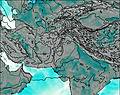
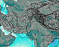
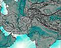
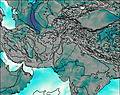
This table gives the weather forecast for Khiangyang Kish at the specific elevation of 5000 m. Our advanced weather models allow us to provide distinct weather forecasts for several elevations of Khiangyang Kish. To see the weather forecasts for the other elevations, use the tab navigation above the table. For a wider overview of the weather, consult the Weather Map of Pakistan.

