
– Lat/Long: 41.87° S 146.26° E
 King Davids Peak
Weather Forecast, AustraliaIssued: 4 am Tue 01 Apr Local TimeUpdates in: hr min sUpdate imminent
King Davids Peak Weather Forecast, Australia
Issued: 4 am Tue 01 Apr Local Time
Updates in:
Update imminent hr min s

Issued: 4 am Tue 01 Apr Local Time
Updates in:
Update imminent hr min s
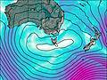
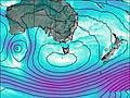
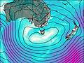
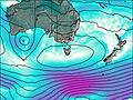
Days 1–3 Weather SummaryMostly dry. Very mild (max 15°C on Wed afternoon, min 4°C on Thu night). Wind will be generally light. | Days 4–6 Weather SummaryA moderate fall of snow, heaviest on Fri night. Turning milder with moderate rain (total 12mm), heaviest on Sun night. Freeze-thaw conditions (max 9°C on Fri afternoon, min -1°C on Fri night). Winds increasing (light winds from the WNW on Fri morning, gales from the WNW by Sun afternoon). | Days 7–9 Weather SummaryA dusting of snow on Mon morning. Freezing level rising with drizzle on Wed night. Freeze-thaw conditions (max 5°C on Tue afternoon, min 0°C on Mon morning). Winds decreasing (near gales from the SW on Mon morning, calm by Tue night). | Days 10–12 Weather SummaryMostly dry. Freeze-thaw conditions (max 13°C on Sat afternoon, min 0°C on Thu morning). Wind will be generally light. | |||||||||||||||||||||||||||||||||
Tuesday 1 | Wednesday 2 | Thursday 3 | Friday 4 | Saturday 5 | Sunday 6 | Monday 7 | Tuesday 8 | Wednesday 9 | Thursday 10 | Friday 11 | Saturday 12 | |||||||||||||||||||||||||
AM | PM | night | AM | PM | night | AM | PM | night | AM | PM | night | AM | PM | night | AM | PM | night | AM | PM | night | AM | PM | night | AM | PM | night | AM | PM | night | AM | PM | night | AM | PM | night | |
clear | some clouds | some clouds | some clouds | some clouds | some clouds | some clouds | rain shwrs | rain shwrs | clear | cloudy | mod. snow | snow shwrs | light rain | light rain | light rain | light rain | light snow | light snow | some clouds | some clouds | clear | clear | clear | cloudy | light rain | rain shwrs | clear | clear | clear | clear | clear | clear | clear | clear | clear | |
km/h | ||||||||||||||||||||||||||||||||||||
 |  |  |  |  |  |  |  |  |  |  |  | |||||||||||||||||||||||||
— | — | — | — | — | — | — | — | — | — | — | 7 | 2.0 | — | — | — | — | 3 | 3 | — | — | — | — | — | — | — | — | — | — | — | — | — | — | — | — | — | |
— | — | — | — | — | — | — | 0.1 | 0.1 | — | — | 2 | — | 0.3 | 0.6 | 0.4 | 0.4 | 8 | — | — | — | — | — | — | — | 0.3 | 0.8 | — | — | — | — | — | — | — | — | — | |
max°C | 8 | 13 | 9 | 11 | 15 | 10 | 10 | 12 | 7 | 7 | 9 | 6 | 0 | 3 | 5 | 5 | 6 | 6 | 0 | 1 | 1 | 3 | 5 | 3 | 5 | 5 | 5 | 2 | 6 | 3 | 6 | 10 | 7 | 10 | 13 | 9 |
min°C | 7 | 12 | 9 | 9 | 14 | 8 | 8 | 11 | 4 | 4 | 6 | -1 | -1 | 2 | 4 | 5 | 6 | 1 | 0 | 1 | 0 | 1 | 5 | 2 | 4 | 5 | 0 | 0 | 5 | 3 | 3 | 9 | 7 | 7 | 12 | 7 |
4 | 12 | 8 | 9 | 14 | 8 | 7 | 9 | 3 | 2 | 2 | -9 | -9 | -5 | -3 | -1 | -1 | -6 | -8 | -7 | -5 | -3 | 4 | 2 | 0 | 2 | -5 | -5 | 3 | 3 | 0 | 8 | 7 | 5 | 11 | 5 | |
3100 | 3150 | 3250 | 3000 | 2700 | 2750 | 2450 | 2400 | 2250 | 2250 | 2050 | 1250 | 1000 | 1450 | 2350 | 2200 | 2000 | 1300 | 1050 | 1150 | 1050 | 1350 | 2400 | 1700 | 2000 | 1800 | 1200 | 1250 | 2050 | 1950 | 2200 | 2600 | 3100 | 3100 | 3150 | 3200 | |
Cloud base (m) | 8550 | 7000 | 6400 | 5450 | 2450 | 850 | 6950 | 1800 | 550 | 600 | 600 | 600 | 550 | 600 | 550 | 600 | 650 | 700 | 650 | 1600 | 950 | 850 | 700 | 850 | 650 | 1900 | ||||||||||
7:30 | — | — | 7:31 | — | — | 7:31 | — | — | 7:33 | — | — | 7:33 | — | — | 6:35 | — | — | 7:35 | — | — | 7:37 | — | — | 7:39 | — | — | 7:39 | — | — | 7:41 | — | — | 7:41 | — | — | |
— | 7:06 | — | — | 7:05 | — | — | 7:02 | — | — | 7:00 | — | — | 7:00 | — | — | 5:58 | — | — | 6:55 | — | — | 6:54 | — | — | 6:52 | — | — | 6:52 | — | — | 6:50 | — | — | 6:47 | — | |
King Davids Peak Weather (Days 0-3):
The weather forecast for King Davids Peak is: Mostly dry. Very mild (max 15°C on Wed afternoon, min 4°C on Thu night). Wind will be generally light.
King Davids Peak Weather (Days 3-6):
A moderate fall of snow, heaviest on Fri night. Turning milder with moderate rain (total 12mm), heaviest on Sun night. Freeze-thaw conditions (max 9°C on Fri afternoon, min -1°C on Fri night). Winds increasing (light winds from the WNW on Fri morning, gales from the WNW by Sun afternoon).
King Davids Peak Weather (Days 6-9):
A dusting of snow on Mon morning. Freezing level rising with drizzle on Wed night. Freeze-thaw conditions (max 5°C on Tue afternoon, min 0°C on Mon morning). Winds decreasing (near gales from the SW on Mon morning, calm by Tue night).
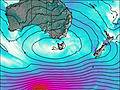
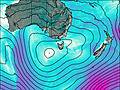
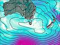
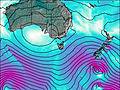
This table gives the weather forecast for King Davids Peak at the specific elevation of 1000 m. Our advanced weather models allow us to provide distinct weather forecasts for several elevations of King Davids Peak. To see the weather forecasts for the other elevations, use the tab navigation above the table. For a wider overview of the weather, consult the Weather Map of Tasmania.

