– Lat/Long: 45.59° N 110.46° W
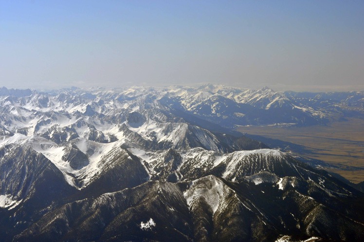
 Livingston Peak
Weather Forecast, United StatesIssued: 5 am Sun 27 Apr Local TimeUpdates in: hr min sUpdate imminent
Livingston Peak Weather Forecast, United States
Issued: 5 am Sun 27 Apr Local Time
Updates in:
Update imminent hr min s

Issued: 5 am Sun 27 Apr Local Time
Updates in:
Update imminent hr min s
Days 1–3 Weather SummaryLight rain (total 3mm) on Sun afternoon. Becoming colder with heavy fall of snow, heaviest during Sun night. Freeze-thaw conditions (max 5°C on Sun morning, min -3°C on Mon morning). Winds increasing (calm on Sun morning, fresh winds from the WNW by Tue night). | Days 4–6 Weather SummaryA dusting of new snow. Freeze-thaw conditions (max 11°C on Fri afternoon, min -2°C on Wed morning). Wind will be generally light. | |||||||||||||||||
Sunday 27 | Monday 28 | Tuesday 29 | Wednesday 30 | Thursday 1 | Friday 2 | |||||||||||||
AM | PM | night | AM | PM | night | AM | PM | night | AM | PM | night | AM | PM | night | AM | PM | night | |
cloudy | light rain | heavy snow | mod. snow | cloudy | clear | some clouds | rain shwrs | light snow | some clouds | snow shwrs | snow shwrs | clear | rain shwrs | clear | clear | clear | clear | |
km/h | ||||||||||||||||||
 |  |  |  |  |  | |||||||||||||
— | — | 30 | 10 | — | — | — | — | 3 | — | 2.0 | 1.0 | — | — | — | — | — | — | |
— | 3 | — | — | — | — | — | 0.3 | — | — | — | — | — | 0.1 | — | — | — | — | |
max°C | 5 | 4 | 1 | -2 | -1 | 0 | 2 | 3 | 1 | -2 | 0 | -1 | 1 | 4 | 3 | 7 | 11 | 8 |
min°C | 5 | 3 | -2 | -3 | -1 | -1 | 1 | 3 | -3 | -2 | -1 | -2 | -1 | 3 | 3 | 5 | 10 | 6 |
4 | 0 | -5 | -7 | -3 | -6 | -4 | -2 | -8 | -6 | -4 | -5 | -4 | 2 | 1 | 1 | 8 | 2 | |
3300 | 3000 | 2450 | 1950 | 2350 | 2300 | 2800 | 2900 | 2400 | 2150 | 2450 | 2250 | 2400 | 2800 | 3150 | 3450 | 3700 | 3850 | |
Cloud base (m) | 5200 | 3200 | 2050 | 2050 | 2050 | 2100 | 2000 | 2050 | 2100 | 2200 | 2100 | 2700 | 2500 | 3050 | 8600 | 8600 | ||
6:16 | — | — | 6:13 | — | — | 6:13 | — | — | 6:11 | — | — | 6:09 | — | — | 6:07 | — | — | |
— | 8:22 | — | — | 8:23 | — | — | 8:24 | — | — | 8:27 | — | — | 8:28 | — | — | 8:29 | — | |
Loading...
Livingston Peak Weather (Days 0-3):
The weather forecast for Livingston Peak is: Light rain (total 3mm) on Sun afternoon. Becoming colder with heavy fall of snow, heaviest during Sun night. Freeze-thaw conditions (max 5°C on Sun morning, min -3°C on Mon morning). Winds increasing (calm on Sun morning, fresh winds from the WNW by Tue night).
Livingston Peak Weather (Days 3-6):
A dusting of new snow. Freeze-thaw conditions (max 11°C on Fri afternoon, min -2°C on Wed morning). Wind will be generally light.
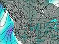
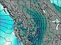
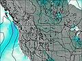
This table gives the weather forecast for Livingston Peak at the specific elevation of 2500 m. Our advanced weather models allow us to provide distinct weather forecasts for several elevations of Livingston Peak. To see the weather forecasts for the other elevations, use the tab navigation above the table. For a wider overview of the weather, consult the Weather Map of Montana.
| Weather Station | Temp. | Weather | Wind | Gusts | Cloud / Visibility |
|---|---|---|---|---|---|
Livingston Airport | |||||
* NOTE: not all weather observatories update at the same frequency which is the reason why some locations may show data from stations that are further away than known closer ones.
Livingston Peak Photos
View all
Columbia Plateau photos (3) |
Intermountain West photos (146) |
photos from mountains in United States (2892) |
all photos
 Upload new photo
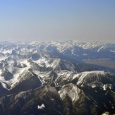
Livingston Peak

