– Lat/Long: 56.96° N 3.24° W
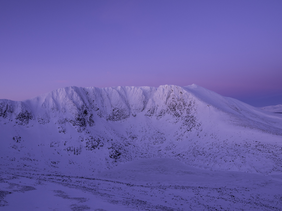
 Lochnagar
Weather Forecast, United KingdomIssued: 11 am Sun 14 Dec Local TimeUpdates in: hr min sUpdate imminent
Issued: 11 am Sun 14 Dec Local Time
Updates in:
Update imminent hr min s

Issued: 11 am Sun 14 Dec Local Time
Updates in:
Update imminent hr min s
Days 1–3 Weather SummaryLight rain (total 5mm), mostly falling on Sun afternoon. Freeze-thaw conditions (max 6°C on Sun morning, min -1°C on Sun night). Winds decreasing (stormy winds from the SW on Sun afternoon, light winds from the WNW by Mon night). | Days 4–6 Weather SummaryA light covering of new snow mostly falling on Thu night. Becoming milder with light rain (total 4mm) on Thu night. Freeze-thaw conditions (max 2°C on Wed afternoon, min -3°C on Thu night). Winds decreasing (severe gales from the SW on Wed afternoon, fresh winds from the SSW by Thu morning). | |||||||||||||||||
Sunday 14 | Monday 15 | Tuesday 16 | Wednesday 17 | Thursday 18 | Friday 19 | |||||||||||||
AM | PM | night | AM | PM | night | AM | PM | night | AM | PM | night | AM | PM | night | AM | PM | night | |
light rain | light rain | light rain | cloudy | cloudy | cloudy | clear | clear | some clouds | cloudy | cloudy | cloudy | cloudy | light snow | snow shwrs | some clouds | some clouds | some clouds | |
km/h | ||||||||||||||||||
 |  |  |  |  |  | |||||||||||||
— | — | — | — | — | — | — | — | — | — | — | — | — | 4 | 5 | — | — | — | |
0.1 | 4 | 0.6 | — | — | — | — | — | — | — | — | — | — | — | 4 | — | — | — | |
max°C | 6 | 6 | 6 | 1 | 1 | 1 | 0 | -1 | -1 | 0 | 2 | 1 | 2 | 1 | 2 | -1 | -1 | 0 |
min°C | 6 | 5 | -1 | 1 | 1 | -1 | -1 | -1 | -1 | -2 | 1 | 0 | 1 | 0 | -3 | -2 | -1 | -2 |
-1 | -3 | -8 | -5 | -4 | -5 | -7 | -9 | -9 | -13 | -8 | -8 | -6 | -9 | -13 | -12 | -10 | -12 | |
2600 | 2900 | 1850 | 1400 | 1350 | 1200 | 1050 | 1000 | 950 | 900 | 1350 | 1350 | 1600 | 1350 | 1650 | 850 | 1000 | 1100 | |
Cloud base (m) | 450 | 350 | 350 | 6200 | 5800 | 5150 | 5050 | 650 | 600 | 600 | 400 | 400 | 450 | 350 | 350 | 500 | 500 | 500 |
8:42 | — | — | 8:44 | — | — | 8:45 | — | — | 8:45 | — | — | 8:47 | — | — | 8:48 | — | — | |
— | 3:30 | — | — | 3:30 | — | — | 3:30 | — | — | 3:30 | — | — | 3:30 | — | — | 3:30 | — | |
Loading...
Lochnagar Weather (Days 0-3):
The weather forecast for Lochnagar is: Light rain (total 5mm), mostly falling on Sun afternoon. Freeze-thaw conditions (max 6°C on Sun morning, min -1°C on Sun night). Winds decreasing (stormy winds from the SW on Sun afternoon, light winds from the WNW by Mon night).
Lochnagar Weather (Days 3-6):
A light covering of new snow mostly falling on Thu night. Becoming milder with light rain (total 4mm) on Thu night. Freeze-thaw conditions (max 2°C on Wed afternoon, min -3°C on Thu night). Winds decreasing (severe gales from the SW on Wed afternoon, fresh winds from the SSW by Thu morning).
This table gives the weather forecast for Lochnagar at the specific elevation of 1155 m. Our advanced weather models allow us to provide distinct weather forecasts for several elevations of Lochnagar. To see the weather forecasts for the other elevations, use the tab navigation above the table. For a wider overview of the weather, consult the Weather Map of United Kingdom.
| Weather Station | Temp. | Weather | Wind | Gusts | Cloud / Visibility |
|---|---|---|---|---|---|
AboyneNO2 | |||||
CairngormSummit | |||||
Dunde / iverside Airport | |||||
* NOTE: not all weather observatories update at the same frequency which is the reason why some locations may show data from stations that are further away than known closer ones.
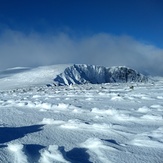
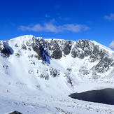
Lochnagar Photos
View all
Grampians photos (160) |
Scottish Highlands photos (293) |
photos from mountains in United Kingdom (2078) |
all photos
 Upload new photo
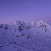
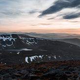
Early Morning
Lochnagar
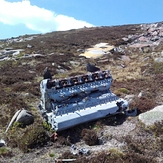
Lochnagar
1949 Crash Site