
– Lat/Long: 64.48° N 17.80° W
 Loki-fogrufjoll
Weather Forecast, IcelandIssued: 11 am Mon 31 Mar Local TimeUpdates in: hr min sUpdate imminent
Loki-fogrufjoll Weather Forecast, Iceland
Issued: 11 am Mon 31 Mar Local Time
Updates in:
Update imminent hr min s

Issued: 11 am Mon 31 Mar Local Time
Updates in:
Update imminent hr min s
Days 1–3 Weather SummaryA heavy fall of snow, heaviest during Wed morning. Freeze-thaw conditions (max 1°C on Mon night, min -7°C on Wed afternoon). Winds increasing (calm on Tue afternoon, near gales from the W by Wed afternoon). | Days 4–6 Weather SummaryMostly dry. Freeze-thaw conditions (max 5°C on Sat morning, min -5°C on Thu morning). Wind will be generally light. | Days 7–9 Weather SummaryMostly dry. Mild temperatures (max 7°C on Tue afternoon, min 3°C on Sun afternoon). Winds increasing (calm on Mon night, fresh winds from the SSE by Tue night). | Days 10–12 Weather SummaryLight rain (total 6mm), mostly falling on Wed night. Mild temperatures (max 7°C on Fri night, min 4°C on Wed afternoon). Winds decreasing (near gales from the S on Wed night, light winds from the SW by Thu night). | |||||||||||||||||||||||||||||||||
Monday 31 | Tuesday 1 | Wednesday 2 | Thursday 3 | Friday 4 | Saturday 5 | Sunday 6 | Monday 7 | Tuesday 8 | Wednesday 9 | Thursday 10 | Friday 11 | |||||||||||||||||||||||||
AM | PM | night | AM | PM | night | AM | PM | night | AM | PM | night | AM | PM | night | AM | PM | night | AM | PM | night | AM | PM | night | AM | PM | night | AM | PM | night | AM | PM | night | AM | PM | night | |
light snow | light snow | light snow | some clouds | cloudy | mod. snow | mod. snow | light snow | light snow | some clouds | some clouds | some clouds | clear | clear | some clouds | clear | some clouds | some clouds | cloudy | light rain | cloudy | cloudy | some clouds | some clouds | clear | clear | rain shwrs | light rain | rain shwrs | rain shwrs | light rain | light rain | cloudy | cloudy | light rain | light rain | |
km/h | ||||||||||||||||||||||||||||||||||||
 |  |  |  |  |  |  |  |  |  |  | ||||||||||||||||||||||||||
3 | 1.0 | 2.0 | — | — | 10 | 9 | 4 | 1.0 | — | — | — | — | — | — | — | — | — | — | — | — | — | — | — | — | — | — | — | — | — | — | — | — | — | — | — | |
— | — | — | — | — | — | — | — | — | — | — | — | — | — | — | — | — | — | — | 0.1 | — | — | — | — | — | — | 0.1 | 0.1 | 0.5 | 3 | 0.4 | 0.9 | — | — | 0.1 | 1.3 | |
max°C | -5 | -4 | 1 | -3 | -3 | 0 | -5 | -6 | -6 | -4 | -3 | -1 | 3 | 4 | 4 | 5 | 5 | 4 | 5 | 4 | 4 | 4 | 5 | 6 | 6 | 7 | 5 | 5 | 5 | 6 | 5 | 4 | 4 | 5 | 5 | 7 |
min°C | -5 | -4 | -5 | -4 | -3 | -4 | -6 | -7 | -7 | -5 | -4 | -2 | 1 | 4 | 3 | 5 | 5 | 4 | 4 | 3 | 3 | 4 | 5 | 5 | 6 | 6 | 5 | 5 | 4 | 5 | 4 | 4 | 4 | 5 | 4 | 5 |
-14 | -14 | -12 | -11 | -9 | -8 | -16 | -18 | -16 | -9 | -9 | -6 | 1 | 1 | -2 | 1 | 1 | 1 | 3 | -1 | -2 | 0 | 1 | 1 | 4 | 3 | 1 | 0 | -2 | -1 | -2 | -1 | 0 | 2 | -2 | -1 | |
200 | 400 | 1250 | 300 | 500 | 600 | 200 | 0 | 0 | 0 | 500 | 450 | 1250 | 2300 | 2500 | 2250 | 2250 | 2250 | 2050 | 1700 | 1750 | 1850 | 2250 | 2300 | 2400 | 2650 | 2650 | 2250 | 2250 | 2950 | 1900 | 1850 | 2700 | 2850 | 2200 | 2400 | |
Cloud base (m) | 1350 | 800 | 1400 | 850 | 850 | 1500 | 850 | 850 | 900 | 1950 | 2250 | 3300 | 1000 | 900 | 6500 | 7450 | 950 | 900 | 900 | 1750 | 900 | 900 | 9450 | 2850 | 1950 | 8500 | 900 | 900 | 900 | 850 | 900 | 850 | ||||
6:31 | — | — | 6:28 | — | — | 6:24 | — | — | 6:20 | — | — | 6:18 | — | — | 6:13 | — | — | 6:09 | — | — | 6:07 | — | — | 6:03 | — | — | 5:58 | — | — | 5:56 | — | — | 5:52 | — | — | |
— | 8:00 | — | — | 8:02 | — | — | 8:06 | — | — | 8:08 | — | — | 8:12 | — | — | 8:15 | — | — | 8:17 | — | — | 8:21 | — | — | 8:23 | — | — | 8:27 | — | — | 8:30 | — | — | 8:32 | — | |
Loki-fogrufjoll Weather (Days 0-3):
The weather forecast for Loki-fogrufjoll is: A heavy fall of snow, heaviest during Wed morning. Freeze-thaw conditions (max 1°C on Mon night, min -7°C on Wed afternoon). Winds increasing (calm on Tue afternoon, near gales from the W by Wed afternoon).
Loki-fogrufjoll Weather (Days 3-6):
Mostly dry. Freeze-thaw conditions (max 5°C on Sat morning, min -5°C on Thu morning). Wind will be generally light.
Loki-fogrufjoll Weather (Days 6-9):
Mostly dry. Mild temperatures (max 7°C on Tue afternoon, min 3°C on Sun afternoon). Winds increasing (calm on Mon night, fresh winds from the SSE by Tue night).
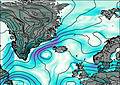
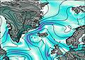
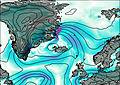
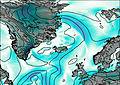
This table gives the weather forecast for Loki-fogrufjoll at the specific elevation of 1000 m. Our advanced weather models allow us to provide distinct weather forecasts for several elevations of Loki-fogrufjoll. To see the weather forecasts for the other elevations, use the tab navigation above the table. For a wider overview of the weather, consult the Weather Map of Iceland.

