– Lat/Long: 46.70° N 9.35° E
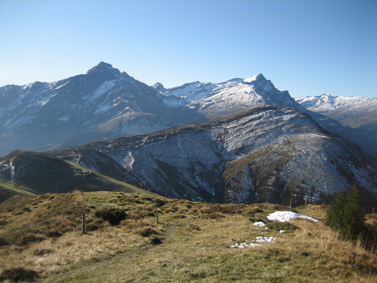
 Lüschgrat
Weather Forecast, SwitzerlandIssued: 1 pm Sat 19 Apr Local TimeUpdates in: hr min sUpdate imminent
Lüschgrat Weather Forecast, Switzerland
Issued: 1 pm Sat 19 Apr Local Time
Updates in:
Update imminent hr min s

Issued: 1 pm Sat 19 Apr Local Time
Updates in:
Update imminent hr min s
Days 1–4 Weather SummaryLight rain (total 7mm), mostly falling on Mon morning. Mild temperatures (max 9°C on Mon afternoon, min 3°C on Sun night). Wind will be generally light. | Days 5–7 Weather SummaryModerate rain (total 12mm) heaviest on Wed afternoon, then becoming colder with a dusting of snow on Thu night. Very mild (max 12°C on Tue afternoon, min 1°C on Thu night). Wind will be generally light. | ||||||||||||||||
Sat 19 | Sunday 20 | Monday 21 | Tuesday 22 | Wednesday 23 | Thursday 24 | ||||||||||||
PM | night | AM | PM | night | AM | PM | night | AM | PM | night | AM | PM | night | AM | PM | night | |
light rain | rain shwrs | rain shwrs | rain shwrs | light rain | light rain | rain shwrs | rain shwrs | rain shwrs | rain shwrs | light rain | light rain | light rain | light rain | rain shwrs | light rain | light snow | |
km/h | |||||||||||||||||
 |  |  |  |  |  | ||||||||||||
— | — | — | — | — | — | — | — | — | — | — | — | — | — | — | — | 1.0 | |
0.4 | 0.5 | 0.3 | 1.2 | 1.9 | 1.4 | 0.9 | 0.5 | 0.2 | 0.2 | 0.3 | 0.2 | 5 | 3 | 0.1 | 1.0 | 3 | |
max°C | 8 | 5 | 7 | 8 | 5 | 6 | 9 | 6 | 7 | 12 | 7 | 8 | 9 | 4 | 5 | 8 | 3 |
min°C | 7 | 4 | 5 | 7 | 3 | 4 | 8 | 5 | 5 | 10 | 5 | 6 | 6 | 3 | 3 | 7 | 1 |
4 | 1 | 3 | 5 | 2 | 4 | 7 | 3 | 4 | 9 | 5 | 6 | 5 | 2 | 2 | 5 | -2 | |
2450 | 2250 | 2450 | 2500 | 2200 | 2350 | 2550 | 2300 | 2550 | 2750 | 2450 | 2600 | 2500 | 2200 | 2300 | 2400 | 1650 | |
Cloud base (m) | 1750 | 1700 | 1950 | 1950 | 1700 | 1700 | 2250 | 1850 | 1950 | 2900 | 2000 | 2100 | 1750 | 1750 | 1900 | 2250 | 1650 |
— | — | 6:26 | — | — | 6:24 | — | — | 6:22 | — | — | 6:22 | — | — | 6:20 | — | — | |
— | 8:15 | — | — | 8:15 | — | — | 8:17 | — | — | 8:19 | — | — | 8:20 | — | — | 8:22 | |
Loading...
Lüschgrat Weather (Days 0-3):
The weather forecast for Lüschgrat is: Light rain (total 7mm), mostly falling on Mon morning. Mild temperatures (max 9°C on Mon afternoon, min 3°C on Sun night). Wind will be generally light.
Lüschgrat Weather (Days 3-6):
Moderate rain (total 12mm) heaviest on Wed afternoon, then becoming colder with a dusting of snow on Thu night. Very mild (max 12°C on Tue afternoon, min 1°C on Thu night). Wind will be generally light.
This table gives the weather forecast for Lüschgrat at the specific elevation of 1500 m. Our advanced weather models allow us to provide distinct weather forecasts for several elevations of Lüschgrat. To see the weather forecasts for the other elevations, use the tab navigation above the table. For a wider overview of the weather, consult the Weather Map of Switzerland.
Lüschgrat Photos
View all
Lepontine Alps photos (83) |
Alps photos (1456) |
photos from mountains in Switzerland (643) |
all photos
 Upload new photo
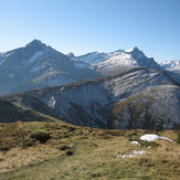
Lüschgrat

