– Lat/Long: 49.63° N 125.97° W
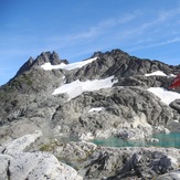
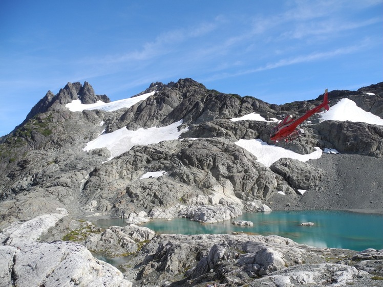
 Matchlee Mountain
Weather Forecast, CanadaIssued: 4 pm Tue 01 Apr Local TimeUpdates in: hr min sUpdate imminent
Matchlee Mountain Weather Forecast, Canada
Issued: 4 pm Tue 01 Apr Local Time
Updates in:
Update imminent hr min s

Issued: 4 pm Tue 01 Apr Local Time
Updates in:
Update imminent hr min s
Days 1–4 Weather SummarySome drizzle, heaviest during Wed afternoon. Freeze-thaw conditions (max 6°C on Thu afternoon, min 0°C on Tue night). Wind will be generally light. | Days 5–7 Weather SummaryHeavy rain (total 22mm), heaviest during Sun night. Later becoming colder with a dusting of snow on Sun night. Freeze-thaw conditions (max 9°C on Sat afternoon, min 0°C on Sun night). Wind will be generally light. | Days 8–10 Weather SummaryA heavy fall of snow, heaviest during Tue morning. Becoming milder with heavy rain (total 108mm) on Thu morning. Freeze-thaw conditions (max 5°C on Wed night, min 0°C on Mon night). Wind will be generally light. | Days 11–13 Weather SummaryHeavy rain (total 22mm), mostly on Sat morning. Becoming colder with a light covering of snow, mostly falling on Sat night. Very mild (max 11°C on Fri night, min 1°C on Thu night). Wind will be generally light. | |||||||||||||||||||||||||||||||||
Tue 1 | Wednesday 2 | Thursday 3 | Friday 4 | Saturday 5 | Sunday 6 | Monday 7 | Tuesday 8 | Wednesday 9 | Thursday 10 | Friday 11 | Saturday 12 | Sun 13 | ||||||||||||||||||||||||
PM | night | AM | PM | night | AM | PM | night | AM | PM | night | AM | PM | night | AM | PM | night | AM | PM | night | AM | PM | night | AM | PM | night | AM | PM | night | AM | PM | night | AM | PM | night | AM | |
rain shwrs | some clouds | some clouds | rain shwrs | rain shwrs | clear | some clouds | clear | some clouds | some clouds | cloudy | some clouds | cloudy | light rain | light rain | mod. rain | light snow | light snow | light snow | heavy snow | mod. snow | light snow | mod. snow | light snow | heavy rain | heavy rain | heavy rain | rain shwrs | rain shwrs | cloudy | cloudy | light rain | mod. rain | mod. rain | light snow | snow shwrs | |
km/h | ||||||||||||||||||||||||||||||||||||
 |  |  |  |  |  |  |  |  |  |  |  |  | ||||||||||||||||||||||||
— | — | — | — | — | — | — | — | — | — | — | — | — | — | — | — | 3 | 1.0 | 1.0 | 12 | 10 | 2.0 | 10 | 2.0 | — | — | — | — | — | — | — | — | — | — | 3 | 1.0 | |
0.3 | — | — | 0.7 | 0.1 | — | — | — | — | — | — | — | — | 1.9 | 5 | 10 | 5 | — | — | — | — | — | — | 6 | 23 | 46 | 32 | 3 | 0.2 | — | — | 0.2 | 9 | 8 | 1.5 | — | |
max°C | 3 | 2 | 1 | 3 | 2 | 4 | 6 | 4 | 5 | 8 | 7 | 8 | 9 | 6 | 3 | 3 | 2 | 0 | 2 | 1 | 2 | 2 | 2 | 2 | 4 | 5 | 4 | 3 | 2 | 4 | 6 | 11 | 8 | 5 | 4 | 2 |
min°C | 3 | 0 | 0 | 2 | 1 | 2 | 6 | 4 | 4 | 7 | 6 | 6 | 8 | 4 | 3 | 3 | 0 | 0 | 1 | 0 | 1 | 1 | 1 | 1 | 3 | 4 | 3 | 3 | 1 | 2 | 5 | 7 | 6 | 5 | 1 | 1 |
1 | 0 | 0 | 2 | 1 | 2 | 6 | 4 | 4 | 7 | 5 | 4 | 6 | 2 | 0 | 0 | -3 | -2 | -2 | -5 | -3 | -4 | -3 | -2 | -1 | 0 | 0 | 0 | 1 | 0 | 3 | 5 | 3 | 1 | -4 | -4 | |
1350 | 1150 | 1100 | 1350 | 1300 | 1450 | 1900 | 2000 | 1950 | 2600 | 2600 | 2400 | 2500 | 1800 | 1550 | 1450 | 1050 | 1000 | 1150 | 1050 | 1350 | 1200 | 1400 | 1600 | 1900 | 2100 | 1550 | 1400 | 1350 | 1650 | 2450 | 2900 | 2050 | 1650 | 1300 | 1250 | |
Cloud base (m) | 800 | 550 | 600 | 800 | 800 | 800 | 2100 | 1000 | 1700 | 1850 | 5350 | 5450 | 2750 | 950 | 500 | 500 | 500 | 500 | 650 | 500 | 500 | 550 | 500 | 500 | 500 | 500 | 550 | 600 | 850 | 650 | 800 | 4850 | 650 | 600 | 500 | 550 |
— | — | 6:58 | — | — | 6:56 | — | — | 6:54 | — | — | 6:52 | — | — | 6:50 | — | — | 6:48 | — | — | 6:46 | — | — | 6:43 | — | — | 6:41 | — | — | 6:39 | — | — | 6:37 | — | — | 6:35 | |
7:54 | — | — | 7:55 | — | — | 7:58 | — | — | 7:59 | — | — | — | 8:00 | — | — | 8:01 | — | — | 8:04 | — | — | 8:05 | — | — | 8:07 | — | — | 8:07 | — | — | 8:09 | — | — | 8:10 | — | |
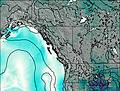
Matchlee Mountain Weather (Days 0-3):
The weather forecast for Matchlee Mountain is: Some drizzle, heaviest during Wed afternoon. Freeze-thaw conditions (max 6°C on Thu afternoon, min 0°C on Tue night). Wind will be generally light.
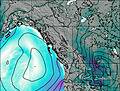
Matchlee Mountain Weather (Days 3-6):
Heavy rain (total 22mm), heaviest during Sun night. Later becoming colder with a dusting of snow on Sun night. Freeze-thaw conditions (max 9°C on Sat afternoon, min 0°C on Sun night). Wind will be generally light.
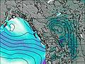
Matchlee Mountain Weather (Days 6-9):
A heavy fall of snow, heaviest during Tue morning. Becoming milder with heavy rain (total 108mm) on Thu morning. Freeze-thaw conditions (max 5°C on Wed night, min 0°C on Mon night). Wind will be generally light.
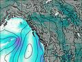
This table gives the weather forecast for Matchlee Mountain at the specific elevation of 1000 m. Our advanced weather models allow us to provide distinct weather forecasts for several elevations of Matchlee Mountain. To see the weather forecasts for the other elevations, use the tab navigation above the table. For a wider overview of the weather, consult the Weather Map of British-Columbia.
| Weather Station | Temp. | Weather | Wind | Gusts | Cloud / Visibility |
|---|---|---|---|---|---|
Estevan Point Airport | |||||
Estevan Point Cs- BC | |||||
Campbell River Airport | |||||
Tofino | |||||
SHIP316 | |||||
SHIP1021 | |||||
Comox Millitary Base Airport | |||||
Sentry Shoal Buoy | |||||
Cfb - Comox- BC | |||||
* NOTE: not all weather observatories update at the same frequency which is the reason why some locations may show data from stations that are further away than known closer ones.