
– Lat/Long: 35.80° N 82.96° W
 Max Patch
Weather Forecast, United StatesIssued: 1 pm Fri 18 Apr Local TimeUpdates in: hr min sUpdate imminent
Max Patch Weather Forecast, United States
Issued: 1 pm Fri 18 Apr Local Time
Updates in:
Update imminent hr min s

Issued: 1 pm Fri 18 Apr Local Time
Updates in:
Update imminent hr min s
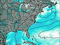
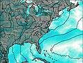
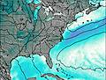
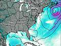
Days 1–4 Weather SummaryMostly dry. Very mild (max 19°C on Sat afternoon, min 13°C on Sun night). Winds increasing (calm on Sat night, fresh winds from the S by Sun night). | Days 5–7 Weather SummaryHeavy rain (total 20mm), heaviest during Mon night. Very mild (max 17°C on Mon afternoon, min 11°C on Tue morning). Wind will be generally light. | ||||||||||||||||
Fri 18 | Saturday 19 | Sunday 20 | Monday 21 | Tuesday 22 | Wednesday 23 | ||||||||||||
PM | night | AM | PM | night | AM | PM | night | AM | PM | night | AM | PM | night | AM | PM | night | |
clear | clear | some clouds | cloudy | some clouds | cloudy | rain shwrs | some clouds | some clouds | some clouds | heavy rain | light rain | risk tstorm | rain shwrs | clear | risk tstorm | risk tstorm | |
km/h | |||||||||||||||||
 |  |  |  | 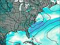 | 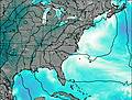 | ||||||||||||
— | — | — | — | — | — | — | — | — | — | — | — | — | — | — | — | — | |
— | — | — | — | — | — | 0.7 | — | — | — | 13 | 0.8 | 2 | 1.3 | — | 1.8 | 1.0 | |
max°C | 18 | 17 | 17 | 19 | 17 | 16 | 19 | 16 | 14 | 17 | 14 | 12 | 13 | 13 | 13 | 15 | 15 |
min°C | 16 | 15 | 16 | 18 | 15 | 15 | 18 | 13 | 13 | 17 | 12 | 11 | 13 | 12 | 12 | 15 | 15 |
15 | 13 | 15 | 18 | 15 | 15 | 18 | 10 | 10 | 16 | 10 | 10 | 12 | 12 | 12 | 15 | 15 | |
4300 | 4300 | 4350 | 4200 | 4200 | 4050 | 3800 | 4300 | 4000 | 3550 | 3500 | 3650 | 3500 | 3500 | 3500 | 3550 | 3700 | |
Cloud base (m) | 5400 | 9650 | 5900 | 7150 | 7150 | 6800 | 3050 | 6900 | 5750 | 2950 | 700 | 700 | 1750 | 7650 | 2500 | 6550 | |
— | — | 6:54 | — | — | 6:52 | — | — | 6:50 | — | — | 6:50 | — | — | 6:48 | — | — | |
— | 8:07 | — | — | 8:07 | — | — | 8:08 | — | — | 8:08 | — | — | 8:09 | — | — | 8:10 | |
Loading...
Max Patch Weather (Days 0-3):
The weather forecast for Max Patch is: Mostly dry. Very mild (max 19°C on Sat afternoon, min 13°C on Sun night). Winds increasing (calm on Sat night, fresh winds from the S by Sun night).
Max Patch Weather (Days 3-6):
Heavy rain (total 20mm), heaviest during Mon night. Very mild (max 17°C on Mon afternoon, min 11°C on Tue morning). Wind will be generally light.
This table gives the weather forecast for Max Patch at the specific elevation of 1411 m. Our advanced weather models allow us to provide distinct weather forecasts for several elevations of Max Patch. To see the weather forecasts for the other elevations, use the tab navigation above the table. For a wider overview of the weather, consult the Weather Map of North-Carolina.
| Weather Station | Temp. | Weather | Wind | Gusts | Cloud / Visibility |
|---|---|---|---|---|---|
Greeneville Airport (Tennessee) |
* NOTE: not all weather observatories update at the same frequency which is the reason why some locations may show data from stations that are further away than known closer ones.
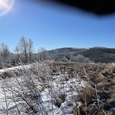
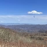
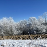
Max Patch Photos
View all
Great Smoky Mountains photos (57) |
Appalachians photos (861) |
photos from mountains in United States (2882) |
all photos
 Upload new photo

 See 16 more Max Patch photos
Subzero Sunrise
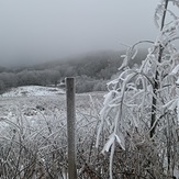
Max Patch Winter Snow
Max patch during snow storm
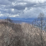
View to the east
Icy
Views of buckeye ridge
Buckeye ridge

