
– Lat/Long: 47.62° N 116.99° W
 Mica Peak (Idaho)
Weather Forecast, United StatesIssued: 4 pm Thu 24 Apr Local TimeUpdates in: hr min sUpdate imminent
Mica Peak (Idaho) Weather Forecast, United States
Issued: 4 pm Thu 24 Apr Local Time
Updates in:
Update imminent hr min s

Issued: 4 pm Thu 24 Apr Local Time
Updates in:
Update imminent hr min s
Days 1–4 Weather SummaryMostly dry. Very mild (max 12°C on Fri afternoon, min 5°C on Sun morning). Winds decreasing (fresh winds from the ESE on Thu night, calm by Sat morning). | Days 5–7 Weather SummaryModerate rain (total 11mm) heaviest on Mon night, then becoming colder with a dusting of snow on Mon night. Very mild (max 11°C on Sun afternoon, min 1°C on Mon morning). Winds decreasing (strong winds from the SW on Mon night, light winds from the SW by Wed morning). | ||||||||||||||||
Thu 24 | Friday 25 | Saturday 26 | Sunday 27 | Monday 28 | Tuesday 29 | ||||||||||||
PM | night | AM | PM | night | AM | PM | night | AM | PM | night | AM | PM | night | AM | PM | night | |
some clouds | clear | clear | clear | some clouds | cloudy | cloudy | clear | clear | clear | some clouds | some clouds | some clouds | light snow | light rain | light rain | rain shwrs | |
km/h | |||||||||||||||||
 |  |  |  |  |  | ||||||||||||
— | — | — | — | — | — | — | — | — | — | — | — | — | 1.0 | — | — | — | |
— | — | — | — | — | — | — | — | — | — | — | — | — | 10 | 0.1 | 0.5 | 0.1 | |
max°C | 10 | 10 | 8 | 12 | 12 | 9 | 10 | 10 | 5 | 11 | 11 | 2 | 6 | 6 | 3 | 8 | 8 |
min°C | 9 | 9 | 8 | 11 | 11 | 8 | 10 | 6 | 5 | 8 | 4 | 1 | 5 | 2 | 1 | 5 | 4 |
7 | 5 | 4 | 10 | 10 | 8 | 9 | 3 | 2 | 5 | 0 | -4 | 0 | -5 | -5 | 2 | -1 | |
2650 | 2700 | 2750 | 2900 | 2900 | 2750 | 2850 | 2700 | 2500 | 2800 | 2700 | 2150 | 2650 | 2100 | 2100 | 2500 | 2350 | |
Cloud base (m) | 3250 | 8900 | 3350 | 6600 | 4550 | 4050 | 3100 | 2950 | 3300 | 850 | 1900 | 550 | 600 | 1950 | 2900 | ||
— | — | 5:41 | — | — | 5:39 | — | — | 5:37 | — | — | 5:35 | — | — | 5:33 | — | — | |
7:49 | — | — | 7:51 | — | — | 7:52 | — | — | 7:53 | — | — | 7:54 | — | — | 7:55 | — | |
Loading...
Mica Peak (Idaho) Weather (Days 0-3):
The weather forecast for Mica Peak (Idaho) is: Mostly dry. Very mild (max 12°C on Fri afternoon, min 5°C on Sun morning). Winds decreasing (fresh winds from the ESE on Thu night, calm by Sat morning).
Mica Peak (Idaho) Weather (Days 3-6):
Moderate rain (total 11mm) heaviest on Mon night, then becoming colder with a dusting of snow on Mon night. Very mild (max 11°C on Sun afternoon, min 1°C on Mon morning). Winds decreasing (strong winds from the SW on Mon night, light winds from the SW by Wed morning).
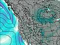
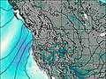
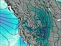
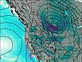
This table gives the weather forecast for Mica Peak (Idaho) at the specific elevation of 1597 m. Our advanced weather models allow us to provide distinct weather forecasts for several elevations of Mica Peak (Idaho). To see the weather forecasts for the other elevations, use the tab navigation above the table. For a wider overview of the weather, consult the Weather Map of Idaho.
| Weather Station | Temp. | Weather | Wind | Gusts | Cloud / Visibility |
|---|---|---|---|---|---|
Spokan / elts Field Aviation Airport | |||||
* NOTE: not all weather observatories update at the same frequency which is the reason why some locations may show data from stations that are further away than known closer ones.

