
– Lat/Long: 0.13° N 78.27° W
 Mojanda
Weather Forecast, EcuadorIssued: 12 am Fri 25 Apr Local TimeUpdates in: hr min sUpdate imminent
Mojanda Weather Forecast, Ecuador
Issued: 12 am Fri 25 Apr Local Time
Updates in:
Update imminent hr min s

Issued: 12 am Fri 25 Apr Local Time
Updates in:
Update imminent hr min s
Days 1–4 Weather SummaryHeavy rain (total 68mm), heaviest during Sun afternoon. Mild temperatures (max 6°C on Fri morning, min 3°C on Thu night). Wind will be generally light. | Days 5–7 Weather SummaryHeavy rain (total 26mm), heaviest during Tue morning. Mild temperatures (max 6°C on Mon morning, min 3°C on Sun night). Wind will be generally light. | ||||||||||||||||||
Friday 25 | Saturday 26 | Sunday 27 | Monday 28 | Tuesday 29 | Wednesday 30 | ||||||||||||||
night | AM | PM | night | AM | PM | night | AM | PM | night | AM | PM | night | AM | PM | night | AM | PM | night | |
rain shwrs | risk tstorm | mod. rain | heavy rain | rain shwrs | rain shwrs | mod. rain | rain shwrs | heavy rain | rain shwrs | rain shwrs | mod. rain | rain shwrs | mod. rain | rain shwrs | rain shwrs | rain shwrs | rain shwrs | mod. rain | |
km/h | |||||||||||||||||||
 |  |  |  |  |  |  | |||||||||||||
— | — | — | — | — | — | — | — | — | — | — | — | — | — | — | — | — | — | — | |
4 | 4 | 8 | 22 | 1.3 | 4 | 6 | 2 | 15 | 1.1 | 3 | 5 | 2 | 6 | 2.0 | 0.6 | 2 | 3 | 7 | |
max°C | 4 | 6 | 4 | 4 | 5 | 4 | 3 | 5 | 4 | 3 | 6 | 5 | 4 | 4 | 4 | 3 | 4 | 5 | 3 |
min°C | 3 | 6 | 4 | 3 | 3 | 3 | 3 | 4 | 3 | 3 | 5 | 4 | 3 | 4 | 4 | 3 | 4 | 3 | 3 |
1 | 6 | 4 | 2 | 1 | 3 | 1 | 2 | 2 | 1 | 2 | 3 | 1 | 4 | 2 | 1 | 2 | 3 | 1 | |
4850 | 5150 | 5050 | 4800 | 4900 | 5050 | 4850 | 5000 | 4950 | 4850 | 5100 | 5050 | 4850 | 4950 | 4950 | 4800 | 4900 | 5050 | 4800 | |
Cloud base (m) | 2950 | 3350 | 2950 | 2950 | 3600 | 2950 | 3300 | 3000 | 3000 | 3500 | 3650 | 3000 | 3100 | 2950 | 2950 | 3050 | 3600 | 2950 | |
— | 6:07 | — | — | 6:07 | — | — | 6:07 | — | — | 6:05 | — | — | 6:05 | — | — | 6:05 | — | — | |
— | — | 6:14 | — | — | 6:14 | — | — | 6:14 | — | — | 6:14 | — | — | 6:13 | — | — | 6:13 | — | |
Loading...
Mojanda Weather (Days 0-3):
The weather forecast for Mojanda is: Heavy rain (total 68mm), heaviest during Sun afternoon. Mild temperatures (max 6°C on Fri morning, min 3°C on Thu night). Wind will be generally light.
Mojanda Weather (Days 3-6):
Heavy rain (total 26mm), heaviest during Tue morning. Mild temperatures (max 6°C on Mon morning, min 3°C on Sun night). Wind will be generally light.
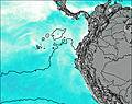
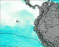
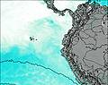
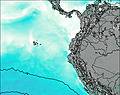
This table gives the weather forecast for Mojanda at the specific elevation of 4263 m. Our advanced weather models allow us to provide distinct weather forecasts for several elevations of Mojanda. To see the weather forecasts for the other elevations, use the tab navigation above the table. For a wider overview of the weather, consult the Weather Map of Ecuador.
| Weather Station | Temp. | Weather | Wind | Gusts | Cloud / Visibility |
|---|---|---|---|---|---|
Quito New International Airport | |||||
AEP Yuracrucito | |||||
Ipiale / an Luis Airport | |||||
lightning 23km NNW of Santo Domingo de los Colorados | |||||
lightning 26km SE of Rosa Zarate | |||||
lightning 19km NNW of La Mana | |||||
lightning 27km E of Barbacoas | |||||
lightning 28km SE of Tumaco |
* NOTE: not all weather observatories update at the same frequency which is the reason why some locations may show data from stations that are further away than known closer ones.

